|
2001 walks |
2002
walks |
2003 walks |
2004
walks |
|
2005 walks |
2006
walks |
2007 walks |
2008
walks |
|
2009 walks |
2010
walks |
2011 walks |
2012 walks |
|
2013 walks |
2014 walks |
2015 walks |
2016 walks |
|
2017 walks |
2018 walks |
2019 walks |
2020 walks |
|
2021 walks |
1993-2000 library |
Find a Route Index |
|
A few Routes to print out |
Request a Route... |
Route No. 813 - Thursday 30 July 2020
Hebden, Edge Top, Mossy Moor Reservoir,
Hebden Beck, Hole Bottom circuit - 5km
Wharfedale . . .
Route map from Ordnance Survey
Open Space service.
Map: OS Explorer OL2 Yorkshire Dales Southern & Western Areas
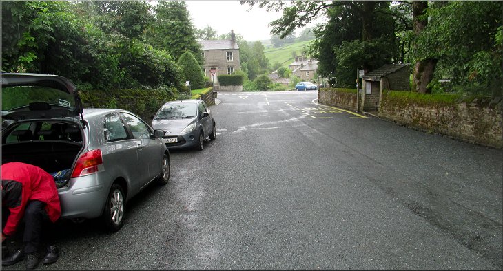
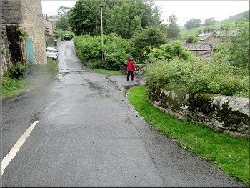
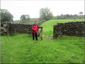
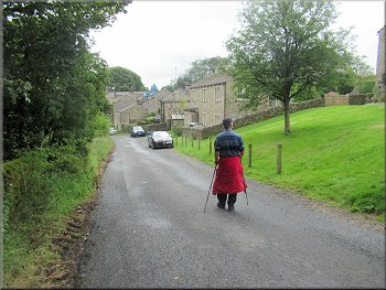
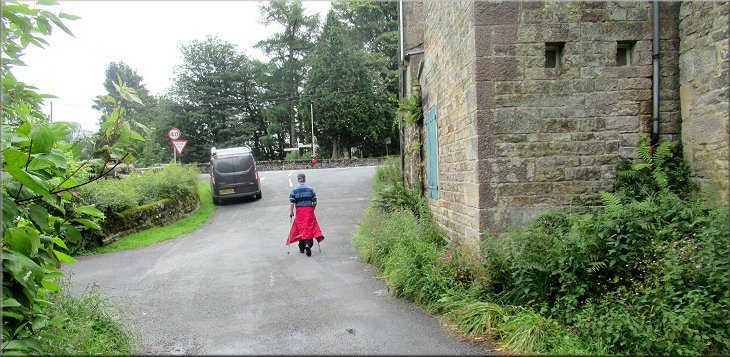
The village street in Hebden where we parked near the junction with the B6265
|

|
|
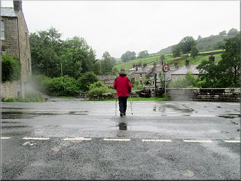
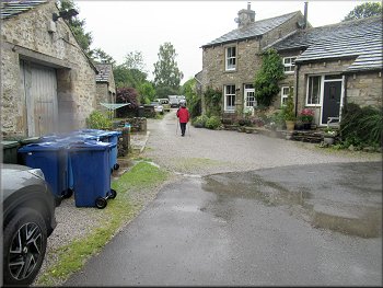
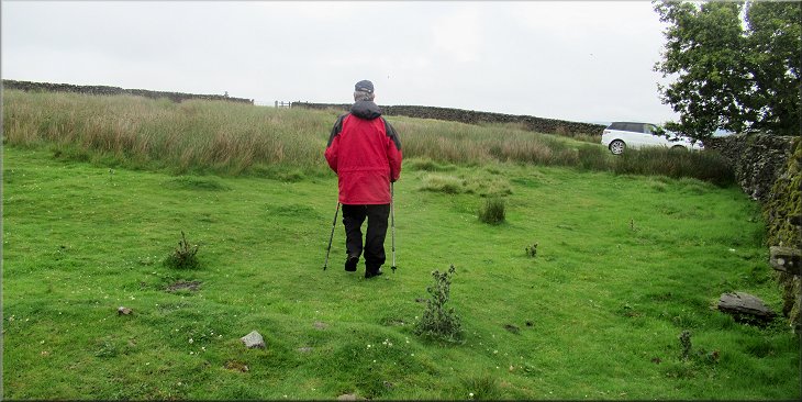
Setting off from Hebden across the B6265
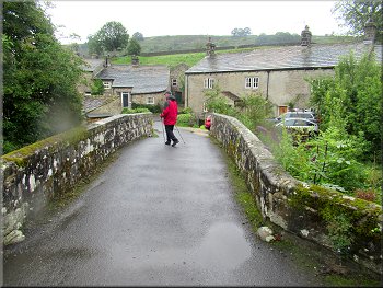
Narrow road bridge over Hebden Beck
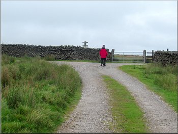
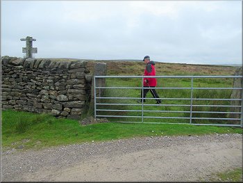
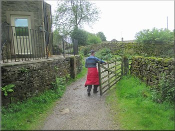
We crossed the B6265 and followed the road opposite for about 25m and then turned right over the narrow road bridge over Hebden Beck. Once over the bridge we followed the road round to our left and along a narrow track in front of a row of stone built houses. The track seemed to be used by local residents as a car & van park. We made our way between the vehicles to the end of the row of houses. Just beyond the last house there was a fence across the track with a little pedestrian gate in it. |
This morning the weather was poor with low cloud and drizzle but it was forecast to improve gradually towards lunch time. My friend, Jim, and I drove to the village of Hebden in Wharfedale. We parked on the village street at the road side at map ref. SE 026 631. It is a wide road with parking space on both sides of the road. From our parking place we walked a few metres back to the crossroads with the B6265.
Turning right to the bridge over Hebden Beck
Over the bridge we turned left along this lane
|
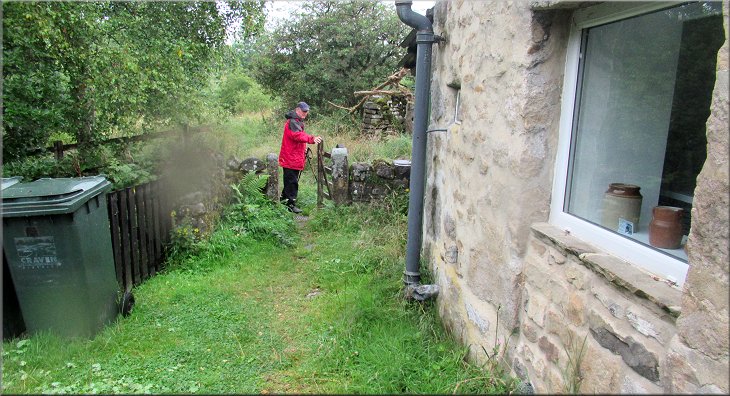
Gate to the footpath along the east bank of Hebden Beck at the last house along the lane
|
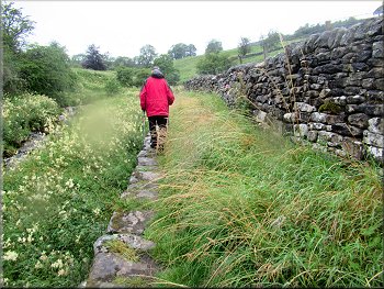
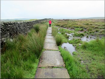
Path along the east bank of Hebden Beck
. . . then the path veered away from the beck over this stile
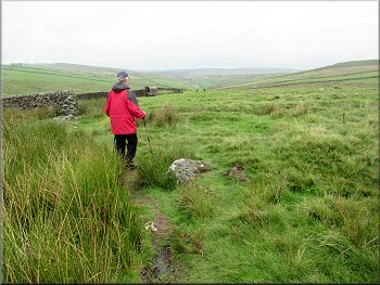
We followed the track to the top edge of the field
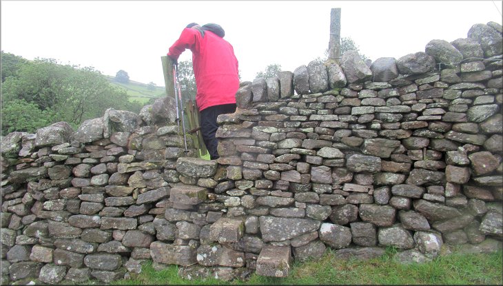
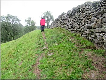
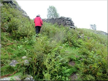
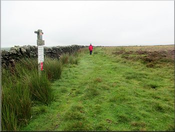
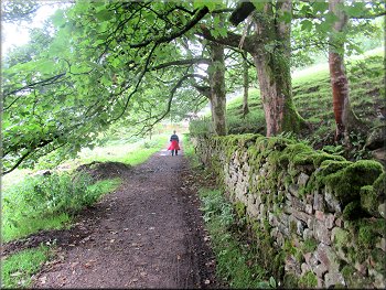
The path gradually wound its way up around the hillside to our right. At the top of the field we came to a gate through the stone wall and continued along the edge of the next field next to the stone wall. We followed the path along the edge of the fields with a stone step stile at each stone wall until we passed a high, gated, stone step stile into a large field. |
We passed though the gate along a path edged by large stone above Hebden Beck on the left of the path. We continued along the path beside the beck for about 150m to a footbridge that carried a public footpath across the beck. Just beyond the footbridge the path passed over a stone step stile to a grassy path.
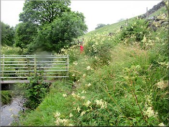
We passed this bridge bringing a footpath across the beck . . .
We followed this grassy track up around the hillside
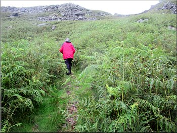
We continued on the path at the edge of the fields
|
Over this stile we followed a path next to a wall on our right bending to our right up the hillside
|
We followed the path with the wall on our right

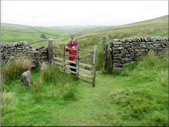
At the gateway on our right we veered left to the top of the field
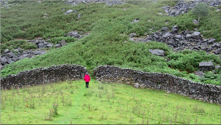
Near this gateway the footpath began to veer away from the wall to our left as we climbed to the top of the field. When we reached the top of this rise there was a little valley where the path dropped down to the wall at the end of the field with a pedestrian gate through the wall to a path up the steep rocky hillside beyond. |
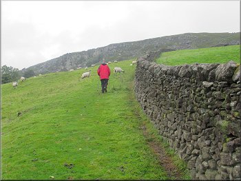
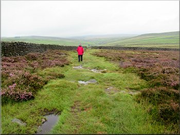
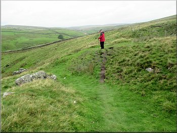
Over the stile the path continued along the field edge with a stone wall on our right. We continued to climb along the path next to the stone wall as it bent around to our right. We came to a field gate in the wall on out right where there was a herd of cattle in the next field.
We followed the path with the wall on our right
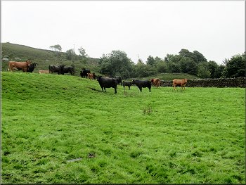
Cattle in the next field seen through the gate on our right
|
Looking down from the top of the field to the start of the path up the steep rocky hillside
|
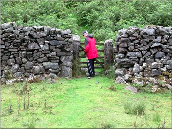
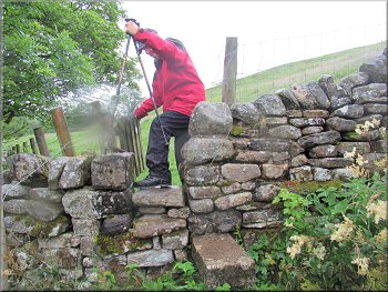
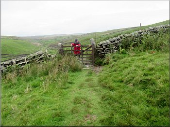
Gate to the path up the steep rocky hillside
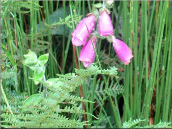
Foxgloves amongst the cotton grass and bracken
Nearing the top of the climb
At last we reached an ungated gap in the wall at the top of the climb. Through this gap in the wall there was a grassy plateau with Scar Top House on our right. |
We passed through the gate and began the climb up the rocky hillside along the zig-zag path up through the bracken. It was a steep climb and with my wonky old knees I needed a couple of rest stops on the way up.
Start of the path up the steep rocky hillside
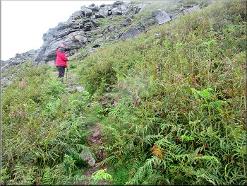
The path zig-zagged up the hillside
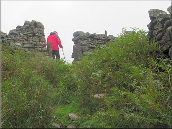
Gap in the wall at the top of the climb
|
Passing Scar Top House on our right heading for the path along Edge Top & Mossy Moor Ridge
|
The access road from Scar Top House
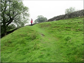
Heading north along Mossy Moor Ridge
Paved path along Mossy Moor Ridge
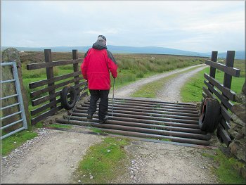
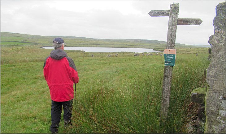
We followed the public footpath along the far side of the wall with the wall on our left for about 400m to a field gate into a wide grassy area with Mossy Moor Reservoir away to our right. |
This is open access land and we walked along the gravel access road from Scar Top House to a cattle grid in the access road next to a moorland boundary wall. We crossed the cattle grid and then doubled back.
We doubled back to our left over the cattle grid
Path along Mossy Moor Ridge
Grassy track heading for Mossy Moor Reservoir
|
Mossy Moor Reservoir away to the right of our path
|
Path by the wall dropping down towards Hebden Beck
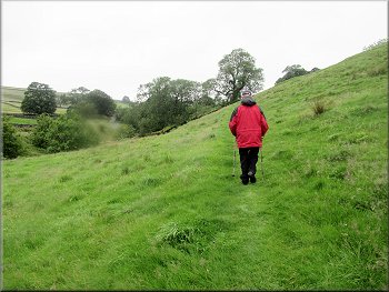
Path dropping down across the fields towards Hebden Beck
Path dropping down across the fields towards Hebden Beck
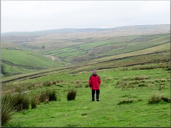
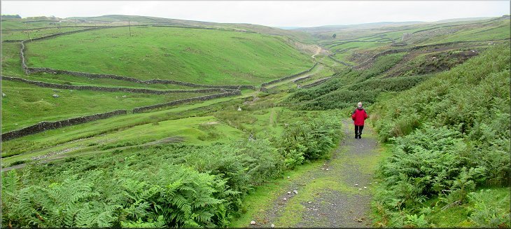
We realised that the drizzle had stopped and the sky was looking brighter. It seemed that the weather forecast was going to be right. After about 800m from the reservoir the path was close to the beck and turned left towards the beck. |
From Mossy Moor Reservoir we continued along the path slowly dropping down the hillside towards Hebden Beck. Ahead and to our right we could see the tall stone cairns on top of Bolton Haw Crags on the skyline.
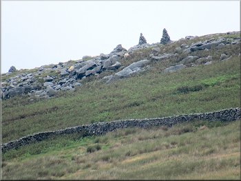
'Pillars' on Bolton Haw Side ahead & to our right
Path dropping down across the fields towards Hebden Beck
Path dropping down across the fields towards Hebden Beck
|
Track dropping down to join the path on the eastern side of Hebden Beck
|
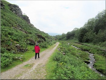
Heading south along the path to the east of Hebden Beck
Remnants of the old mining era
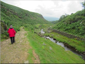
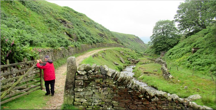
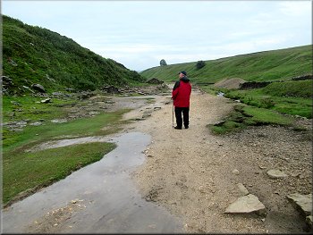
Heading down the valley towards Hole Bottom
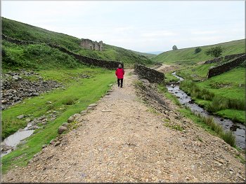
We continued along the track down the valley with Hebden Beck on our right and a craggy hillside up to our left. A little over 1km after joining Hebden Beck to came to a bridge over the beck just before the hamlet of Bottom Hole. |
At the beck side we continued along a path following the beck downstream back towards Hebden. We passed through a field gate next to the beck on a gravel track into a mining area with ruined buildings on the hillside to our left.
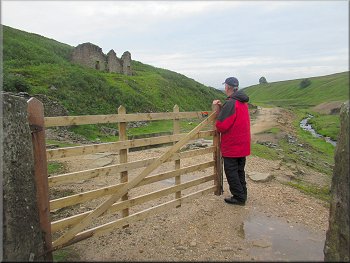
Old mining relics by the beck
Heading down the valley towards Hole Bottom
Heading down the valley towards Hole Bottom
|
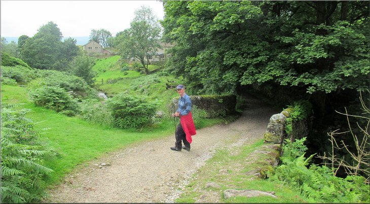
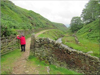
Bridge over Hebden Beck at the hamlet of Hole Bottom
|
The track into the hamlet of Hole Bottom
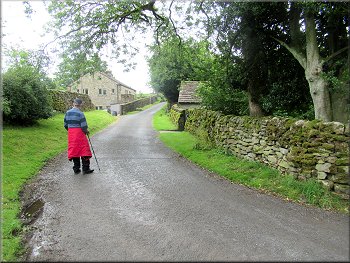
Leaving Hole Bottom along the surfaced access road
Nearing Hebden along the access road
We crossed B6265 and walked a few metres along the village street back to our car and the end of our walk. It had been very good to get out into the hills after the long lockdown period and we were able to restart out traditional cafe stop in Plately Bridge for a coffee and a bacon bap on the way home. |
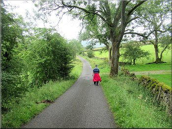
We crossed the bridge and passed a row of holiday cottages. Just beyond the holiday cottages we joined a surfaced access road and continued along this access road down the valley with the beck on our left. We walked along the surfaced access road for about 1km back to the crossroads with the B6265 at Hebden.
Holiday cottages in Hole Bottom
The surfaced access road from Hole Bottom to Hebden
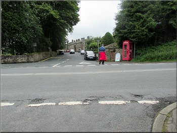
Crossing the B6265 back to our parking spot
|
Approaching the junction of the access road with the B6265 at the end of our walk
|