|
2001 walks |
2002
walks |
2003 walks |
2004
walks |
|
2005 walks |
2006
walks |
2007 walks |
2008
walks |
|
2009 walks |
2010
walks |
2011 walks |
2012 walks |
|
2013 walks |
2014 walks |
2015 walks |
2016 walks |
|
2017 walks |
2018 walks |
2019 walks |
2020 walks |
|
2021 walks |
1993-2000 library |
Find a Route Index |
|
A few Routes to print out |
Request a Route... |
Route No. 801 - Thursday 30 January 2020
Whitby Abbey car park, Cleveland Way,
Saltwick Bay, Hawsker Lane, The Ropery,
St Mary's Church circuit - 5km
Whitby, Yorkshire Coast . . .
Route map from Ordnance Survey
Open Space service.
Map: OS Explorer OL27 North York Moors Eastern area
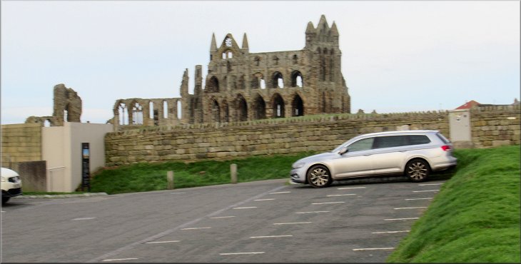
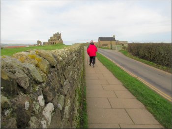
Whitby Abbey seen from the car park where we started our walk
|

|
|
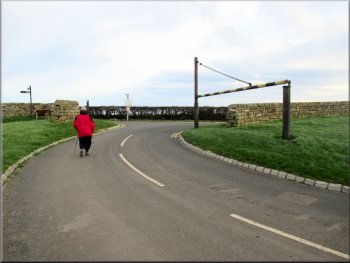
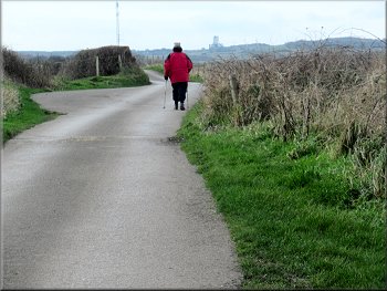
Leaving the car park at the start of our walk
Whitby Abbey seen over the wall by the footway
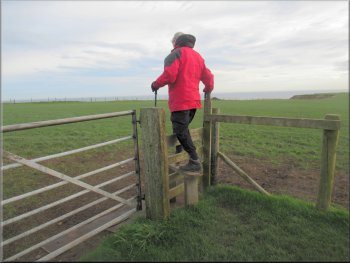
Stile into the field behind Abbey Farm
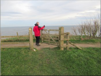
From the car park entrance we turned left to walk along footway by the road towards Whitby Abbey. There was a good view of the abbey over the wall next to the path. After about 300m along the roadside path we turned right to follow a public footpath along the side of Abbey Farm. From the access road into the farm we crossed a stile into the field behind the farm and walked across the field to a stile onto the Cleveland Way coastal path at the cliff edge. |
This morning my friend, Jim, and I drove out to the Yorkshire Coast at Whitby. We parked in the large 'Pay & Display' car park next to Whitby Abbey at map ref. NZ 905 110. During the winter until the 1 March parking here is free. The weather was quite cloudy but with some good sunny spells although there was a strong cold wind. From our parking spot we walk back to the car park entrance.
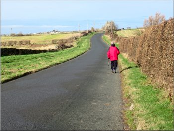
Footway by the road heading towards Whitby Abbey
Path along the access drive into Abbey Farm
Gate from the Abbey Farm field to the Cleveland Way
|
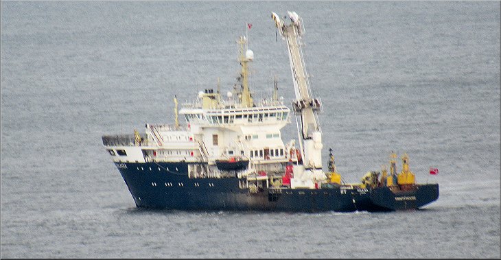
A survey or research vessel anchored off Whitby harbour seen from the Cleveland Way
|
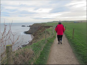
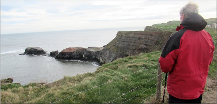
Following the Cleveland Way coastal path
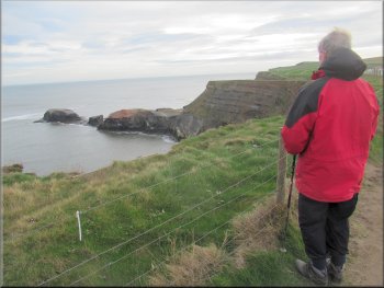
Saltwick Nab seen from the coastal path
Saltwick Nab forms the northwestern edge of Saltwick Bay. When we reached Saltwick Nab the path turned away from the coast passing through a large caravan site. |
At the Cleveland Way path we turned right and walked along the coast path following the Cleveland Way path. We could see a rocky headland ahead of us and this turned out to be Saltwick Nab.
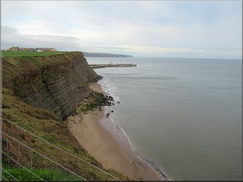
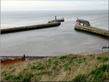
Looking back along the coast to the arms of Whitby Harbour
Path around the caravan site at Saltwick Bay
|
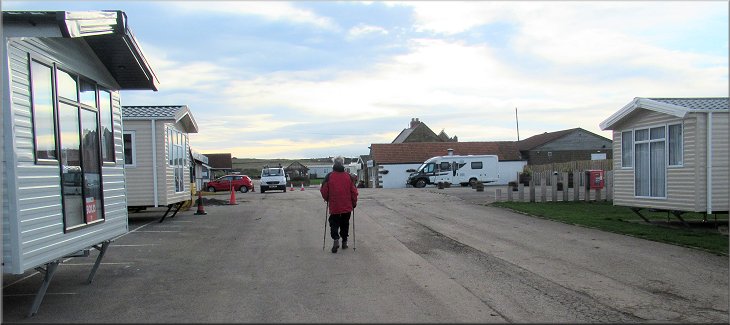
The Cleveland Way path through the caravan site
|
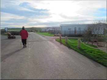
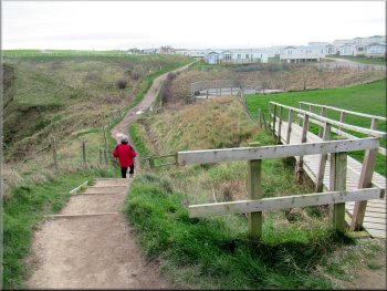
Leaving the Cleveland Way to follow the site access road
Turning right to Hawsker Lane from the caravan site access rd
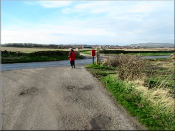
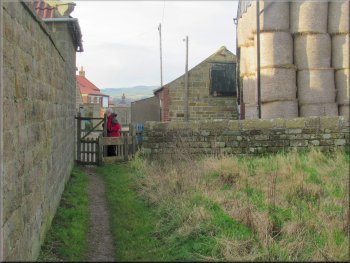
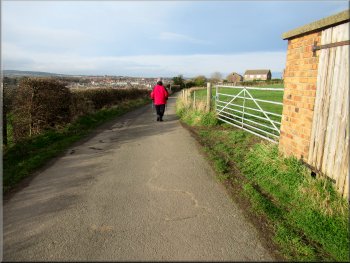
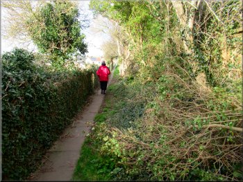
At Hawsker Lane we turned right and walked along this road for about 300m. Here we turned left off the road to follow a public footpath along the edge of a field. |
As we left the caravan site we left the Cleveland Way route and followed the access road from the caravan site for about 500m to a public road called Hawsker Lane.
Following the caravan site access road towards Hawsker Lane
Walking along Hawsker Lane
|
Turning left off Hawsker Lane to the path along the field edge
|
The field path next to the farm buildings
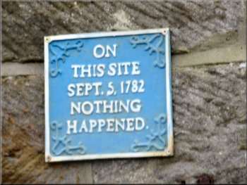
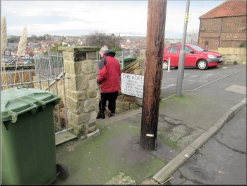
Blue plaque on a house by the lane
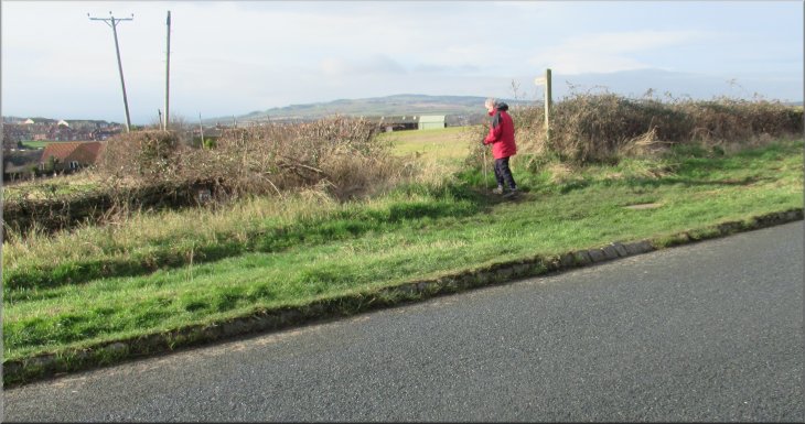
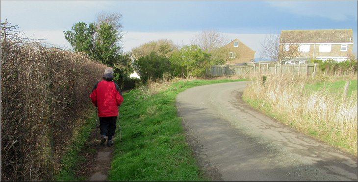
To the left of the road we were looking across the little valley of Spital Beck and ahead we were looking over the valley of the River Esk. After about 400m the lane turned right along the NE edge of a housing estate, but just before this bend in the lane we kept to the left of the lane on a public footpath along the SE edge of the housing estate. |
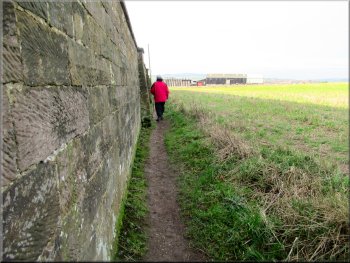
After about 150m there was a high wall on the left of the path and after another 200m we came to a stile onto a lane with farm buildings on our right and some houses on our left. The occupants of one of these houses clearly had a sense of humour and were keen to display their blue plaque commemorating a notable event.
Gate to the lane above the Spital Beck valley
Following the lane above the Spital Beck valley
|
Following the public footpath straight on where the lane bends to our right
|
Public footpath heading for Green Lane
Public footpath heading for Green Lane

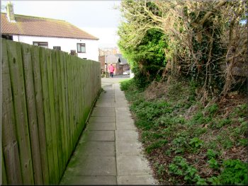
Walking along a residential street from the public footpath
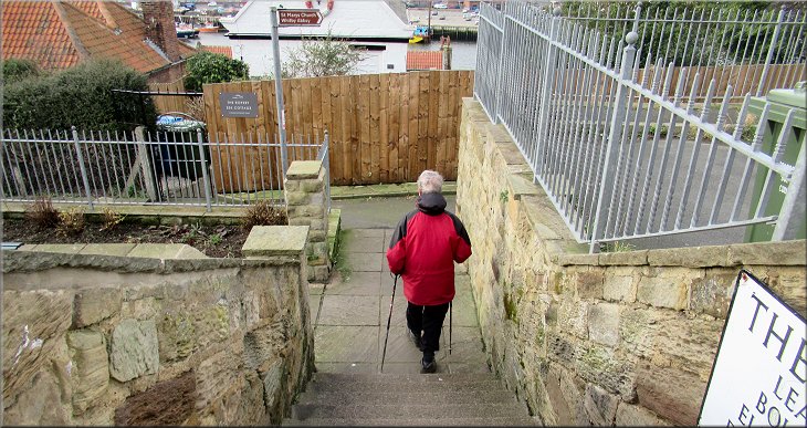
Here my OS Explorer map is a bit misleading because it shows the public footpath continuing straight on through the end of the cul-de-sac but in fact there is no way out of the cul-de-sac, you have to go down the steps and turn right at the bottom.
|
We continued along this path for almost 200m to a road called Green Lane. We crossed Green Lane and continued along the residential street opposite. We walked along this street for about 300m to a sign on the left hand side of the street to a public footpath down some steps.
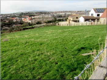
Looking across the valley to the Whitby suburbs
Crossing Green Lane from the public footpath
Turning off the street to follow a public footpath to the church
|
We turned right at the bottom of the steps to follow the path towards St Mary's Church
|
Following the path towards St Mary's Church
Start of the path next to the Donkey Field
There is an information board at the end of the field that explains that the field is know as the Donkey Field or Jack Field and there have been archeological excavations to interpret past uses of the land. From the field the path led us to the cobbled lane next to the steps coming up from Whitby harbour. We crossed the cobbled track and climbed the few steps to the churchyard of St Mary's church. |
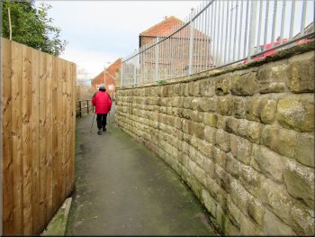
From the bottom of the steps the narrow path then continues parallel to the street with a row of houses called Frank's Terrace, very tasteful, next to the path on our left. At the end of the houses the path bears slightly right and then left climbing up with a field on the left and a wall on the right hand side of the path. There was a view across the River Esk over the field to the left of the path.
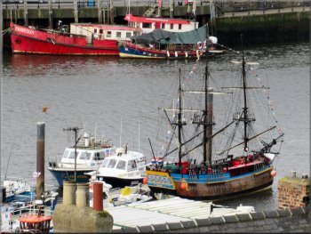
Replica sailing ship for trips from Whitby harbour
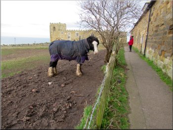
Horse with a coat against the biting wind
|
Steps from the cobbled lane up to the churchyard at St Mary's
|
Exploring the churchyard at St Mary's
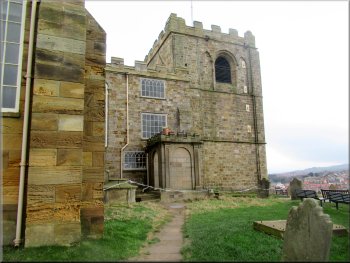
The church tower at St Mary's
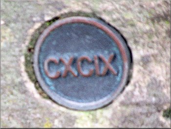
The top step no 199, at the low corner of the churchyard
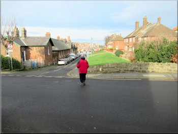
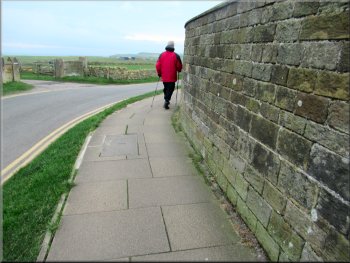
Heading back to the car park along Hawsker Lane
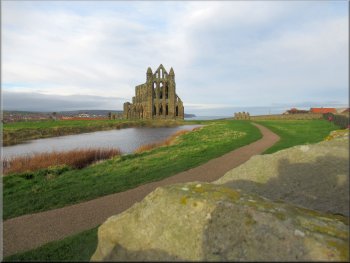
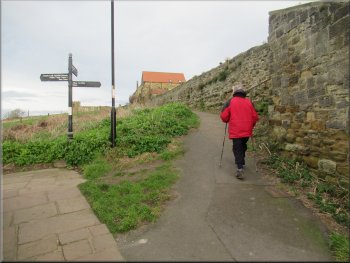
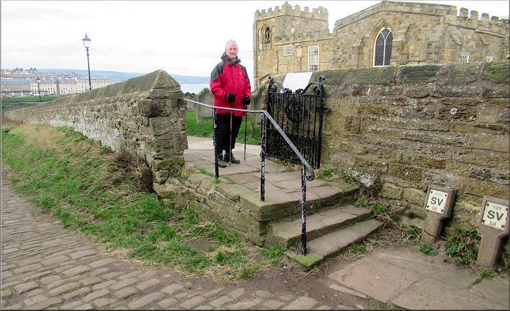
After our fruitless search of the churchyard we crossed the area in front of the Whitby Abbey entrance and followed the footway next to the road back towards the car park. We passed the turning to the footpath out to the Cleveland Way that we had used at the start of the walk. From there we retraced our steps back to the car park and turned onto the tarmac path leading along the edge of the parking area back to the car and the end of our walk. The whole walk had been a little over 5km including our circuit of St Mary's churchyard and this had taken us almost three hours including our search of the gravestones. |
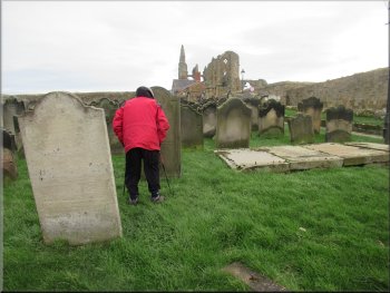
A web site called "7 Secrets of St Mary's Churchyard" provides information to help explorers of the churchyard. We had a good look round for one of the few gravestones with a small scull and crossbones motif carved on it but failed completely. This was very frustrating because both Jim and I have seen two such examples about 20 years ago and neither of us could remember where in the churchyard they were. There are also memorial stones for mariners who were lost at sea with no corpse recovered. We didn't see any of those either!
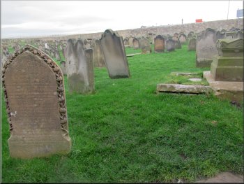
Exploring the churchyard at St Mary's
The arms of Whitby harbour seen from the churchyard
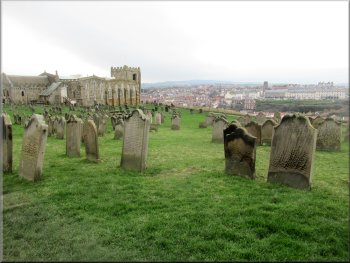
Exploring the churchyard at St Mary's
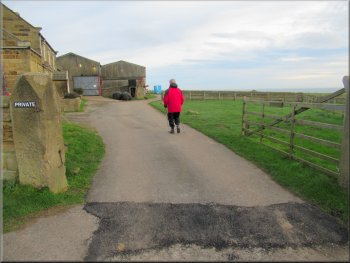
Passing the turning to Abbey Farm on our outward route
|
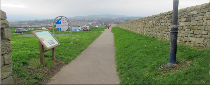
Returning to the car park at the end of our walk
|
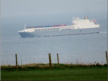
Container ship heading north along the coast
|
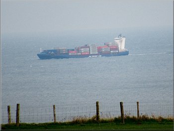
Container ship heading north along the coast
|