|
2001 walks |
2002
walks |
2003 walks |
2004
walks |
|
2005 walks |
2006
walks |
2007 walks |
2008
walks |
|
2009 walks |
2010
walks |
2011 walks |
2012 walks |
|
2013 walks |
2014 walks |
2015 walks |
2016 walks |
|
2017 walks |
2018 walks |
2019 walks |
2020 walks |
|
2021 walks |
1993-2000 library |
Find a Route Index |
|
A few Routes to print out |
Request a Route... |
Route No. 783 - Thursday 8 August 2019
Levisham, Levisham Brow, Dundale Griff,
Dundale Pond, Limpsey Gate Lane circuit - 5km
North York Moors . . .
Route map from Ordnance Survey
Open Space service.
Map: OS Explorer OL27 North York Moors Eastern area

Looking along the village street to the pub in Levisham
|

|
|
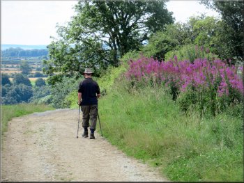
Setting off down the village street in Levisham
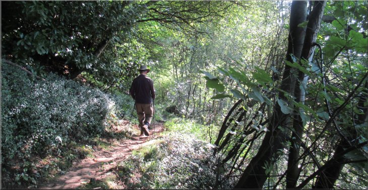
Turning off the road on the edge of Levisham village
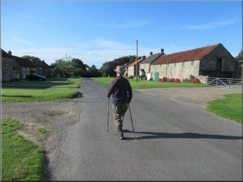
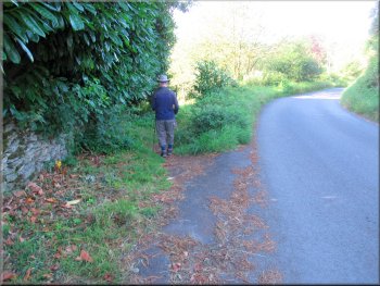
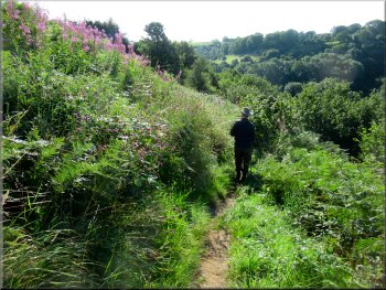
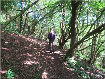
We set off down the village street away from the pub at about 8.30am. We passed the village hall on the right hand side of the road. After about 300m at the bottom end of the village where the road was bending to our right, we turned left off the road on to a public footpath with a wooded bank above us on our left and a steep overgrown wooded slope down to our right. |
There were clear skies and bright sunshine this morning and it was forecast to stay like that for a few hours slowly clouding up with rain likely later in the day. My friend Jim and I made an early start driving out through Pickering to Lockton and then Levisham in the North York Moors. We parked in the village street near the pub in Levisham (map ref. SE 833 906).

The village Hall in Levisham
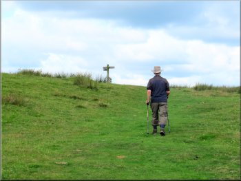
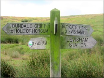
A few metres off the road the sign to the Hole-of-Horcum
|
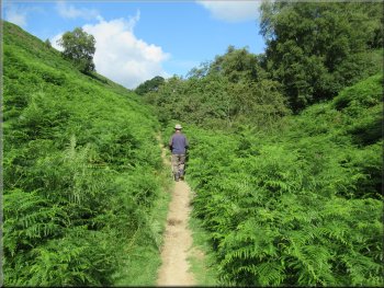
Footpath around the hillside towards Levisham Brow
|
Undulation in the path going up . . .
Painted lady butterfly on knapweed by the path
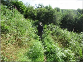
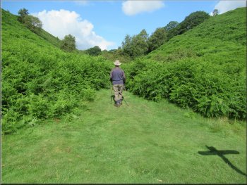
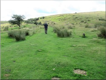
Following the path around the hillside
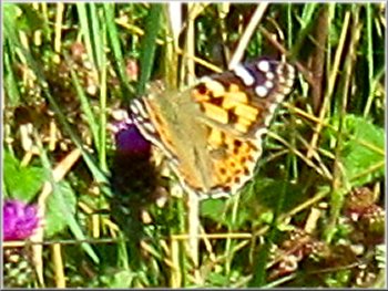
The butterflies were mostly painted ladies, migrants from Europe, and peacocks. The sun was quite warm by now and the butterflies were very active and hard to photograph. Below us now was Levisham Beck and this part of the valley is called Levisham Brow. |
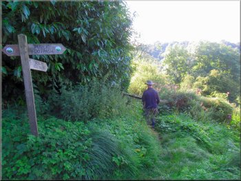
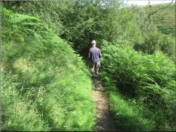
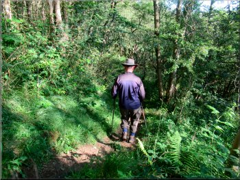
We continued along this path for about 400m from the road to a fork in the path with a finger post indicating the right hand fork to Lockton and our path, the left hand fork heading towards the Hole-of-Horcum. There were large clumps of knapweed with numerous butterflies feeding on them.
Continuing along the path to Levisham Brow
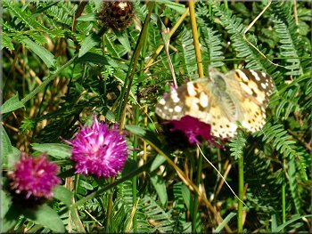
Painted lady butterfly on knapweed by the path

Following the path around the hillside
|
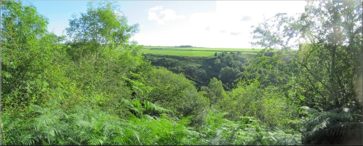
Looking across Levisham Brow
|
Following the path along Levisham Brow
Following the path along Levisham Brow
Starting to drop down towards Levisham Beck
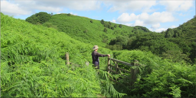
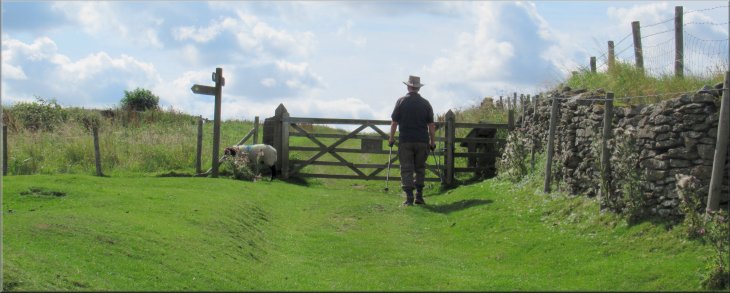
We passed through a pedestrian gate across the path and straight ahead from here we could see the ridge of a hill called Horness Rigg with the path leading down to the beck. We continued down the straight path to a finger post at the bottom of Dundale Griff. |
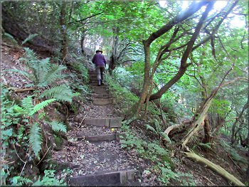
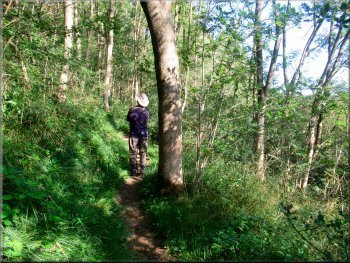
The path along Levisham Brow was narrow and a bit awkward on the steep slope. There were numerous undulations in the path with some quite steep parts. At last we came to a straight length of path dropping gently down towards Levisham Beck.
. . . undulation in the path going down
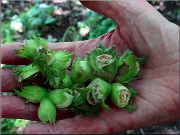
Un-ripe hazel nuts that had been stripped from the trees by the torrential rain a few days ago, they were all over the path
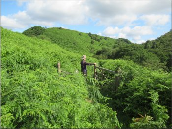
The ridge of Horness Rigg ahead on our way down to the beck
|
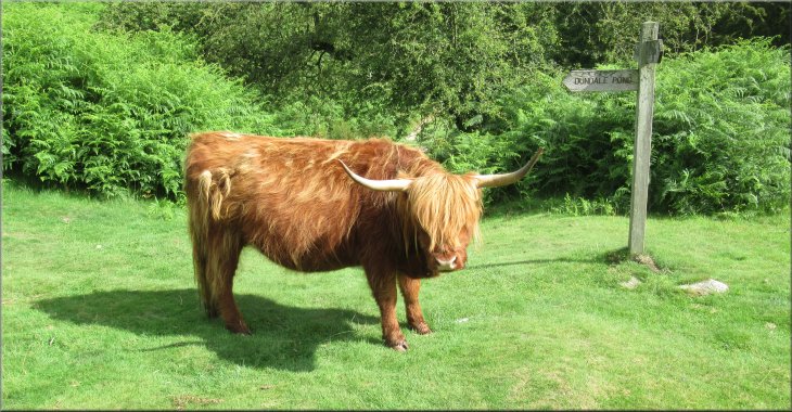
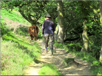
Friendly Highland cow by the finger post
|
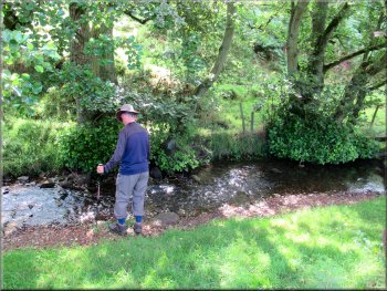
Levisham Beck where we stopped for a drink
Nowadays I look out for such places because it is so much easier to sit down and especially to get up again with my wonky arthritic knees. I'm also very deaf now and I was sitting there having a drink when I sensed some movement behind me. I looked round to see the highland cow grazing no more than two metres away. I sat still and the cow continued grazing and moved away into some tall bracken. When we had had a drink and my knees had recovered from the rough path along Levisham Brow, we walked back to the finger post and took the path up Dundale Griff. |
Next to the finger post at the bottom of Dundale Griff there was a highland cow grazing quietly on its own. There is a herd of highland cattle on the moor that I believe are used for conservation grazing to help preserve the moorland habitat. I have usually seen them on the moorland plateau near Skelton Tower. Our route from here would be up Dundale Griff but first we turned right and walked a few metres to the bank of Levisham Beck where we could sit on the grassy bank with our legs dangling down the bank.
The highland cow followed us to the beck
|
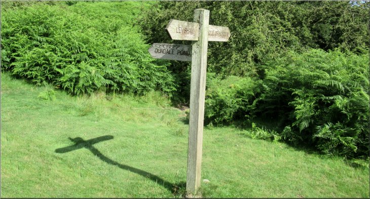
Sign to Dundale Pond along Dundale Griff
|
Pushing through the bracken at the start of the path
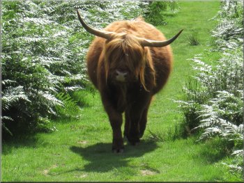
Our Highland cow followed us along the path
Following the path up Dundale Griff
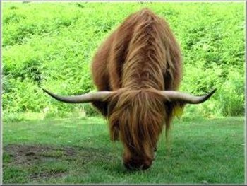
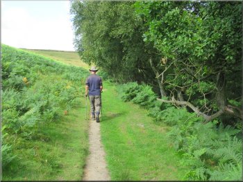
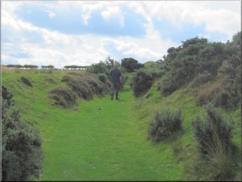
The highland cow seem to want to pass us so we both stood back and the cow overtook us and continued up Dundale Griff. It is a pretty little valley with the heather moor steeply up to our left and the wooded valley down to the dry bed of the beck in Dundale Griff to our right. |
To find the start of the path by the finger post we had to push our way through the tall bracken but after a few metres the bracken cleared and there was a good path. After about 100m I looked back and there was the highland cow following us along the path.
The path up Dundale Griff was soon clear of the bracken
We stood back & let the cow overtake us
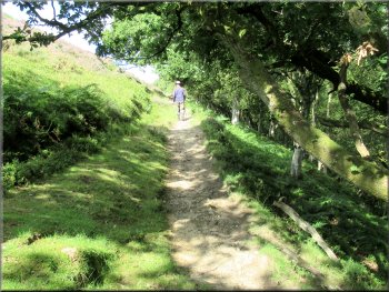
Nearing the end of the woodland
|
At the open moorland we kept to the right hand path at the fork heading for Dundale Pond
|
Approaching the finger post at Dundale Pond
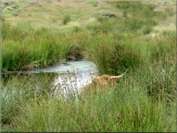
Our Highland cow cooling off in the pond
Grassy track from Dundale Pond
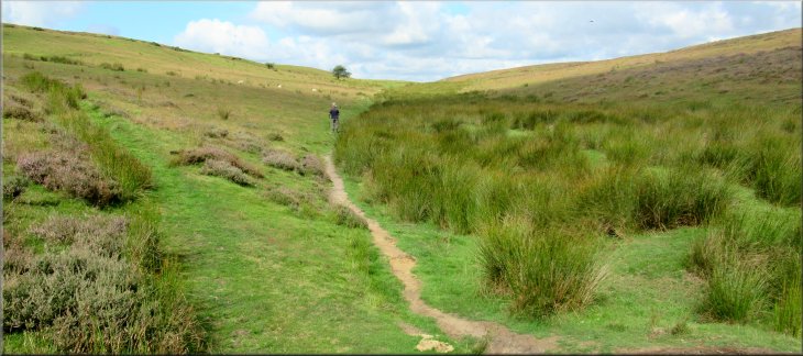
At the pond we could just see our highland cow amongst the reeds standing in the pond. At Dundale Pond we turned left and followed a grassy track between gorse bushes towards Levisham. We followed this track up to a gate at the edge of the open access land. |
About 750m from the finger post at the bottom of Dundale Griff we came out of the little valley to the open moorland and here there was a fork in the path. We kept to the right hand path heading up to Dundale Pond.
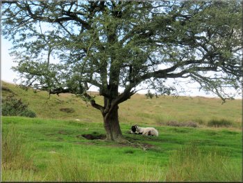
Swaledale ewe resting in the shade
Fingerpost sign at Dundale Pond
Grassy track from Dundale Pond towards Levisham
|
Gate from the open moor on to Limpsey Gate Lane
|
Walking along Limpsey Gate Lane towards Levisham

Farm machinery parked along Limpsey Gate Lane
The whole route had been 5km and it had taken me almost three hours to walk it. We changed out of our walking boots and drove across the valley to Lockton to a little cafe with easy parking where we stopped for our usual coffee and bacon sandwich to round off our outing. |
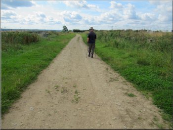
We passed through the gate on to Limpsey Gate Lane. We followed this walled track between the fields for about 1km back to Levisham. We entered the village along the side of the pub and back to our parking spot at the end of our walk.
Walking along Limpsey Gate Lane towards Levisham
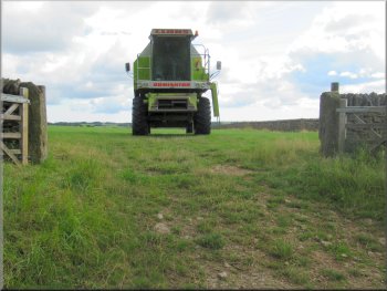
Farm machinery parked along Limpsey Gate Lane
|
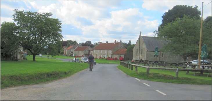
Entering Levisham by the pub along Limpsey Gate Lane
|