|
2001 walks |
2002
walks |
2003 walks |
2004
walks |
|
2005 walks |
2006
walks |
2007 walks |
2008
walks |
|
2009 walks |
2010
walks |
2011 walks |
2012 walks |
|
2013 walks |
2014 walks |
2015 walks |
2016 walks |
|
2017 walks |
2018 walks |
2019 walks |
2020 walks |
|
2021 walks |
1993-2000 library |
Find a Route Index |
|
A few Routes to print out |
Request a Route... |
Route No. 692 - Thursday 5 October 2017
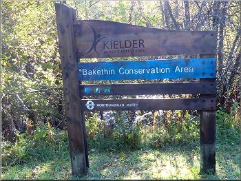
Bakethin conservation area, Lakeside Way,
Bakethin Weir, Old Railway bed path, 5km circuit
Kielder Water & Forest, Northumberland . . .
Route map from Ordnance Survey
Open Space service.
Map: OS Explorer OL42 Kielder Water & Forest
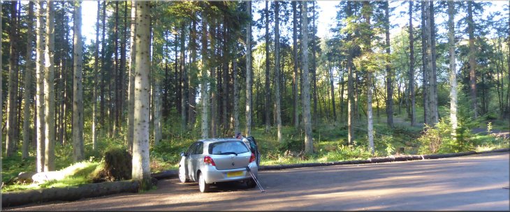
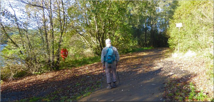
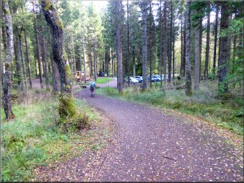
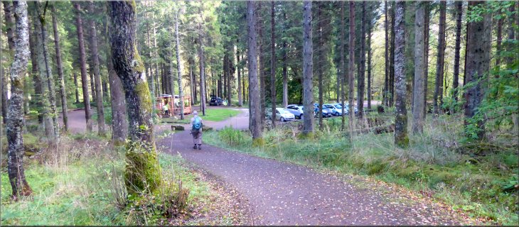
The car park at the Bakethin conservation area
|
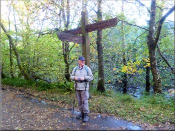
Usual huge finger post sign on the Lakeside Way
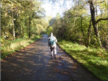
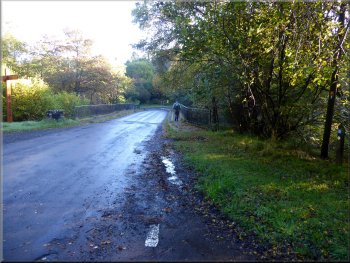
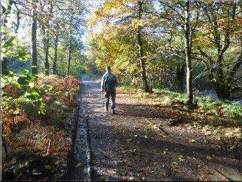
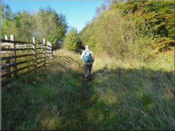
Following the track back from the car park to the road
From the car park we returned via the car park entrance to the public road at map ref. NY 631 928. At the road we turned right and walked along the road over the bridge across the River North Tyne just downstream of its confluence with the Kielder Burn. It was flowing full after the recent rain. |
My friend, Jim, & I have our respective wives agreement to spend a few days exploring the Kielder Water & Forest Park. We are staying at a very nice pub on the edge of the park near the Kielder Water dam. This morning we drove to the Bakethin conservation area car park at map ref. NY 631 927.
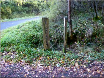
Sign at the turning to the car park
Crossing the road bridge over the River North Tyne
|
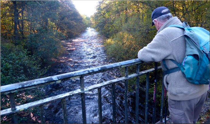
The River North Tyne flowing into Bakethin Reservoir
|
Our right turn off the road on to the Lakeside Way
Turning up the hillside to by-pass the small sewage works
Here the Lakeside Way turned left up the hillside and around the sewage works fence and we continued along the Lakeside Way on the north side of Bakethin Reservoir.
|
Just across the bridge we turned right off the road to follow the Lakeside Way along a wide track. After about 100m the track continued straight ahead into a small sewage works.
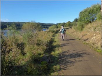
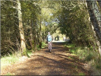
The Lakeside Way heading away from the road
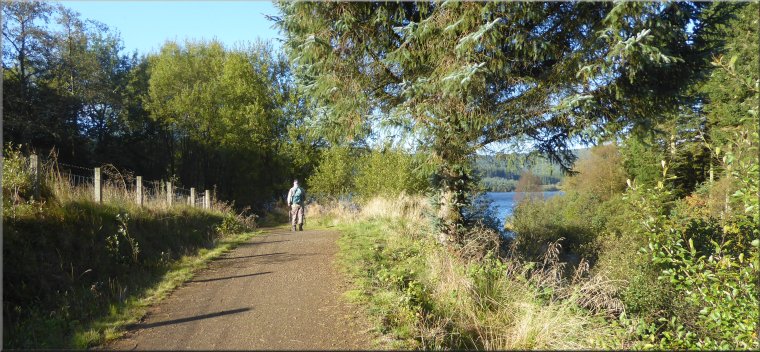
Lakeside Way along the north side of Bakethin Reservoir
|
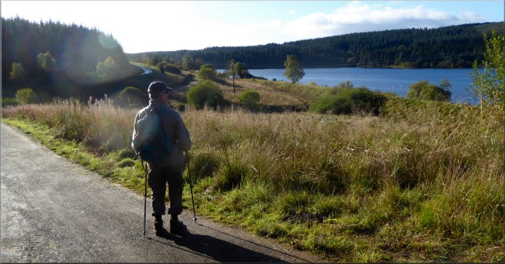
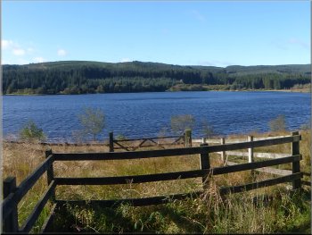
Looking across Bakethin Reservoir from the Lakeside Way above the north shore
|
Lakeside Way bending left to go around a small inlet
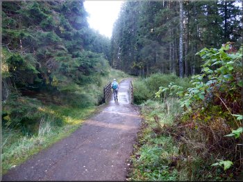
A little over 2km from the road the track began to bend to our left to go around a small inlet of the reservoir. Then at the head of the inlet the track turned right over a bridge across a stream flowing into the reservoir. |
It was a fine sunny morning and the autumn sun was picking out the lovely autumn colours in the trees as we continued along the Lakeside Way route.
Footbridge over a stream at the head of the small inlet
|
Following the Lakeside Way from the footbridge to the Bakethin weir
|
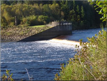
Water at the Bakethin weir flowing into Kielder Water
As far as we could see from this distance it was a stone column about 6m tall with a spiral appearance. There is a car park near the column on the far side of the reservoir for a closer look. |
We continued along the track, still the Lakeside Way, for another 200m to see the weir where water from the Bakethin Reservoir spills over into the head of Kielder Water. At the opposite end of the weir we could just see the Kielder Column amongst the trees.
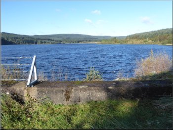
Looking along Bakethin Reservoir from the end of the weir
|
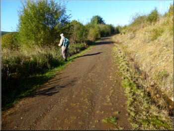
Heading back from the Bakethin weir along the Lakeside Way
|
Looking for the narrow footpath to the left off the Lakeside Way
This path is in fact following the long disused railway running from Hexham to Riccarton Junction, part of the Border Counties Railway. On our walk yesterday we saw Plashetts Incline where tubs of coal were brought down to the railway at Plashetts Station and this path is along the old railway some distance north of Plashetts Station.
|
From the weir we set off back along the Lakeside Way for about 600m to map ref. NY 639 915. Here we turned left off the Lakeside way track onto a narrow path through the long grass towards the north shore of the reservoir. As we continued along this rather wet path it became clearer and wider and easier to follow.
Turning left on to the footpath off the Lakeside Way
|
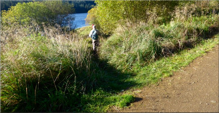
The narrow footpath through the long grass from the Lakeside Way to the old railway bed
|
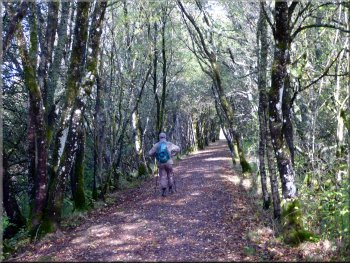
Footpath along the old railway bed
Nearing the railway viaduct over the River North Tyne
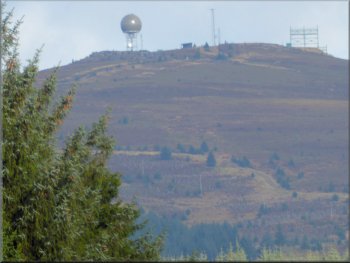
Radome & aerials on Deadwater Fell seen from the viaduct
About 5km away on the summit of Deadwater Fell at almost 600m there were aerials and a what looked like a water tower but it was in fact an MoD Radar Tower. The viaduct parapet has some interesting ironwork panels that are worth a look. |
There were some very pretty views across Bakethin reservoir as we followed the railway path above the shore. After almost 1km along the railway path we came to the railway viaduct over the inlet to the reservoir. Looking north from the viaduct we could see Deadwater Fell.
Looking across Bakethin Reservoir from the railway footpath
Start of the railway viaduct over the North Tyne
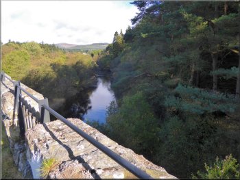
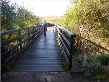
The North Tyne seen from the railway viaduct
|
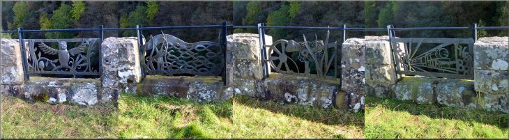
Decorative panels in the parapet of the railway viaduct
|
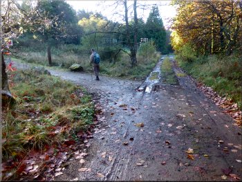
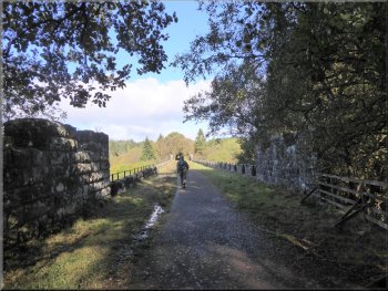
Following the railway path back to the car park
We walked down a track on the right to the car park and the end of our walk. Well not quite the end as we also had a quick look at the conservation area. |
We crossed the viaduct and continued along the railway path towards the road. A few metres before we reached the road we turned right off the railway track.
Walking down from the railway path to the car park
|
Returning to the car park at the Bakethin conservation area at the end of our walk
|
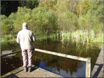
Pond in Bakethin conservation area
Then it was time to set off on the drive home at the end of our visit to the Kielder Water & Forest Park. Today's walk had been about 5km in the autumn sunshine and it had taken us around two hours to walk before we had to set off home. |
We found a pretty pond with a boardwalk on one side and a small viewing platform. Apparently there is also a bird watching hide but we did not see it. From the conservation area car park we drove back to the car park near the Bakethin weir for a quick look at the Kielder Column.
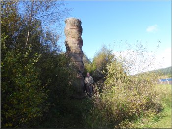
Kielder Column by the weir at the end of Bakethin Reservoir
|
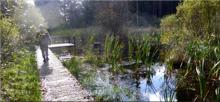
Board walk by the pond in Bakethin conservation area
|
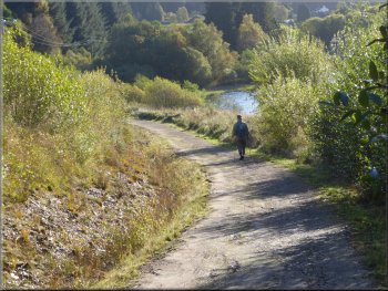
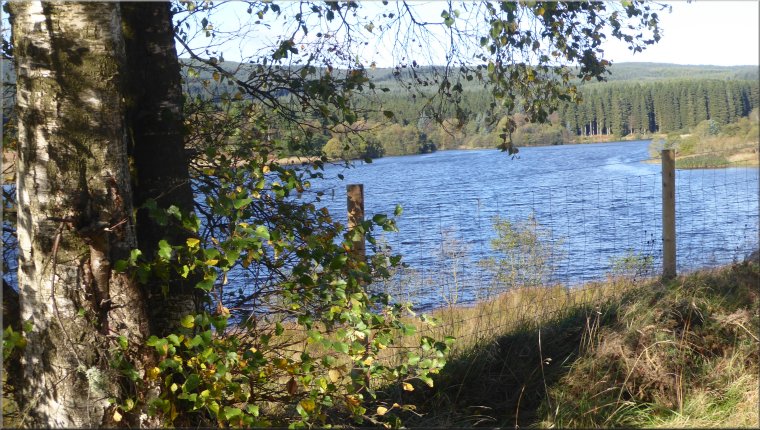 Bakethin Reservoir seen from the path along the old railway bed