|
2001 walks |
2002
walks |
2003 walks |
2004
walks |
|
2005 walks |
2006
walks |
2007 walks |
2008
walks |
|
2009 walks |
2010
walks |
2011 walks |
2012 walks |
|
2013 walks |
2014 walks |
2015 walks |
2016 walks |
|
2017 walks |
2018 walks |
2019 walks |
2020 walks |
|
2021 walks |
1993-2000 library |
Find a Route Index |
|
A few Routes to print out |
Request a Route... |
Route No. 689 - Saturday 23 September 2017
Market Square, Main St, St Mary's Church,
Ruskin's View, Radical Steps or Mill Brow to R. Lune,
Devil's Bridge, Footpath to Jingling Lane - 3km
Kirkby Lonsdale . . .
Route map from Ordnance Survey
Open Space service.
Map: OS Explorer OL2 Yorkshire Dales Southern & Western Areas
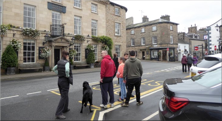
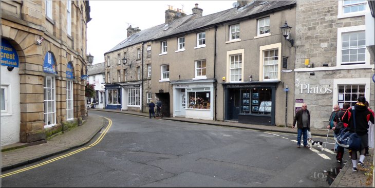
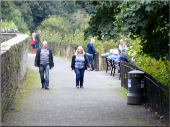
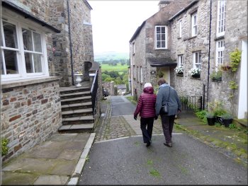
Setting off from the Market Square along Main Street with the family including Max the dog
|
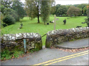
The Market Square, map ref. SD 611 786
. . . but for the purpose of this route description I'm going to start at the Market Square in Kirkby Lonsdale. From the Market Square we walked along Main Street where the ladies took an interest in the boutiquey fashion shops. At the end of Main Street we made a sharp left turn into Market Street. |
This weekend we are having a family gathering in a large holiday cottage in Kirkby Lonsdale. This Saturday morning we managed to get all of us on a very pleasant family stroll through Kirkby Lonsdale and along the side of the River Lune. Obviously we actually started from our holiday cottage . . .
Making our way along Main Street from the Market Square
|
Turning left at the end of Main Street into Market Street
|
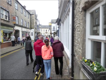
Walking along Market Street
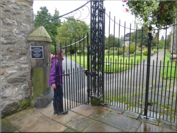
The restored gates into the churchyard
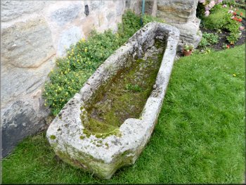
Stone coffin at the corner of the church
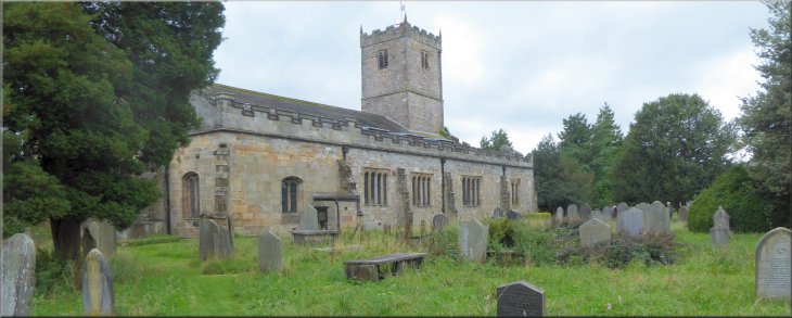
There is a plaque at the gates noting that the gates were restored in 2009 including the unusual self closing and self-centering hinges. We followed the public footpath across the churchyard to the church, St Mary's, where there is an old stone coffin at the corner of the building. |
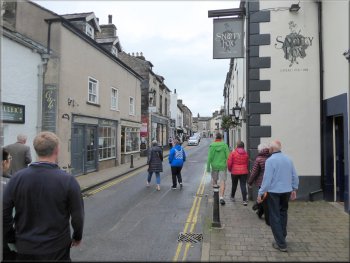
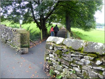
Between 'The Sun Inn' in Market Street and 'The Spotty Hen' (clothing shop that took us some time to pass), we turned right off Market Street into Church Street. This short street ends at the gates to the churchyard.
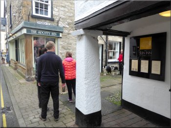
About to turn right at the Sun Inn into Church Street
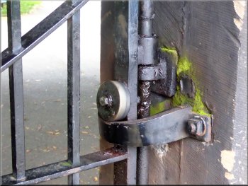
Self closing & self centering hinges on the gates
Sundial in the churchyard
|
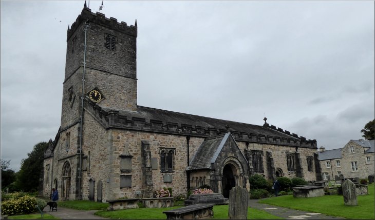
The Parish Church of St. Mary in Kirkby Lonsdale
|
Path from the churchyard to Ruskin's view
Ruskin's view over the River Lune . . .
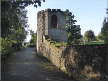
Tower in the churchyard by the Radical Steps
Turner's painting was sold to a private buyer for over £200,000 in January 2012. After enjoying the view for a few minutes we returned along the footpath to the churchyard at the top of the 'Radical Steps', so named on account of the political views of the builder. |
We continued past the church and across the churchyard to a path high above the River Lune. We turned left and walked about 30m along this path to some seats overlooking Ruskin's view. This is a scene that was painted by JMW Turner.
Seats by the path at Ruskin's view
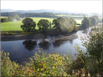
. . . Ruskin's view over the River Lune
The Radical Steps down to the River Lune
|
St. Mary's Church seen from the path leading to the Swine Market
|
Poignant grave of an unknown man drowned in the R. Lune
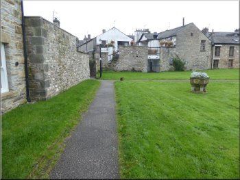
Nearing the alley from the churchyard to the Swine Market
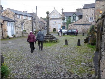
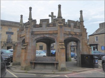
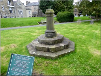
Crossing the old Swine Market to Mill Brow
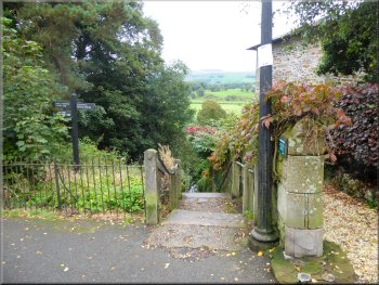
When we reached the corner of the churchyard we followed the path through a narrow cobbled alleyway into the old Swine Market square with a market cross at its centre. We crossed the little square and turned left to walk down a steep narrow lane called Mill Brow. |
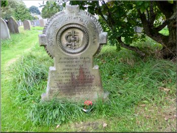
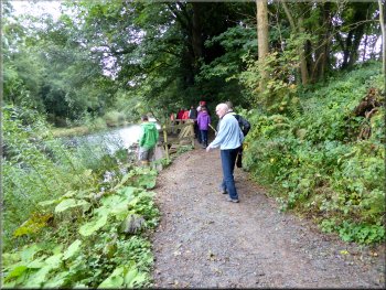
The younger, fitter members of our family went down the steps to meet us on the river bank. The rest of us continued on the path along the edge of the churchyard. There is a poignant grave stone by the path recording the death by drowning of an unknown young man thought to be Italian.
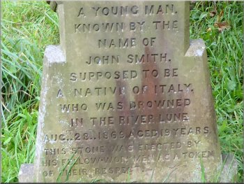
Poignant grave of an unknown man drowned in the R. Lune
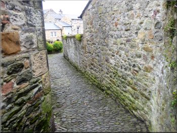
Cobbled alley from the churchyard to the Swine Market
Walking down Mill Brow to the River Lune
|
At the bottom of Mill Brow we joined the rest of the family who had walked along the riverside from the Radical Steps
|
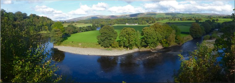
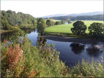
Riverside path looking across to the long island in the river
The river merges into one channel at the end of the island
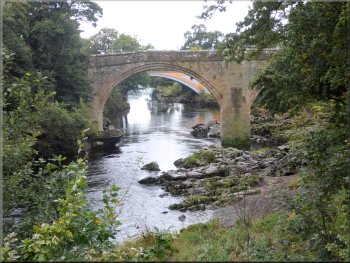
The Devil's Bridge over the River Lune
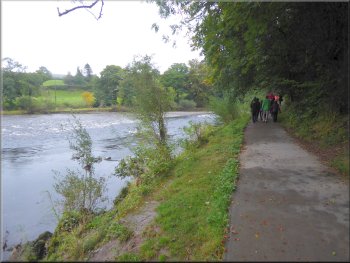
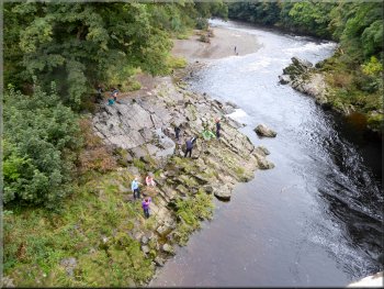
At the bend the whole River Lune is all in one channel again. Below the path the river has a shingle beach for most of the remaining 300m to Devil's Bridge. The agile members of the family picked their way along the beach to the rocky outcrops at Devil's Bridge. |
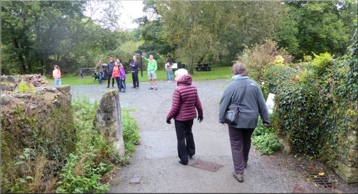
At the bottom of the hill we joined the river side path where the rest of the family were waiting next to an information board. At the river side path we turned right and walked beside the river. It is only part of the river flowing round the south of a long island that stretches from Ruskin's view for about 400m to a bend in the river.
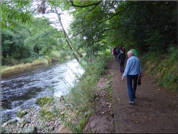
Riverside path looking across to the long island in the river
Waiting for the stragglers/explorers to catch up
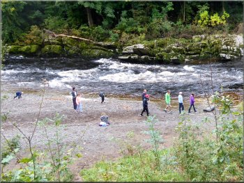
The exploring family members on the shingle beach
|
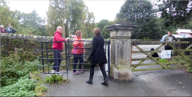
Kissing gate from the riverside path to Bridge Brow at the Devil's Bridge
|
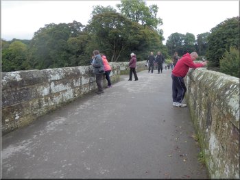
Watching the fast flowing river in its rocky channel below
About 100m downstream there is the road bridge carrying the A65 over the River Lune. We returned to Bridge Brow at the end of the Devil's Bridge and turned left off the road through a stone squeeze stile into a field. The field is mown and used as a picnic area. |
We all passed through the kissing gate on to the road called Bridge Brow and turned left to walk onto the bridge and look at the river. It's a lovely setting. There is something fascination about the fast flowing river tumbling through the rocky channel.
River Lune flowing towards the Devil's Bridge
|
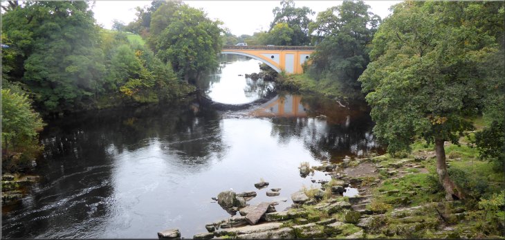
Bridge carrying the A65 over the River Lune
|
Stile from Bridge Brow into the picnic field
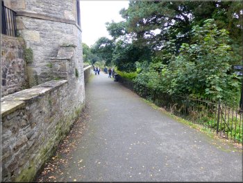
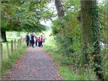
Start of the path from Bridge Brow up to the town
Heading back up to the town
Here we turned left and walked along Jingling Lane, past the public toilets on our left to return to the Market Square where there is a market every Friday. The Market Square is the end of our walk. The whole route was only 3km but it took almost two hours with the whole family.
|
We walked up the field next to Bridge Brow for about 100m to a pedestrian gate back on to the road. We crossed the road and continued along a public footpath opposite climbing gently up the hill side back to the town. We continued along this footpath crossing under Lunefield Drive to the end of Jingling Lane.

We crossed Bridge Brow to join the path back up to the town
Heading back up to the town
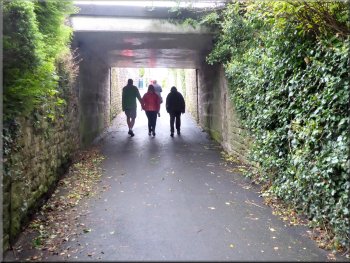
Passing under Lunefield Drive near the top of the climb
|
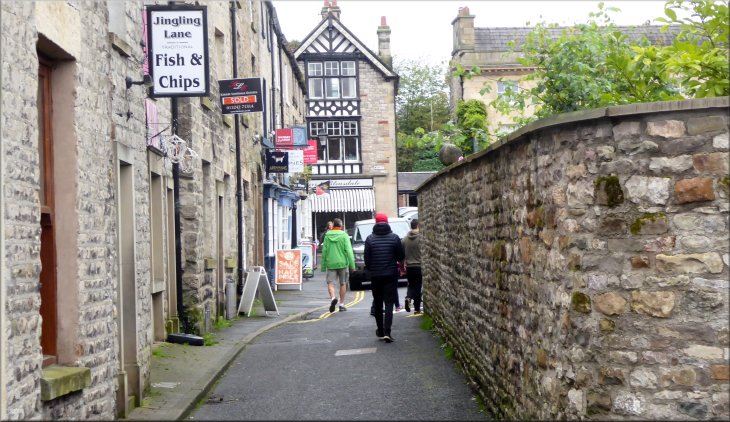
Walking along Jingling Lane to the Market Square & the end of our walk
|