|
2001 walks |
2002
walks |
2003 walks |
2004
walks |
|
2005 walks |
2006
walks |
2007 walks |
2008
walks |
|
2009 walks |
2010
walks |
2011 walks |
2012 walks |
|
2013 walks |
2014 walks |
2015 walks |
2016 walks |
|
2017 walks |
2018 walks |
2019 walks |
2020 walks |
|
2021 walks |
1993-2000 library |
Find a Route Index |
|
A few Routes to print out |
Request a Route... |
Route No. 685 - Thursday 31 August 2017
Newton-on-Rawcliffe, Tabular Hills route,
East Brow Rd, Ruddings Rd, Keldgate Rd,
West Dyke Rd - 8km circuit
North York Moors . . .
Route map from Ordnance Survey
Open Space service.
Map: OS Explorer OL27 North York Moors Eastern area
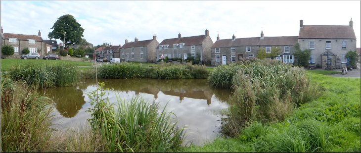
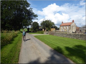
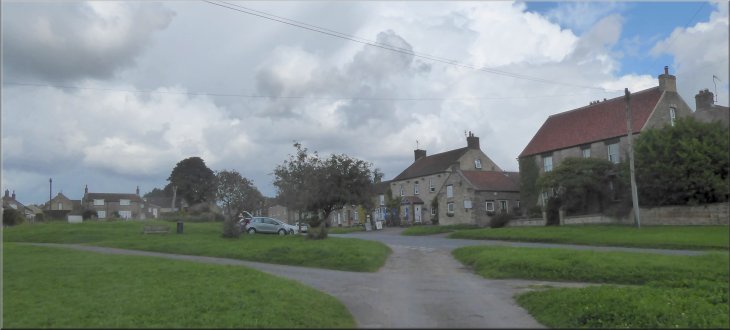
The duck pond and village green at Newton-on-Rawcliffe at the start of our walk
|
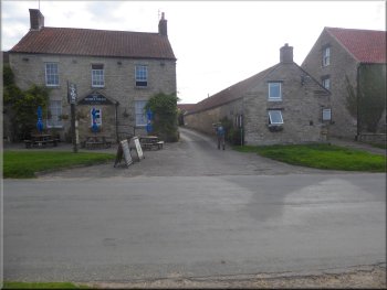
The White Swan pub at the start of our walk
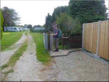
Gate where the footpath goes around the caravan site
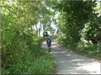
We followed the public footpath along the side of the pub to the edge of the pub's caravan site. Here we kept right through a pedestrian gate to continue along the public footpath around the outside of the caravan site. After about 200m the narrow footpath brought us to a wide grassy track. |
This morning my friend, Jim, and I drove to Newton-on-Rawcliffe about 6km north of Pickering on the edge of the North York Moors National Park. We parked on the village green next to the village duck pond at map ref. SE 812 905. From our parking spot we crossed the road to the White Swan pub.
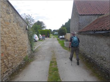
Public footpath along the side of the White Swan pub
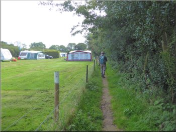
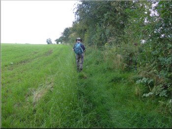
Public footpath around the caravan site
|
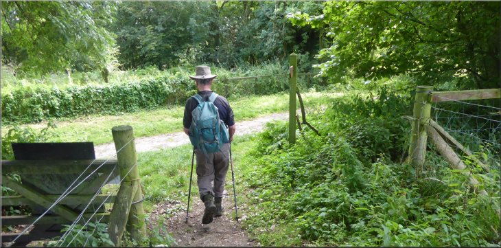
Joining the route of the Tabular Hills Walk
|
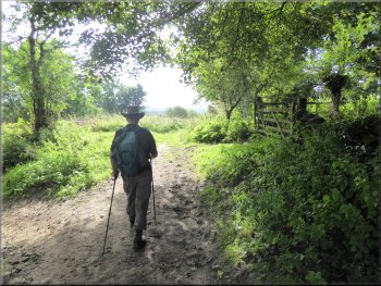
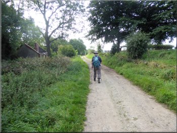
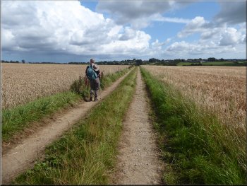
Following the route of the Tabular Hills Walk southwards
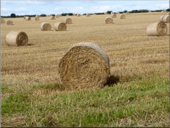
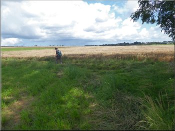
Straw bales after the harvest
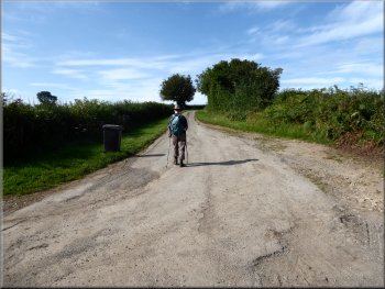
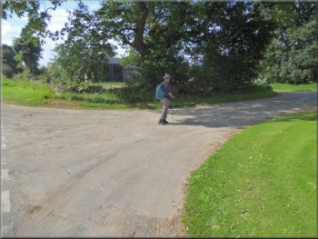
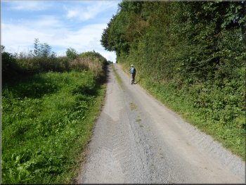
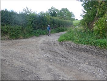
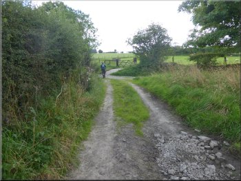
The route of the Tabular Hills Walk continued along the road, called East Brow Road. About 800m from East Brow House the metalled surface ended and the track continued for another 400m past Howlgate Farm to a junction in the tracks at map ref. SE 822 887. |
The route of The Tabular Hills Walk goes along this track and we turned right at the track and followed the Tabular Hills Walk route. After about 700m along this track we came to East Brow House. Here the track joined a metalled road.
Ruined house next to the track
Track passing Howlgate Farm
|
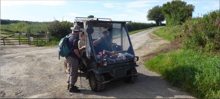
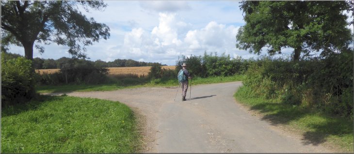
Stopping for a chat at the junction with Ruddings Road
|
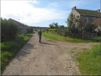
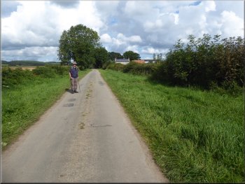
Following Ruddings Road away from the junction
They continued on their way and at the junction we turned right to follow a public road called Ruddings Road. Looking to our right across the fields we could see Newton-on-Rawcliffe about 2km away. We followed Ruddings Road for about 1km to the junction with the road we had driven up from Pickering. |
At the junction we met a couple in an old ATV pickup. They were very friendly and had their labrador type dog (not quite as friendly) lying across both their knees and the dashboard shelf full of soft toys for the dog.
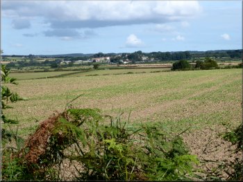
Looking across the fields back to Newton-on-Rawcliffe
|
Following Ruddings Road down to the road from Pickering near Lydds Farm
|
Walking along the Pickering road towards Lydds Farm
Following Keldgate Road past Lydds Farm
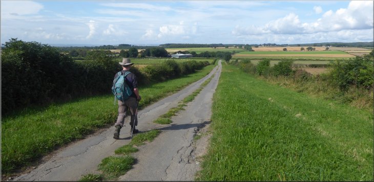
Following Keldgate Road westwards from Lydds Farm
As we walked nearer to the wires we could see that they were sturdy power cables and the birds we quite big, certainly not swallows or martins. Eventually we could see clearly that it was a large flock of pigeons. We continued along Keldgate Road to a junction at map ref. SE 801 886. |
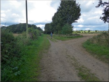
At this road we turned left walked along the road for about 200m, then between Lydds Farm and Yatts Farm we turned right off the road to follow a lane with a metalled surface called Keldgate Road. After a few hundred metres we saw a large number of birds all sitting on the overhead wires.
Turning on to Keldgate Road
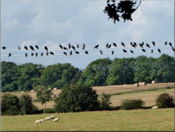
Flock of pigeons on the overhead wires
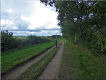
Following Keldgate Road westwards from Lydds Farm
|
Turning right from Keldgate Road on to West Dyke Road
|
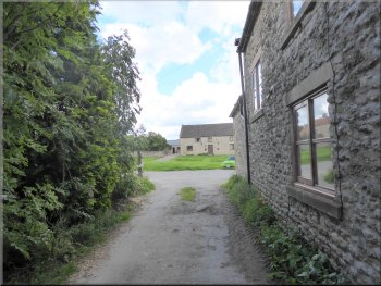
Approaching Haugh Rigg farm & caravan site
Straight on along West Dike Road, not the track into the field
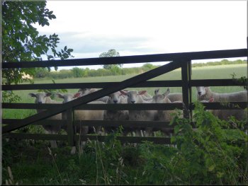
Well grown lambs peering through the gate
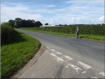
It seemed to be quite busy with children playing on the grass as we passed by along West Dyke Road. A little further on we passed a track on our left that leads down to a public road called Bradley Road. We continued straight on for another 200m and then turned right off the track on to a public footpath heading north east along the edge of the fields. |
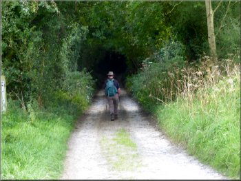
Here there was a grassy track to the left called Haugh Rigg Road and the metalled lane continued to our right and was called West Dyke Road. Along the way we had passed several signs giving the distance to Haugh Rigg and shortly we came to Haugh Rigg where the metalled surface ended and a grassy track continued. Haugh Rigg is a farm with a caravan & camping site.
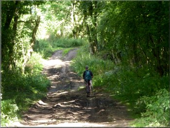
Grassy track, West Dike Road, beyond Haugh Rigg
Small wood on West Dike Road at map ref. SE 798 898

We kept straight on, ignore the track to the right
|
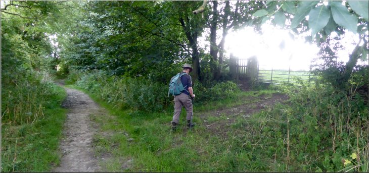
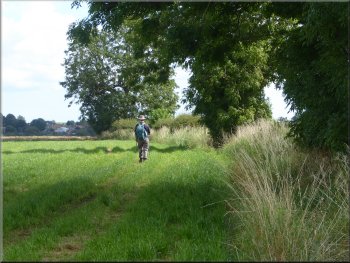
Turning right off West Dike Road to follow a footpath along the edge of the field heading for Newton-on-Rawcliffe
|
Heading for Newton-on-Rawcliffe along the edge of the field
The path turns left & then right along a farm track
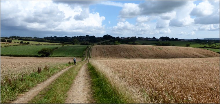
Turning right at a junction in the track map ref. SE 808 904 . . .
We crossed the village green back to our car and the end of our walk. The whole route had been 8km and it had taken me about two and three quarter hours to walk. The weather forecast had wared of shower, some thundery, all day but we had missed the rain completely with just a couple of long loud claps of thunder and we returned between the fields back to Newton-on-Rawcliffe. |
At the end of this first field the path turned sharp left for about 30m and then sharp right following a farm track between the fields. We continued along this track to a junction in the tracks at map ref. SE 808 904. At the junction we turned right for a few metres and the left to follow a track up the slope back to the village green in Newton-on-Rawcliffe.
Heading for Newton-on-Rawcliffe along the edge of the field
Following a farm track between the fields
. . . then we turned left heading into Newton-on-Rawcliffe
|
Track up a slope to the village green
|
Emerging from the track at the village green
|
Crossing the village green in Newton-on-Rawcliffe to our car at the end of our walk
|