| 2001 walks | 2002
walks | 2003 walks | 2004
walks |
| 2005 walks | 2006
walks | 2007 walks | 2008
walks |
| 2009 walks | 2010
walks | 2011 walks | 2012 walks |
| 2013 walks | 2014 walks | 2015 walks | 2016 walks |
| 2017 walks | 2018 walks | 2019 walks |2020 walks |
| 2021 walks | 1993-2000 library | Find a Route Index |
| A few Routes to print out | Request a Route... |
Route No. 649 - Wednesday 23 November 2016
'K'-Village, River Kent, Miller Bridge,
Castle St, Kendal Castle, Sunnyside,
Jenning's Yard Bridge circuit - 4km
Kendal, English Lake District . . .
Route map from Ordnance Survey
Open Space service.
Map: OS Explorer OL7 The English Lakes South-eastern area
My wife & I are having a few days in the Lake District staying not far from Newby Bridge at the southern end of Windermere. Yesterday we did a short walk over Cartmel Fell & today we are in Kendal. The weather is fine and bright and it's forecast to stay fine all day. We have to head home this afternoon so we are planning to have a walk to the ruins of Kendal Castle this morning.
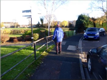
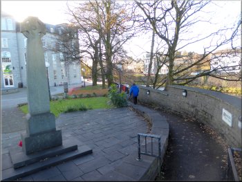
Nearing the war memorial on the riverside by the K-Village shopping centre
|
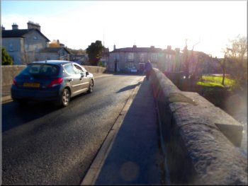
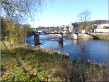
The A65 bridge over the River Kent
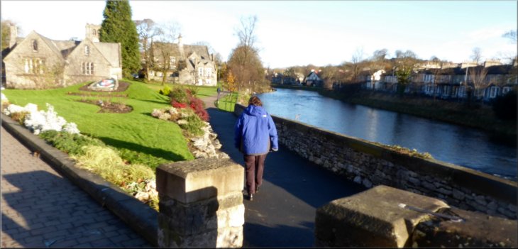
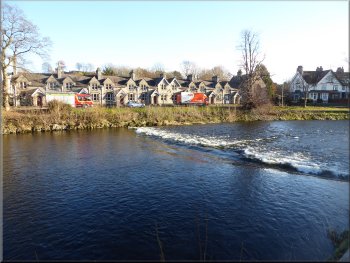
We climbed the stairs from the basement car park and came out onto the walkway beside the River Kent. We followed the walkway heading upstream for about 150m to the war memorial next to the A65 road bridge over the river. |
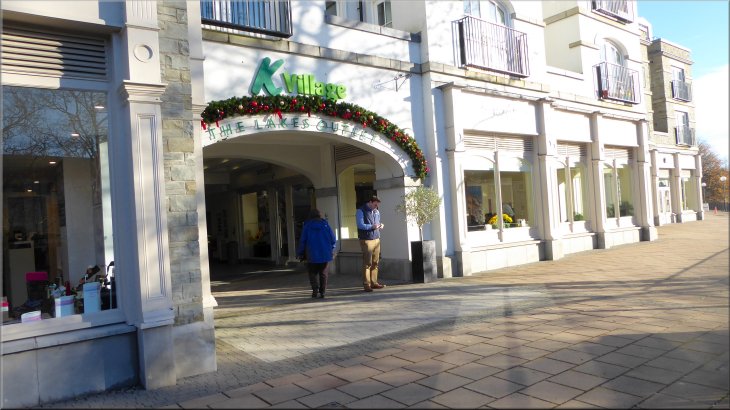
There is a large shopping centre by the River Kent in Kendal called the 'K Village'. It has a large underground car park that only cost us £1 for four hours. The car park entrance is off Lound Road (A65), map ref. SD 518 917.
Looking upstream from the A65 bridge over the River Kent
|
Starting along the riverside path from the A65 bridge over the River Kent
|
Following the riverside path upstream
Walking along Kent Place towards Miller Bridge
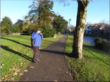
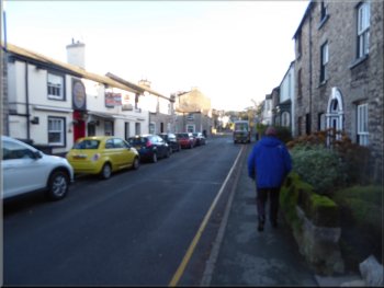
We continued past Jenning's Yard Footbridge over the River Kent on our right and walked along Kent Place by the river to the road bridge called Miller Bridge on our right. |
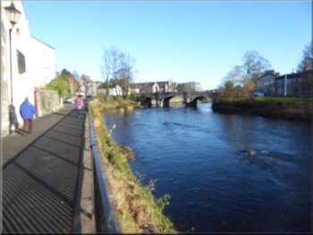
We crossed the river on the road bridge and then turned right to walk upstream along the riverside path. On our left we passed the imposing facade of the Holy Trinity Kendal Parish Church.
Holy Trinity Kendal Parish Church from the riverside path
Crossing Miller Bridge over the River Kent
|
Turning off Bridge Street to the short cut from Bridge Street to Little Aynam
|
Short cut from Bridge Street to Little Aynam
The river side footpath heading to Castle Street
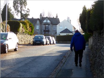
After about 100m along Little Aynam where the road bends right we turned off the road to the left along a footpath to the riverside at Gooseholme footbridge over the River Kent. We did not cross the footbridge but continued upstream along the riverside path for about 200m to Castle Street (A684). |
We crossed the bridge and turned off the A65 (Aynam Road) into Bridge Street. After just a few metres along Bridge Street we turned left off Bridge Street along a footpath that cut off a corner and brought us into a street called Little Aynam.
Turning off Little Aynam onto the riverside path
Looking back to Gooseholme footbridge
|
Riverside appartments seen across the River Kent from Castle Street
|
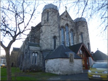
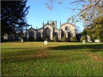
The Parish Church of St. George at the start of Castle Street
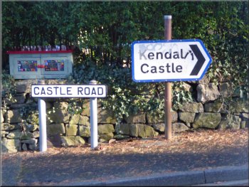
Turning right from Castle Street onto Castle Road
Castle Road heading for the path up Castle Hill
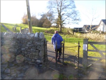
Here, just beyond a cul-de-sac called Castle Park on our right, there is an iron gate into the open grassy area of Castle Hill with an information board. |
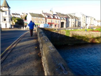
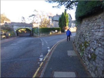
We turned right and walked along Castle Street for about 300m to the junction with Castle Road on our right. Here we turned right and walked along Castle Road for about 120m.
Following Castle Street (A684)
Turning right from Castle Street onto Castle Road
Gate from Castle Road to the path up Castle Hill
|
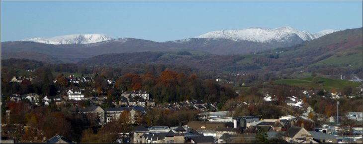
Snow on the distant Lakeland Fells looking North West from Castle Hill
|
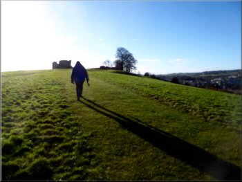
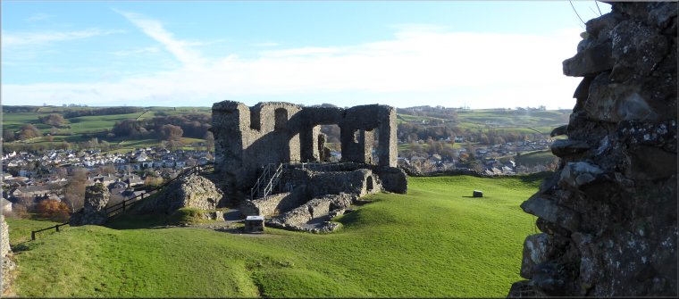
Nearing the top of Castle Hill with the castle ruins in sight
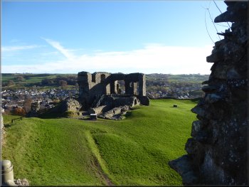
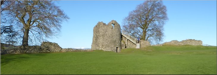
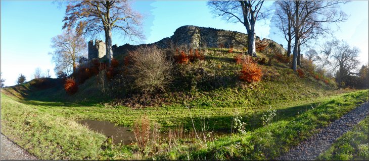
Part of Kendal Castle ruins
The castle ruins are free to explore with a number of information boards to explain the history of the site. The castle site is surrounded by a ditch and earth rampart. |
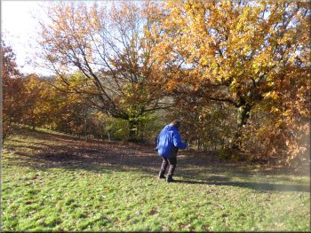
From the gate there is a mown grassy path up the hill to the site of Kendal Castle at the top. There are lovely view from the hill top and today the distant high Lakeland fells were covered in snow.
View looking west from the castle ruins
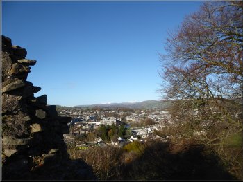
Looking out over Kendal from the castle ruins
|
Part of the Kendal Castle ruins seen from inside the castle wall
|
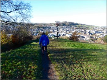
Heading down from the castle ruins past the castle beacon
|
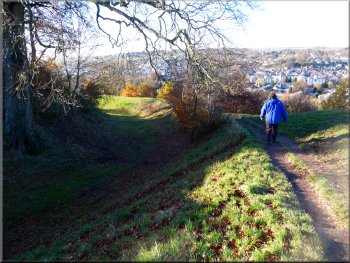
Path around the ditch along the low rampart
|
Looking back across the ditch to the castle mound
|
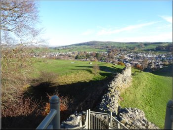
Short bit of slippy bank before the start of the iron handrail
Steps down from Castle Hill to Sunnyside
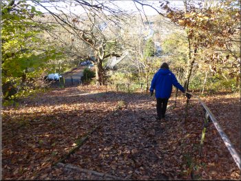
We made our way carefully for a few metres down the steep bank to some steps with an iron rail to hold onto and walked down the steps to an iron gate onto a street called Sunnyside. |
There is a footpath around the rampart which we followed around the western side of the castle.
Handrail & steps down from Castle Hill
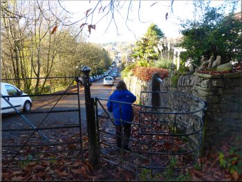
Heading along Sunnyside towards Aynam Road (A65)
|
Turning from Parr Street onto Aynam Road (A65) heading for Jenning's Yard footbridge over the River Kent
|
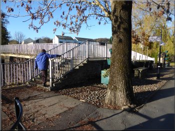
Crossing the River Kent on Jenning's Yard footbridge
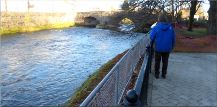
We crossed the river on the footbridge and then turned left to walk back downstream along the river side path. We returned past the parish church to the road bridge over the river. |
We followed Sunnyside and then Parr Street out to Aynam Road (A65). We turned right along Aynam Road for a few metres, then crossed the road to Jenning's Yard Footbridge over the River Kent.
River Kent downstream of Jenning's Yard footbridge
|
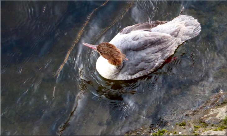
Female goosander, a fish eating duck, on the River Kent
|
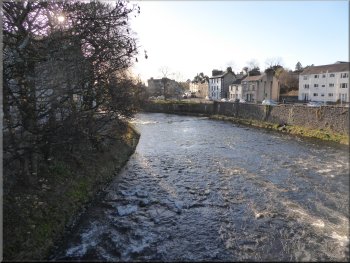
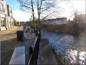
River Kent looking downstream from the A65 bridge
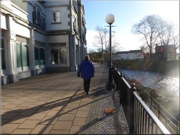
Walkway beside the River Kent at the K-Village shopping centre
We stopped for a coffee at a riverside coffee shop before returning to the basement car park and the end of our walk. The whole route had been 4km and it had taken me about two hours to walk including our coffee stop. |
We crossed the road bridge and turned right past the war memorial to the riverside walkway next to the 'K' Village shopping centre.
War memorial by the A65 bridge over the River Kent
Walkway beside the River Kent at the K-Village shopping centre
|
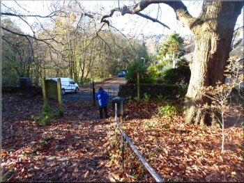
Returning to the K-Village car park at the end of our walk
|