| 2001 walks | 2002
walks | 2003 walks | 2004
walks |
| 2005 walks | 2006
walks | 2007 walks | 2008
walks |
| 2009 walks | 2010
walks | 2011 walks | 2012 walks |
| 2013 walks | 2014 walks | 2015 walks | 2016 walks |
| 2017 walks | 2018 walks | 2019 walks |2020 walks |
| 2021 walks | 1993-2000 library | Find a Route Index |
| A few Routes to print out | Request a Route... |
Route No. 634 - Thursday 4 August 2016
Bolton Castle, Carperby,
Beldon Beck ford circuit - 8km
Wensleydale, Yorkshire Dales . . .
Route map from Ordnance Survey
Open Space service.
Map: OS Explorer OL30 Yorkshire Dales Northern & Central Areas
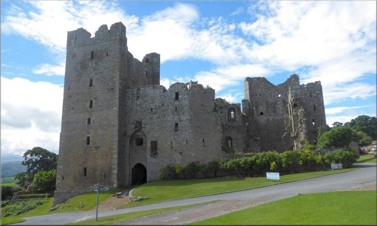
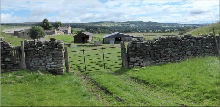
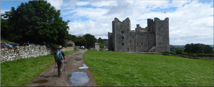
Note: The car park at Bolton Castle is really for the use of visitors to the castle but no-one seems to mind if you park there provided you use the "Pay & Display" machine, unless there is an event on at the castle when the car park is likely to get full. There is a good alternative car park & starting point at the village hall in Carperby (£1 parking charge via honesty box). By starting & finishing the walk at Carperby you do the climb up the valley side straight away and the rest of the walk is relatively flat or down hill
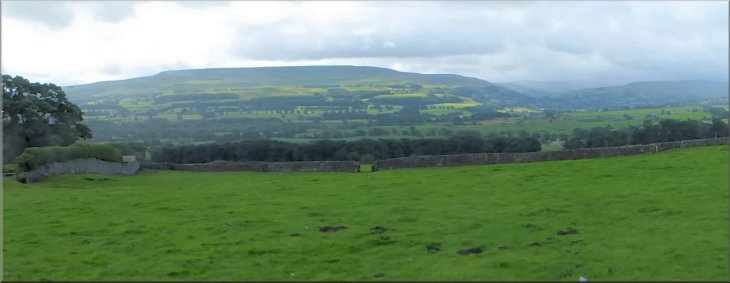
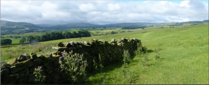
Looking across Wensleydale to Pen Hill from the car park at Bolton Castle
|
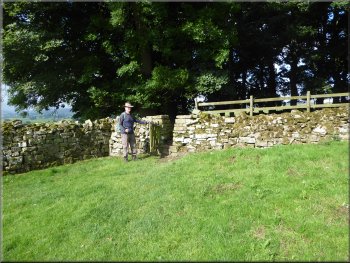
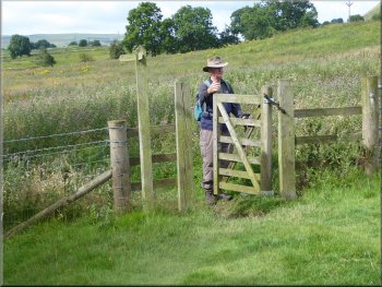
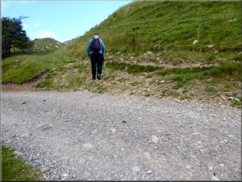
Stile into the wood at the bottom of the field from the car park
The sign indicated a path heading south west diagonally across the field to the bottom edge of a small wood. We followed this path and entered the wood via a gated stone squeeze stile. The wood is only a few metres wide and we passed though the stile at the far side of the wood out into the open fields. The view across Wensleydale was lovely and we continued along the path where there was a well worn mark in the grass. |
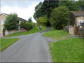
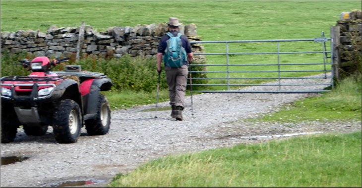
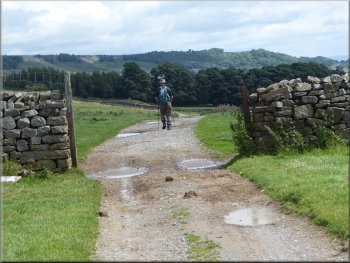
This morning my friend, Jim, and I drove up Wensleydale to Bolton Castle in the village of Castle Bolton. We parked in the "pay & display" car park next to the castle at map ref. SE 033 918. From the car park entrance we crossed the track, it's an old by-way, to the sign post on the edge of the open field opposite. The old by-way would be our return route to the car park.
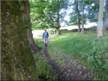
Path through the little wood between the fields
|
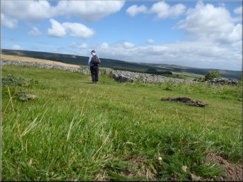
Looking up Wensleydale from the field path near Bolton Castle
|
Following the field path towards Beldon Beck
Approaching West Bolton farm
Turning off the farm access road to the path up to the plantation
From the farm we walked along the farm access road for about 100m to a left hand bend in the access road. On the bend we turned right off the access road and followed a footpath up to the edge of West Bolton Plantation. |
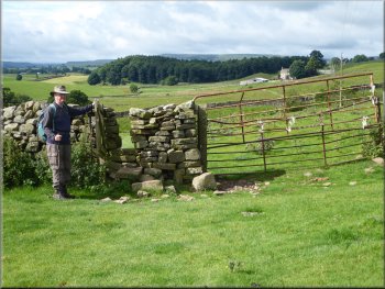
After a few more stiles we came to a footbridge across Beldon Beck and then followed the path across the fields to West Bolton farm where there were donkeys, goats, kune-kune pigs and very free range hens.
Footbridge over Beldon Beck
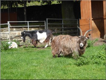
Goats at West Bolton farm
The path up to West Bolton plantation
|
Looking back to West Bolton farm
|
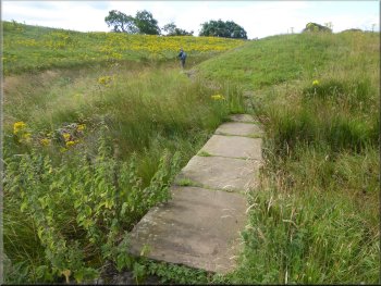
Gate into a rather marshy field full of ragwort
There were two stone lab pathways across the really wet bits and the field was full of yellow poisonous ragwort plants. |
We followed the path around the northern side of West Bolton Plantation and a across a large marshy field.
Stone slab path across the marsh
|
We crossed a series of fields recently cut for hay/silage
|
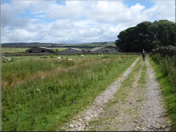
Farm track heading for Carperby
Reaching the road at Carperby
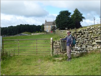
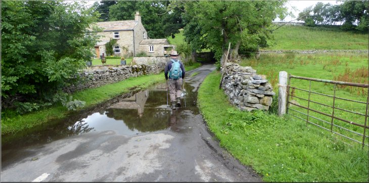
The track led us out to the road at East End Farm on the eastern edge of Carperby at map ref. SE 010 900. At the road we turned right and walked along the road for about 150m. Then we turned right along a narrow lane. |
Beyond the ragwort field we crossed several fields where the grass had recently been cut for hay. We continued along the field path which joined a farm track.
Farm track heading for Carperby
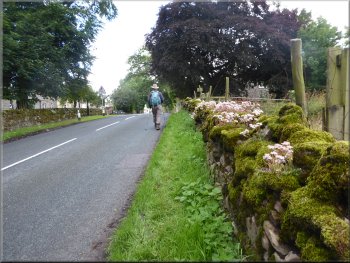
Walking along the road in Carperby
|
Turning off the road in Carperby to follow a lane up the hillside
|
Taking the road from the green up the hill out of Carperby
Nearing our turn to the right just beyond the stone building
The bridleway up the hillside with the wall on our right
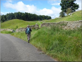
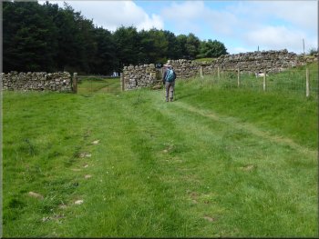
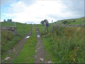
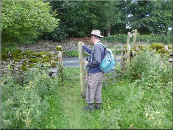
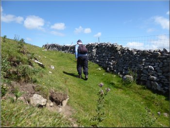
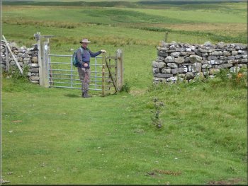
About 50m further along the lane bent to our left and there was a track off to the right following a drystone wall up the hillside. This was our route climbing up alongside the wall on the right for about 300m to join a bridleway at the top of the climb coming from our left. A few metres further on we came to a field gate at map ref. SE 007 909 on to open access land. |
After about 100m along the lane, it bent round to our left and came to a small green. At the green we turned right and followed a lane climbing up the hillside out of Carperby. After about 350m we passed a bridleway that came along the bottom of Ponderledge Scar and joined the lane from our left.
Following Peatmoor Lane out of Carperby
Turning right off the track to follow a bridleway up the hillside
Joining another bridleway at the top of the climb
|
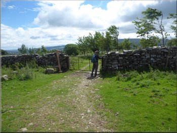
Gate on to open access land just after we joined the bridleway at the top of the climb
|
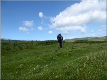
Grassy track across open area of rough grassland and bracken

Looking back along the bridleway as I neaed the field gate
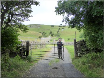
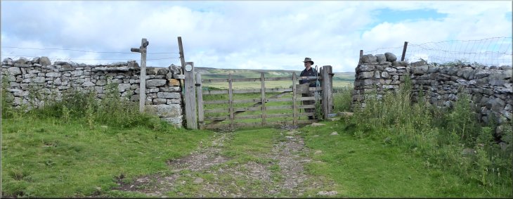
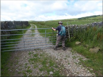
At the far side of the field we came to a gate with a sign post indicating that the bridleway ran from Arkrigg & Carperby to Castle Bolton. |
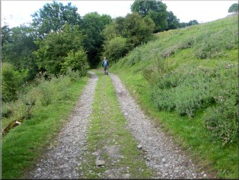
We passed through the field gate and followed a wide grassy track across the open access land for about 750m following a route about 200m to the west of the wall at the eastern edge of the field.
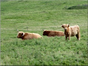
Highland cattle in the next field to the east of the path
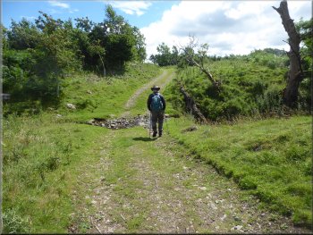
The track here is an old by-way that continues to Bolton Castle
|
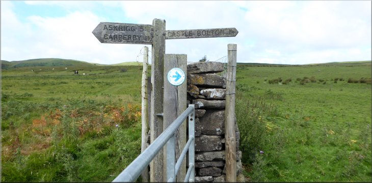
Sign post at the gate indicating that the bridleway runs from Arkrigg & Carperby to Castle Bolton
|
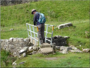
Footbridge by the ford across Beldon Beck
Following the by-way eastwards from Beldon Beck
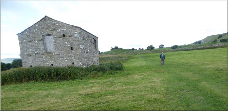
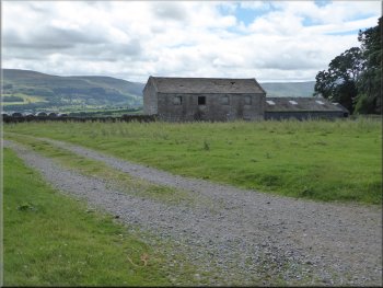
By-way next to the farm sheds
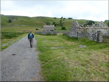
These sheds were of modern construction but seemed to be completely abandoned and derelict. They looked to have been built for intensive livestock rearing, maybe bull beef or pigs or poultry? I don't know but there had been a lot of investment that came to nothing. |
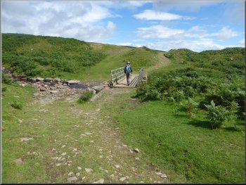
Beyond the gate the bridleway goes along an old By-Way and crossed the ford over Beldon Beck. Don't be alarmed there's a footbridge alongside the ford. From Beldon Beck we followed the by-way for about 900m to a group of large agricultural sheds.
Following the by-way eastwards from Beldon Beck
Nearing a group of abandoned farm sheds
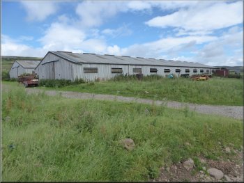
Abandoned farm sheds
|
Quad bike apparently abandoned too as we left the site of the farm sheds
|
The by-way heading back towards Bolton Castle
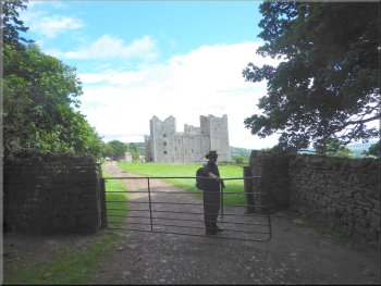
Heading back to the car park by Bolton Castle
The weather had be kind to us with plenty of bright sunny intervals and a few threatening clouds that came to nothing. The whole route had been 8km and it had taken me about three hours to walk it including as usual far too many stope for photos.
|
From the abandoned buildings we continued along the by-way for about 1.3km across the fields back to the car park next to Bolton Castle and the end of our walk.
The by-way heading back towards Bolton Castle

|
Returning to the car park by Bolton Castle at the end of our walk
|