| 2001 walks | 2002
walks | 2003 walks | 2004
walks |
| 2005 walks | 2006
walks | 2007 walks | 2008
walks |
| 2009 walks | 2010
walks | 2011 walks | 2012 walks |
| 2013 walks | 2014 walks | 2015 walks | 2016 walks |
| 2017 walks | 2018 walks | 2019 walks |2020 walks |
| 2021 walks | 1993-2000 library | Find a Route Index |
| A few Routes to print out | Request a Route... |
Route No. 618 - Tuesday 19 April 2016
Saltergate car park, Glebe Farm, Pifelhead Wood,
Newtondale Halt, Hudson‘s Cross, Yewtree Scar,
A169 circuit - 6km, North York Moors . . .
Route map from Ordnance Survey
Open Space service.
Map: OS Explorer OL27 North York Moors Eastern area
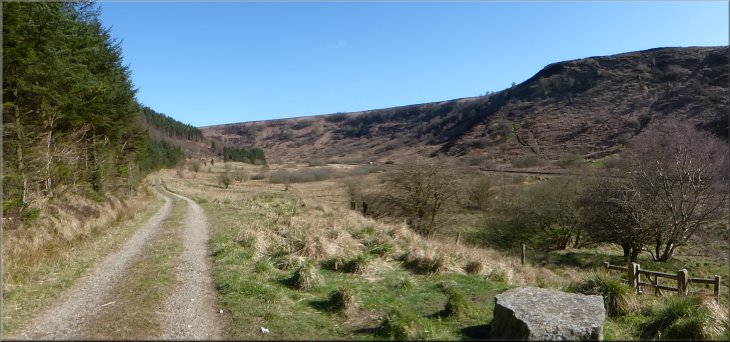
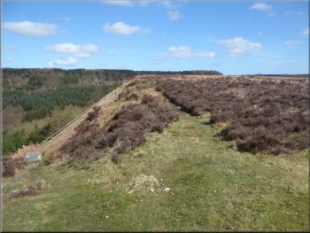
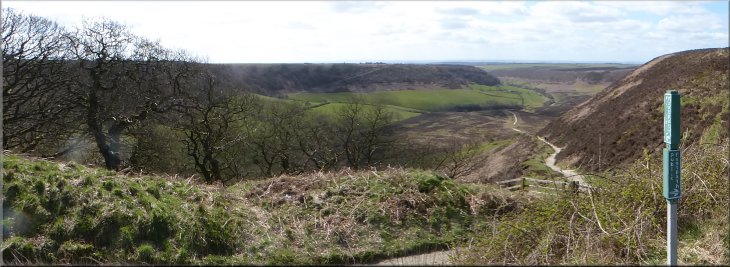
Looking across the Hole-of-Horcum from the Saltergate car park in the morning sunshine
|

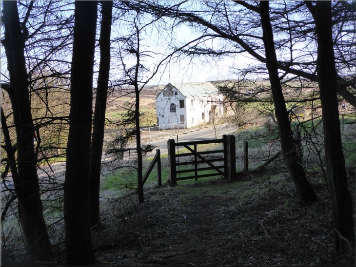
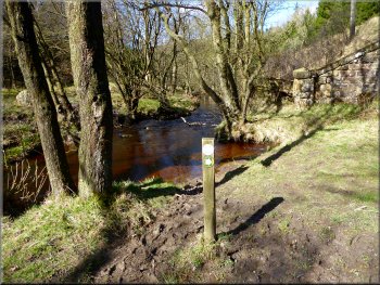
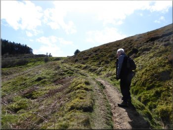
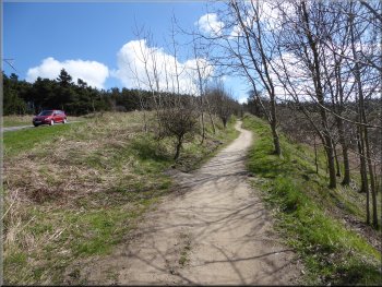
Leaving the car park to walk 350m along the A169
I arrived there at about 8.15am. It was all very quiet and I parked next to the 'Pay & Display' machine (£2.50 for all day). From the car park I walked northwards along the right hand verge of the A169 for about 350m and then turned right off the road along a bridleway into the woods. There is a pedestrian gate set back from the road by about 20m.
|
This morning the weather was fine and clear again. My friend, Jim, who I usual walk with is sunning himself in Tenerife and my wife is have a girlie trip to France with two old friends. So this morning I set off early and parked at the Saltergate car park overlooking the Hole-of-Horcum off the A169 Pickering to Whitby road.

Gate set back from the road where the bridleway enters the wood
|
Looking out from the bridleway in the wood to Glebe Farm across the A169
|
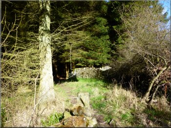
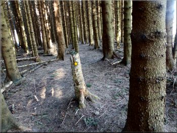
Bridleway down through the woods
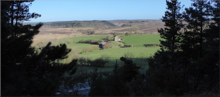
The Saltergate Inn used to boast a fire in the hearth that had not gone out for a few hundred years but now I'm not sure if there is a hearth let alone any fire burning! I crossed road and walked down the access track to Glebe farm about 150m from the road. |
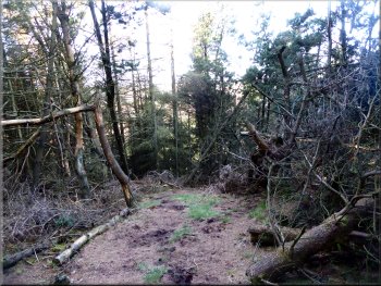
I went through the gate and followed the path heading quite steeply down the hillside through the wood. After about 250m the path reached the road (A169) near the Saltergate Inn. It's a sorry sight at present with renovation work halted for the last few years.
Gate onto the A169 opposite the Saltergate Inn
|
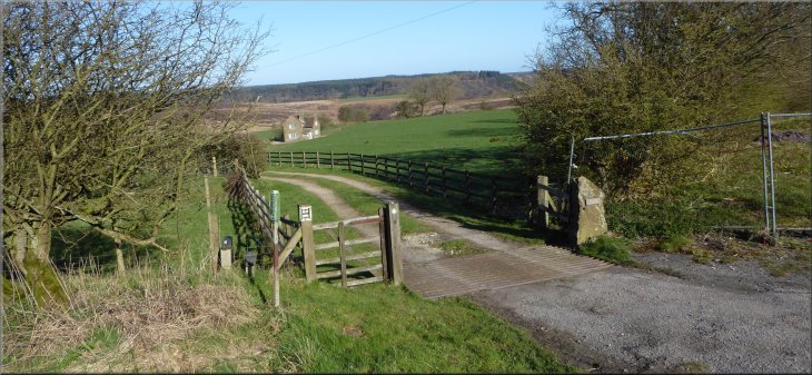
The access track off the A169 leading to Glebe Farm
|
Path leaving Glebe Farm
Path down into the valley of Havern Beck
Path through the woods in the valley of Havern Beck
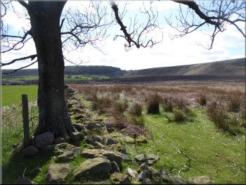
The wet weather punctuated with excellent bright walking days brought many people out walking producing lots of squelchy mud. At the bottom the slope the path goes through the edge of Piflehead Wood and emerges on to the valley floor next to Havern Beck and the gate to a level crossing over the North York Moors Railway. |
I followed the path past the farm (maybe a holiday cottage now?) and continued along the path around the edge of a the steep little valley of Havern Beck. I followed the path round to the right and began the steep descent down the wooded valley side. It's a very pretty path but quite steep and rather slippy
The valley of Havern Beck to the right of the path
Path down into the valley of Havern Beck
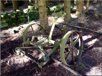
Agricultural implement lost in the woods
|
Path through the woods in the valley of Havern Beck
|
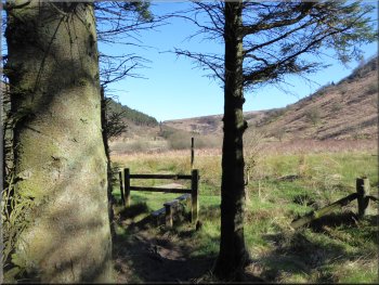
Path leaving the woods by the railway
|
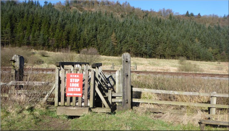
Pedestrian crossing of the North York Moors Railway in Newtondale
|
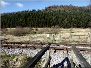
Crossing Pickering Beck and the railway
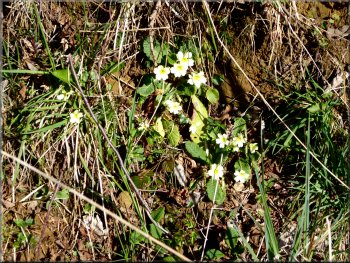
Primroses by the track

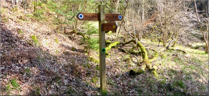
Access track (Well Road) heading towards Newtondale Halt
The sign also showed a footpath to my left heading for Newtondale Halt, an unmanned stop on the North York Moors Railway. I walked down to the station platform and sat on one of the seats for a break in the sunshine. I had a drink and an orange, very refreshing (& I took my orange peel home - it doesn't seem to rot down and it's an unpleasant eyesore). |
I crossed the railway line and followed the path up to a pedestrian gate onto the stony access track running along the valley bottom. I turned left and walked along the stony track with the railway about 100m away to my left and Pickering Beck just beyond the railway. After about 1.2km I came to a finger post indication that there is a bridleway along the stony track which is called 'Well Road'.
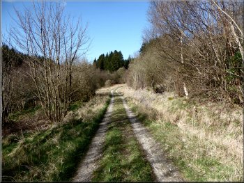
Access track (Well Road) along the bottom of Newtondale
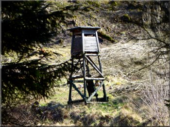
Observation/shooting tower in the woods
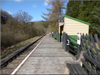
Newtondale Halt, an unmanned station on the NYMR
|
Turning off the forest access track called Well Road to Newtondale Halt
|
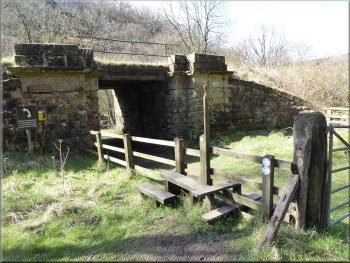
Path under the railway next to Newtondale Halt
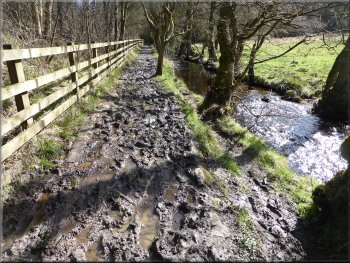
Muddy path squeezed between the beck and the railway
Path climbing up to Hudson's Cross
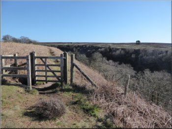
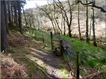
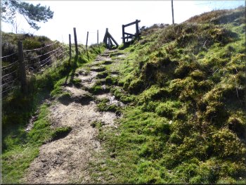
Higher up the hillside there were longer flights of stairs zig-zagging up the hillside leading eventually to a pedestrian gate out to the path around the edge of the cliffs above Newtondale. There used to be a sign here noting 'Hudson's Cross' but the final few metres of the path have been changed (probably for the better) and the path emerges onto the moor at a slightly different place now and the sign has gone. |
After my break I returned to the footpath and followed it through the bridge under the railway, then turned left to follow the rather muddy path between the railway and Pickering Beck. After about 250m I came to a footbridge over Pickering Beck. I turned right here to cross the footbridge and continue along the footpath now beginning to climb straight up the valley side through the woods. The climb gradually became steeper and there were short flights of stairs.
Looking downstream along Pickering Beck
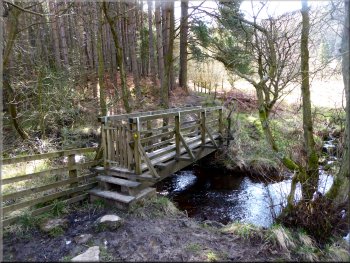
Footbridge over Pickering Beck
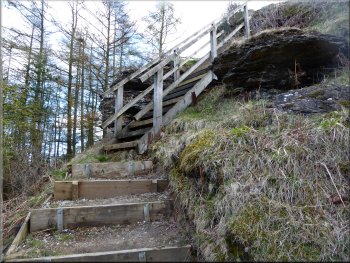
Steps up the valley side to Hudson's Cross
|
Looking back to the gate on the path near Hudson's Cross at the top of the climb up from Newtondale
|
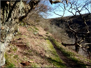
The path from Hudson's Cross towards Yewtree Scar
I managed to get my camera focused on the little station with a the right level of zoom and waited. The clanking noise from the forest below seemed to go on for ages before the steam engine and its five coaches emerged from the trees and stopped at Newtondale Halt. (for the enthusiast I think that the engine is the Stanier Black Five 45428 ERIC TREACY). |
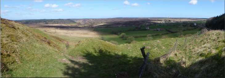
When I reached the open moor at the top of the climb, I turned left and followed the public footpath around the edge of the cliffs overlooking Newtondale. Looking back I could see Newtondale Halt below me in the valley bottom and I could hear an approaching train.
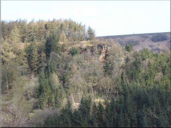
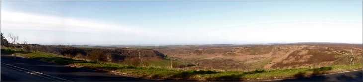
The cliffs at Needle Point seen from Yewtree Scar
|
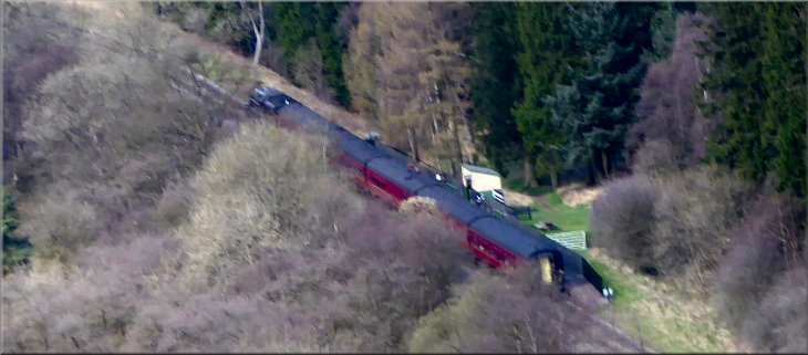
Train at Newtondale Halt probably hauled by the Stanier Black Five 45428 ERIC TREACY
|

Path around Yewtree Scar
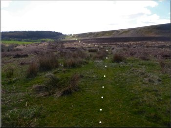
The route of the path up to the A169 hairpin bend
Not far to the A169 now
Looking along this track across the moor to my right it seemed to be leading all the way to the hair pin bend on the A169 at map ref. SE 849 940. I followed this track which after a while became narrower, just a footpath across the moor. |
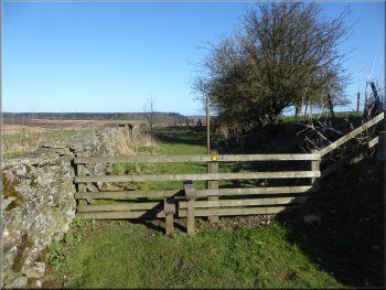
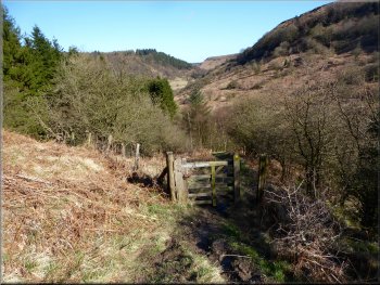
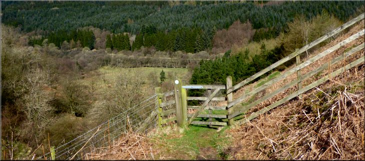
I continued along the footpath around Yewtree Scar until I had almost joined my outward route at map ref. SE 845 948. On my left here there was a steel field gate and leading out from the gate was a track made by the farmers vehicles, small tractor or quad bike.
Just touching the outward route before heading off to the A169

Handy gate post to stand my camera with its self timer
Top of the climb to the A169 in sight
|
Looking back over Newtondale near the top of the climb to the A169
|

The stile at the hairpin bend in the A169
Including my break at Newtondale Halt the whole walk took over three hours. It's such a lovely place I needed plenty of time to look around.
PS don't the photos look drab without Jim's red anorak to cheer them up? Anyway he should be back from Tenerife next week. |
At the road I crossed the stile and walked along the footpath below the road round to the car park and the end of my walk in the lovely spring sunshine. The route was only 6km but there is a long steep climb out of Newtondale and a shorter steep climb up to the hairpin bend on the main road.
Path next to the A169 leading back to the car park
|
Looking down into the Hole-of-Horcum from the stile at the hairpin bend in the A169
|