| 2001 walks | 2002
walks | 2003 walks | 2004
walks |
| 2005 walks | 2006
walks | 2007 walks | 2008
walks |
| 2009 walks | 2010
walks | 2011 walks | 2012 walks |
| 2013 walks | 2014 walks | 2015 walks | 2016 walks |
| 2017 walks | 2018 walks | 2019 walks |2020 walks |
| 2021 walks | 1993-2000 library | Find a Route Index |
| A few Routes to print out | Request a Route... |
Route No. 588 - Thursday 13 August 2015
Middleham, Park Lane, Middleham Bridge, Spennithorne,
Ulshaw, Cover Bridge, Six Dales Trail, Middleham Castle
11km circuit - Wensleydale . . .
Route map from Ordnance Survey
Open Space service.
Map: OS Explorer OL30 Yorkshire Dales Northern & Central areas
and OS Explorer 302 Northallerton & Thirsk
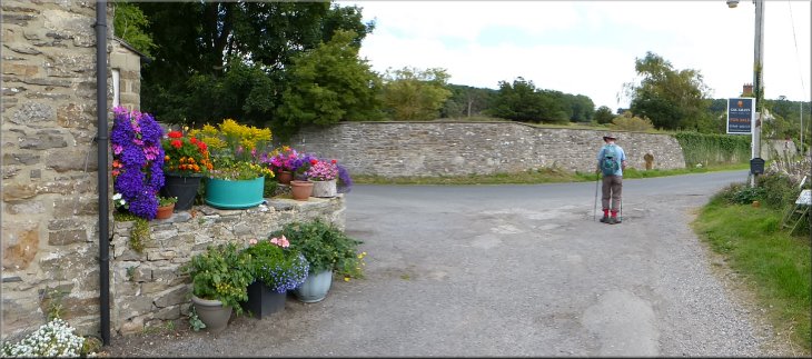
Square in the town centre at Middleham
|
Square in the centre of Middleham
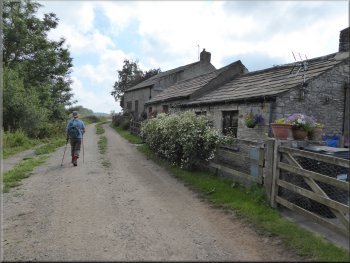
At the crossroads next to the castle we turned right to walk along Park Lane. At the crossroads there is a small square with several cobbled areas and an unusual building on the corner of Park Lane with a tower topped by a bell. This is a school building endowed by a former Rector of Middleham and built in 1869. |
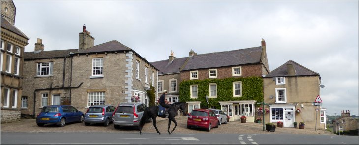
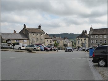
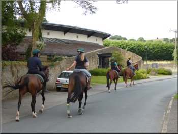
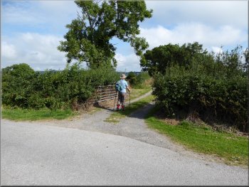
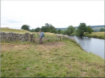
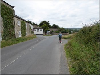
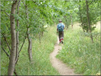
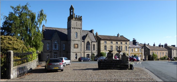
This morning my friend Jim and I drove into Wensleydale to the small market town of Middleham. The little town is on a hillside with cobbled margins to the roads through the town centre. We found a space to park on one of these busy cobbled areas near the centre and set off walking up the street towards the castle.
Crossing West End into Park Lane at the start of our walk
|
String of race horses in Park Lane
String of race horses in Park Lane
Race horses by the track & Pen Hill beyond
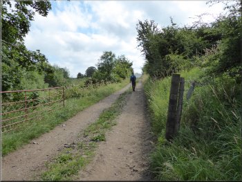
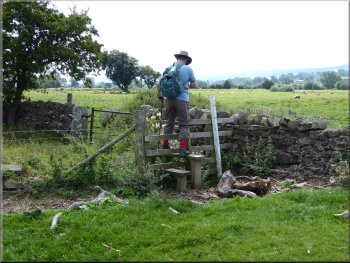
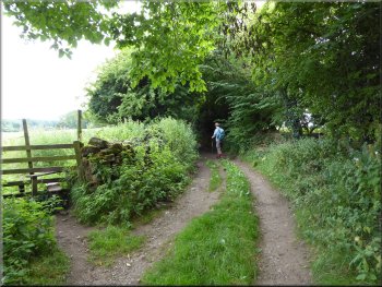
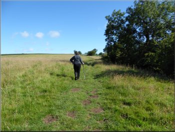
About 800m from the crossroads we came to Sharp Hill Farm on the left and just beyond the farm buildings we turned right off the road to follow a footpath along a track between the fields.
|
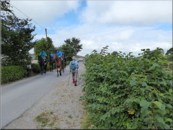
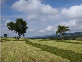
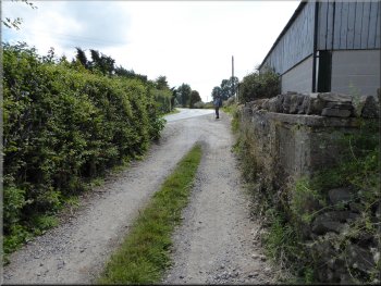
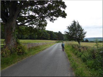
We followed Park Lane out of the town and along the way we were passed by stings of race-horses making their way to and from the training gallops.
Leaving Middleham along Park Lane
Turning off Park Lane opposite Sharp Hill Farm

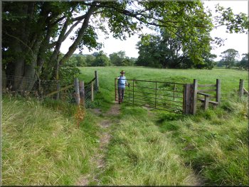
Gate into the field at the end of the track
|
Path diagonally across the field heading down towards the River Ure
|
Crossing the fields down towards the River Ure
Gate from a field onto the gallops
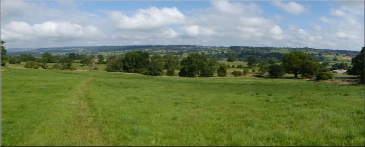
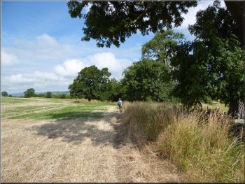
We continued across the next field and then along the boundary of the following field to cross a mowed strip of grass that was part of a race-horse training gallop. Across the gallops we followed the path through rough grassland around the field margin. |
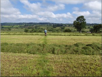
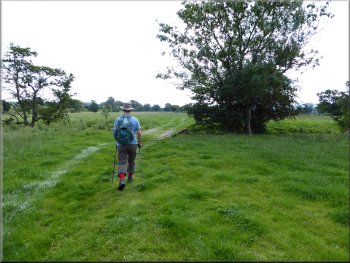
After about 150m we reached a gate where the track ended and through the gate we followed a bridleway heading diagonally across the field to the bottom corner.
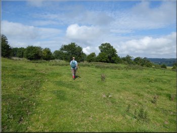
Crossing the fields down towards the River Ure
Path along the field margin on the far side of the gallops
|
|
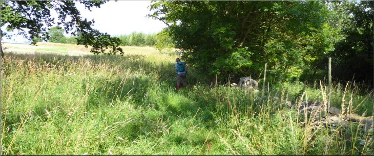
Path through rough grassland around the field margin
|
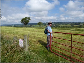
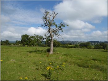
Gate into a large field sloping down towards the River Ure
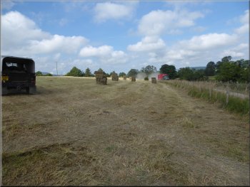
Wilted grass rowed up ready for collecting
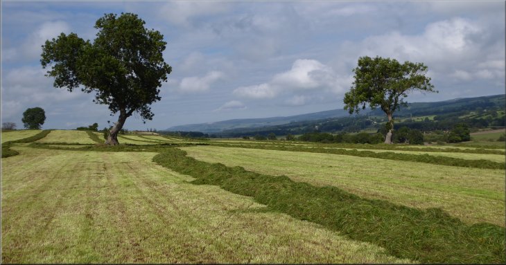
I believe the grass was to be made into silage, or haylage as I think it is called, winter feed for the horses that are notoriously fussy about their feed. |
We came to a gate into a large field sloping down towards the River Ure. There was a large machine working in the field collecting up neat rows of cut grass that seem to have been allowed to wilt of a day or so.
Path across the field down to the River Ure
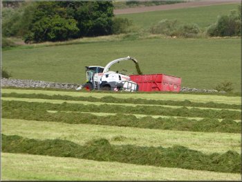
This machine kept 3 tractors busy leading
the grass away and returning for more
|
Gate onto the track by the River Ure
Track by the River Ure heading for the A6108
Junction of the track with the A6108
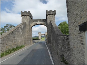
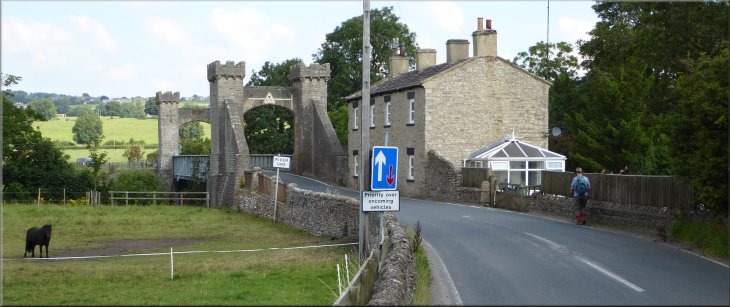
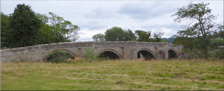
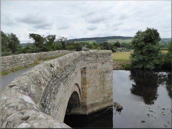
We reached the A6108 at map ref. SE 147 872 and turned left to walk about 200m along this busy road to Middleham Bridge over the River Ure. The
bridge is of steel construction disguised to look like the approach to a castle drawbridge.
|
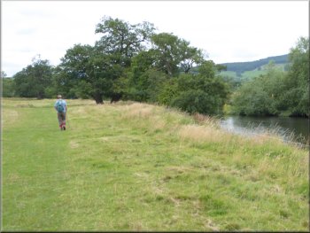
At the bottom of the field we came to a track along the south bank of the River Ure which we followed eastwards towards the A6108. We passed another much
smaller field where small bales of hay were being loaded by hand onto a trailer behind a small tractor in stark contrast to the amazing system we had seen
before.
Track by the River Ure heading for the A6108
Bales of hay stacked for collection
Middleham Bridge over the River Ure
|
Middleham Bridge over the River Ure
|

Turning off the A6108 at Middleham Bridge
Path to the north of the river heading for Spennithorne
Path to the north of the river heading for Spennithorne
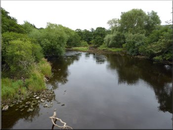
Here we turned right to continue along a footpath
following the river downstream with river meandering away to our right. At map ref. SE 149 881 we came to a ford across a beck with a footbridge alongside
the ford. |
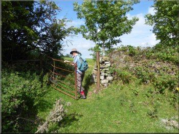
Just across the bridge we turned right off the road to go through a field gate and follow a path across the field with the River Ure about 50m away to our
right. We continued into the next field to a point just beyond a sharp right angle bend in the river.
Path to the north of the river heading for Spennithorne
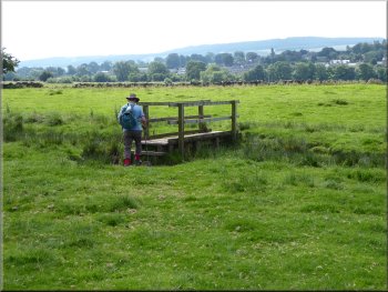
Footbridge over a wide ditch
Path to the north of the river heading for Spennithorne
|
Footbridge across the beck to a farm access track to Spennithorne
|
Track to Spennithorne from the ford
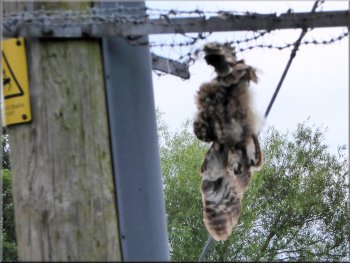
Remains of a bird of prey hanging from the barbed wire
In the sky high above us we saw four buzzards circling. I assume they were a family group. We continued along the access track to the road on the edge of Spennithorne at map ref. SE 137 887. |
We crossed the footbridge and followed a farm access track on the other side of the beck past the Spennithorne village sewage works. There was a power line by
the sewage works and hanging from the barbed wire, put there to prevent idiot climbers, was the suspended carcass of a bird of prey (possibly an owl?).
Spennithorne sewage works by the track
Track to Spennithorne from the ford
|
Joining the road on the edge of Spennithorne
|
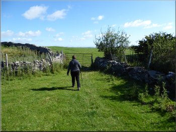
Following the road away from Spennithorne
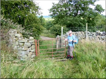
Our turning off the road onto the path to Ulshaw
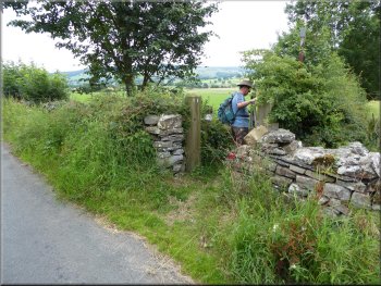
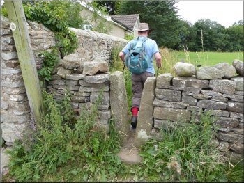
The path continued between the river and the fence/hedge and then turned left through a pedestrian gate to cross the field boundary and then walk along the other side of the fence/hedge and then continued along the river bank. Almost 1km from the bend in the river the path passed a pair of cottages on our left and continued along their access road to the public road at map ref. SE 145 872 at Ulshaw. |
At the road we turned right and walked along the road for about 600m to map ref. SE 140 883. Here we turned right off the road to follow a fenced footpath along the edge of the field for about 300m to the end of the field. we crossed into the next field, a large sheep pasture. We followed the path along the field boundary towards a bend in the River Ure.
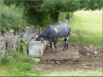
This cow ambled up the field for a drink as we approached

|
Footpath across the fields by the River Ure to Ulshaw |
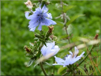
Chicory flowers by the path
|
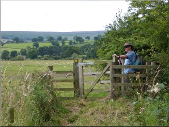
We turned left through this gate & walked along the fence line
|
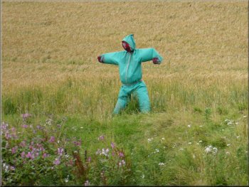
Scarecrow built around a gas powered bird scarer
|
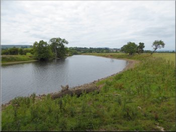
Long meander in the River Ure
|
Riverside path heading for Ulshaw
|
Riverside path heading for Ulshaw
|
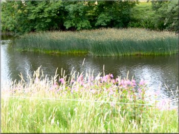
Large reed bed in the River Ure
|
Riverside path heading for Ulshaw
|
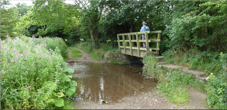
Ulshaw Bridge over the River Ure
|
Catholic church of St Simon & St Jude at Ulshaw
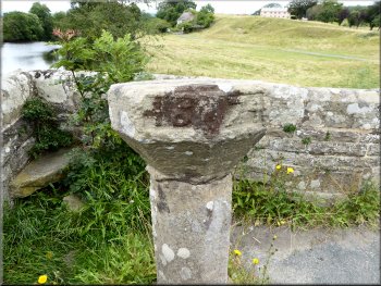
The sundial dated 1674 on Ulshaw Bridge
Road from Ulshaw Bridge to the A6108 near Cover Bridge
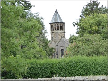
From Ulshaw Bridge we followed the road for about 200m to the junction with the A6108. To the left at the junction the A6108 has just crossed Cover Bridge. We crossed the main road and a few metres along the road to the right we turned left off the A6108 to follow a footpath along the side of the buildings to the bank of the River Cover. |
At the junction we could see the tower of a church in the trees opposite. This is the Roman Catholic church of St. Simon and St. Jude. At the road we
turned right and crossed the River Ure on Ulshaw Bridge.
Ulshaw Bridge with its sundial at the pedestrian refuge
The River Ure at Ulshaw
Stile off the A6108 leading to the River Cover
|
We sat on the bank of the River Cover here for a break
|
The Six Dales Trail following the River Cover upstream
A memorial seat by the path
The Six Dales Trail following the River Cover upstream
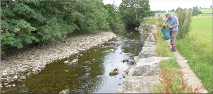
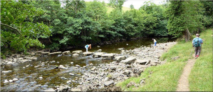
After our break we followed the path
along the river bank across about half a dozen fields to map ref. SE 137 867. Here a path from Middleham that goes along Straight Lane crosses the River
Cover on a series of very large limestone slabs (to simply call then stepping stones would not do them justice). |
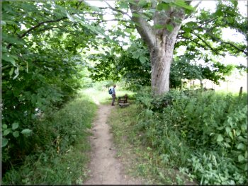
From the road we were following the route of the Six Dales Trail all the way back to Middleham Castle. The river bank has been reinforced with a wall of several layers of large rock slabs. These provided a handy seat on the river bank for a drink and a short break.

Cow grazing by the path - could be Simmental or Maine Anjou?
The Six Dales Trail following the River Cover upstream
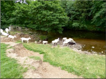
A flock of sheep dashed to the river to drink behind us
|
Stepping stones across the River Cover made out of large limestone slabs
|
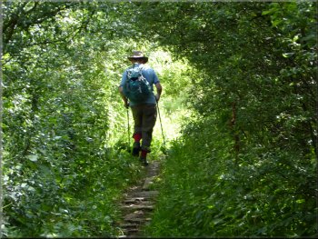
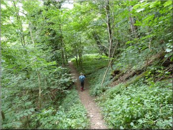
Six Dales Trail through the woods by the River Cover
Six Dales Trail along the bank of the River Cover

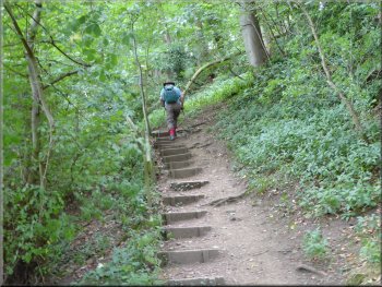
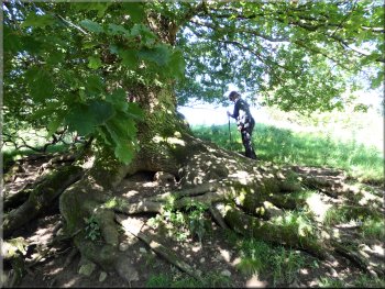
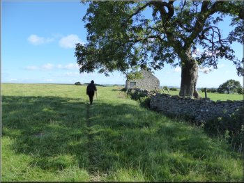
From map ref. SE127 866 the path climbs up to a large oak tree
The oak tree is on the edge of some scrubby woodland where the main path passes below the large trunk of the oak. Our path, along the route of the Six Dales Trail, passes above the oak (a bit awkward under the branches and easy to miss) and continues to climb up the grassy bank above the oak. |
From here the path was mostly in woodland and on a couple of occasions climbed up around headlands where the river flowed round a meander. At map ref. SE127 866 the path again climbs up the hillside for about 100m to a large oak tree.
Six Dales Trail through the woods by the River Cover
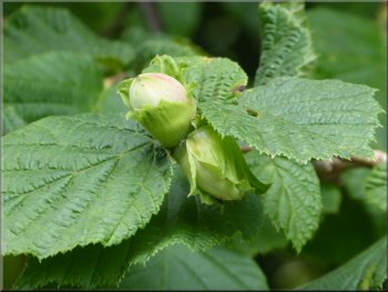
Hazel nuts by the path
The Six Dales Trail heading up the bank above the oak tree
|
Following the Six Dales Trail climbing up the grassy bank above the oak tree
|
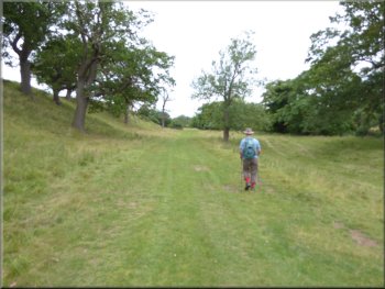
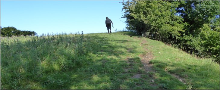
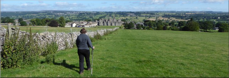
Following the Six Dales Trail over Williams Hill
Following the Six Dales Trail over Williams Hill
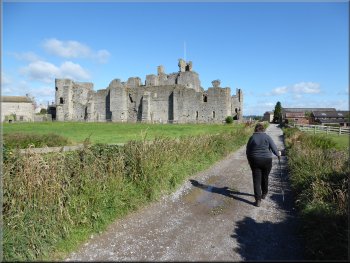
Approaching Middleham Castle along Canaan Lane
We continued along the
path down towards the castle and joined a track called Canaan Lane. We walked passed the side of the castle to the junction with Back Street. |
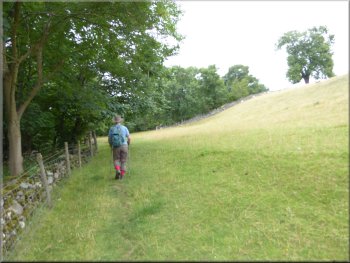
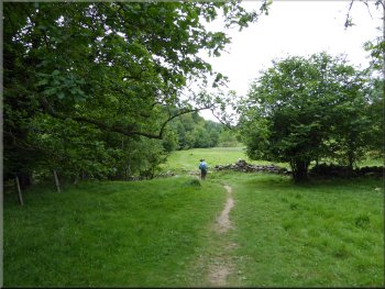
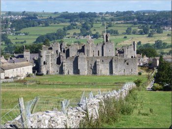
The path continues along the field boundary with a gentle climb up William's Hill. Once we were at the top there was a good view down to Middleham Castle and across Wensleydale to Leyburn.
Following the Six Dales Trail over Williams Hill
Middleham Castle
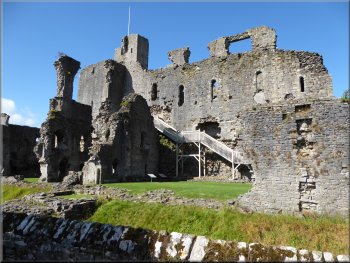
The east side of Middleham Castle
|
View over Middleham & Wensleydale from the top of Williams Hill
|
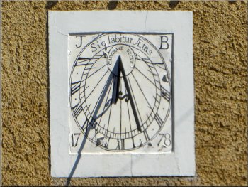
Sundial on the wall of a house on West End, Middleham
From this junction we made our way back to the car parked on one of the cobbled roadside areas in the town, to drive home at the end of our walk. The whole route had been about 11km and it had take us about four hours on this warm and humid day. |
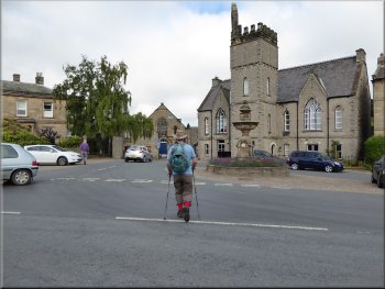
At the junction we turned left and followed Back Street past the front of the castle to the junction with West End and Park Lane where our walk had started. There is an information board on the cobbles at the junction with details of the various monuments and buildings at the junction.
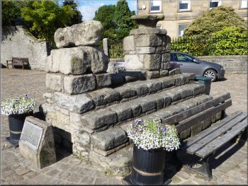
Remains of the old market cross in Middleham
|
The old market cross and endowed 19th century school behind at the junction of Park Lane & West End
|