| 2001 walks | 2002
walks | 2003 walks | 2004
walks |
| 2005 walks | 2006
walks | 2007 walks | 2008
walks |
| 2009 walks | 2010
walks | 2011 walks | 2012 walks |
| 2013 walks | 2014 walks | 2015 walks | 2016 walks |
| 2017 walks | 2018 walks | 2019 walks |2020 walks |
| 2021 walks | 1993-2000 library | Find a Route Index |
| A few Routes to print out | Request a Route... |
Route No. 531 - Saturday 1 February 2014
Ripley, Nidderdale Greenway,
River Nidd, Nidd Gorge (linear route) - 7km
Nidderdale . . .
Route map from Ordnance Survey
Open Space service.
Map: OS Explorer 297 Lower Wharfedale & Washburn Valley
& first kilometre on OS Explorer 299 Ripon & Boroughbridge
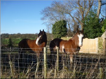
Shire horses at Ripley car park
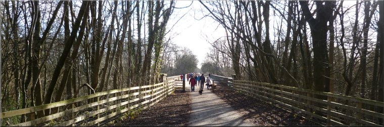
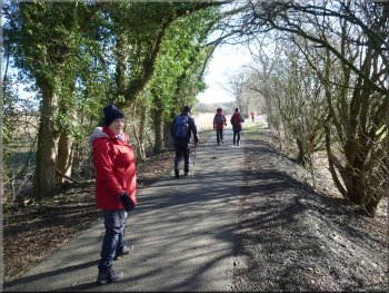
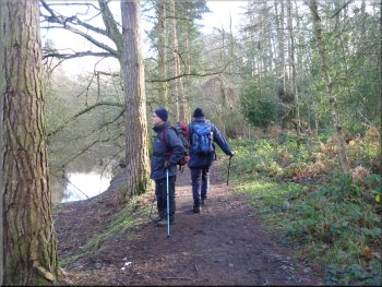
Nidderdale Greenway path from Ripley car park
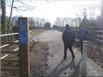
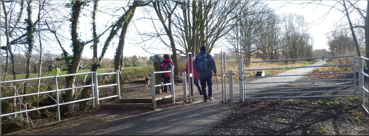
From the Ripley car park we followed a route called the "Nidderdale Greenway" opened in April 2013. It's a combined cycleway and footpath that goes along the bed of a disused railway to Knaresborough & Harrogate. To start there's a new tarmac path across the Ripley car park and parallel to the road for about 500m. The path then crosses the A61 at a pedestrian crossing controlled by traffic lights. It's needed too as the road is very busy. |
This morning I drove in convoy with a friend of mine from home to the Woodland Trust car park at the Nidd Gorge Woods, map ref. SE330584 on the edge of Knaresborough. We left my car there and drove together in my friend's car to the large grassy car park, map ref. SE284603, at Ripley. At the car park we met three other friends for our regular monthly walk. We're down to about half our usual number as the rest were tied up with a variety of family stuff.
Start of the Nidderdale Greenway at Ripley car park
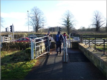
Crossing the A61 on the Nidderdale Greenway route
|
The Nidderdale Greenway cycleway & path next to the A61 at Ripley
|
Minor road down to the River Nidd at Mill Farm
There's a good view of the river as it flows over the weir by the old mill buildings. From the bridge we returned a little way back up the hill to a public footpath on the right. |
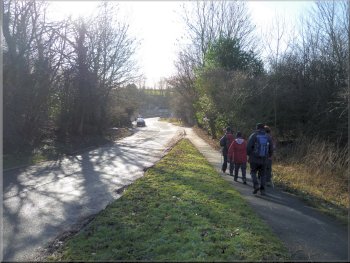
Once across the road the path leaves the main road and follows a minor road down to the old road bridge over the River Nidd at Mill Farm.
Nidderdale Greenway route from the road above the R. Nidd
|
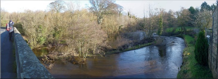
Weir across the River Nidd at Mill Farm
|
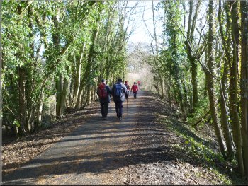
The Nidderdale Greenway cycleway & footpath on the old railway bed next to the River Nidd
|
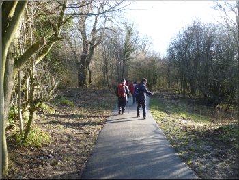
The tarmac path was welcome across the wet muddy terrain
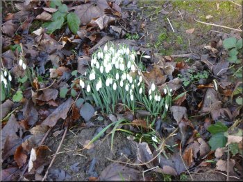
Snowdrops by the path
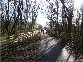
Continuing along the path towards the Nidd Viaduct
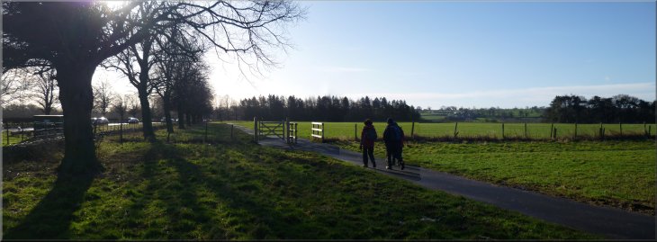
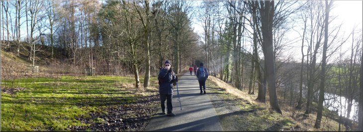
We continued on the Nidderdale Greenway along the old railway bed which was heading roughly southeast to Harrogate. |
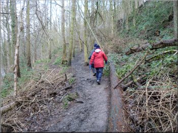
From the road, the path follows the route of this public footpath for about 400m to the point where the footpath crosses the bed of the disused railway at map ref. SE290597. Here our route bears right to follow the Nidderdale Greenway along the bed of the disused railway. There is a tarmac track all the way and the route was clearly popular with walkers, joggers and cyclists on this bright sunny morning. About 1km after joining the railway we came to a fork in the railway with a branch going northwards to Ripon and the branch we had followed extended behind us westwards along the Nidd valley to Pateley Bridge.
Winter sunshine for the first part of the day
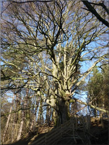
Magnificent beech tree by the path
|
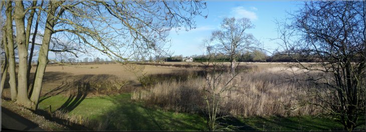
Looking across the fields from the old railway bed
|
Approaching the Nidd Viaduct
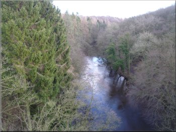
View from the Nidd Viaduct
Just across the viaduct we turned left off the railway path to follow a permissive path down to the side of the River Nidd at map ref. SE309584. |
After about another kilometre along the railway path we crossed the restored Nidd Viaduct with a great view of the River Nidd over the parapet.
Crossing the Nidd Viaduct
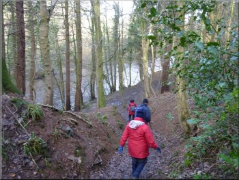
Permissive path down from the old railway into the Nidd Gorge
|
Leaving the Nidd Viaduct to turn left on to the permissive path down into the Nidd Gorge
|
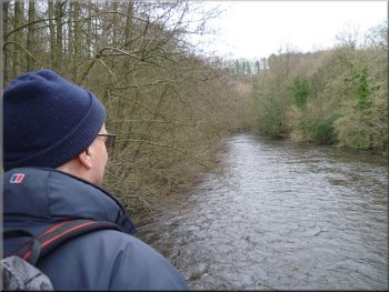
The River Nidd where we joined the riverside path
|
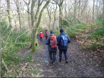
Permissive path down through the woods into the Nidd Gorge
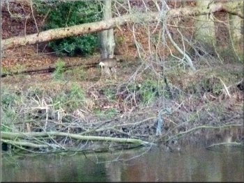
The white rump pin points a roe deer across the River Nidd
Riverside path through Nidd Gorge Woods
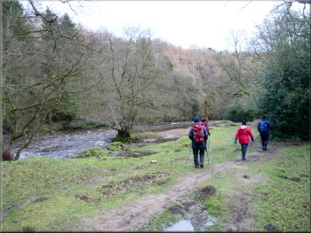
After our break we continued along the path across a footbridge over a side stream and along the riverside for
about 600m to the weir across the river at Scotton Flax Mill. |
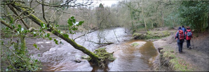
At the riverside we paused for a drink
and as we stood quietly looking at the lovely woodland and riverside a roe deer appeared on the opposite bank of the river and walked slowly along
the riverside path and out of sight.
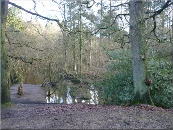
River Nidd where we joined the riverside path
Footbridge over a stream where it joins the river
Riverside path through Nidd Gorge Woods
|
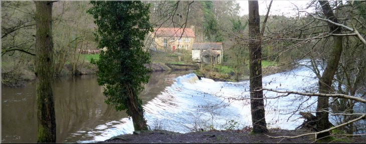
Weir across the River Nidd at Scotton Flax Mill
|
The path climbs up to by-pass the weir
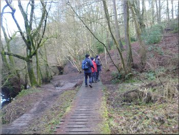
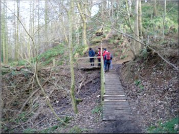
The path drops down to the riverside again
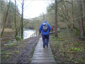
The riverside boardwalk keeps us out of the mud
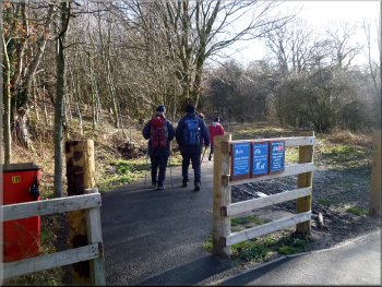
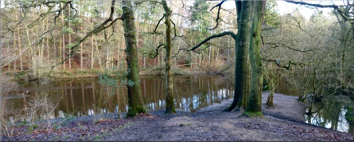
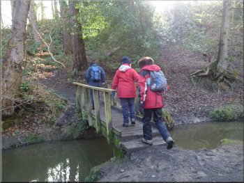
After about 2km we came to a footbridge over the river at map ref. SE328582. This is Burgess Bridge opened in 1988. The whole
site is now owned and managed by the Woodland Trust to maintain this wonderful area of ancient woodland. |
From the weir the path climbs up the hillside to a footpath on the right that leads up to
Bilton. From there our route drops down to the riverside again. We continued along the river bank using a series of solid boardwalks to negotiate the
muddiest areas.
From here the path to Bilton goes off to the right
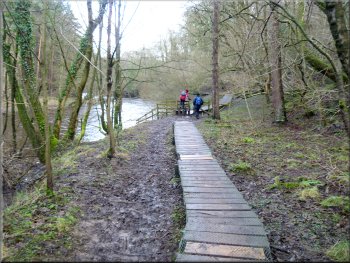
The boardwalk keeps us out of the mud
The path crosses a riverside clearing in the woods
|
Path beside the River Nidd on the way to Burgess Bridge
|
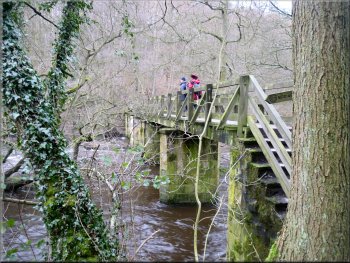
Crossing the River Nidd on Burgess Bridge
Looking downstream from Burgess Bridge
We left our
muddy gear in the cars and walked through the village to the cafe at the entrance to Ripley Castle for a coffee and a variety of tasty snacks before
heading for home. The whole walk had been 7km and it had taken us two and a half hours to walk. |
We crossed footbridge and climbed a
few steps to the track on the opposite bank where we turned left to follow the track as it wound its way up the steep valley side for about 300m to the
car park where I had left my car this morning. The five of us could just fit in it with all our walking gear for the short trip back to Ripley.
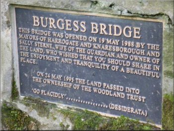
Plaque at Burgess Bridge

Approaching the Woodland Trust car park
|