| 2001 walks | 2002
walks | 2003 walks | 2004
walks |
| 2005 walks | 2006
walks | 2007 walks | 2008
walks |
| 2009 walks | 2010
walks | 2011 walks | 2012 walks |
| 2013 walks | 2014 walks | 2015 walks | 2016 walks |
| 2017 walks | 2018 walks | 2019 walks |2020 walks |
| 2021 walks | 1993-2000 library | Find a Route Index |
| A few Routes to print out | Request a Route... |
Route No. 493- Tuesday 18 December 2012
White Horse Bank, John Bunting's Chapel,
Cleveland Way, Roulston Scar circuit - 8km
Hambleton Hills . . .
Route map from Ordnance Survey
Open Space service.
Map: OS Explorer OL26 North York Moors Western area
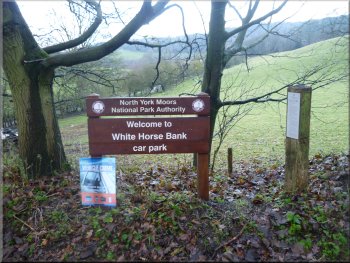
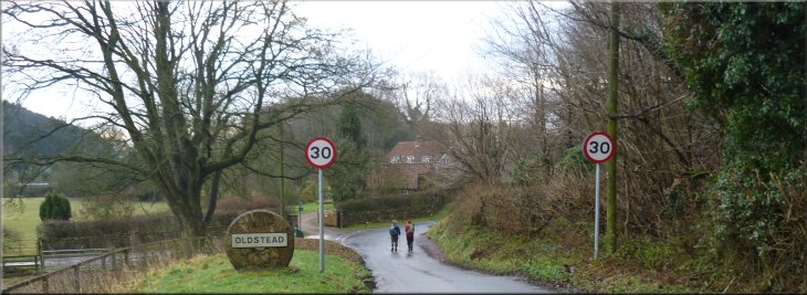
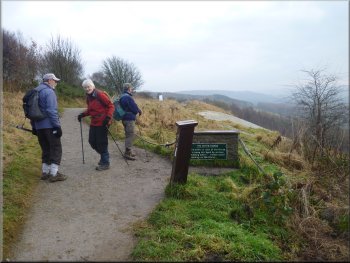
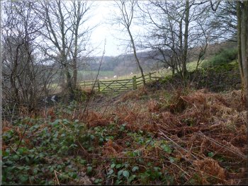
Car park at the bottom of White Horse Bank
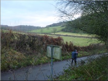
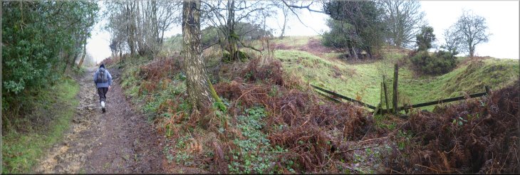
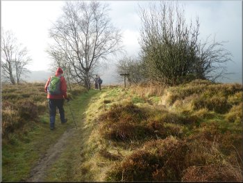
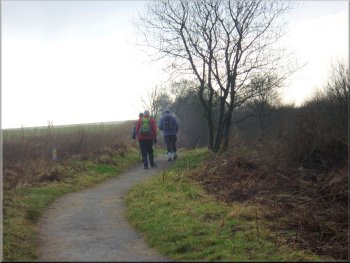
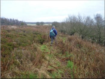
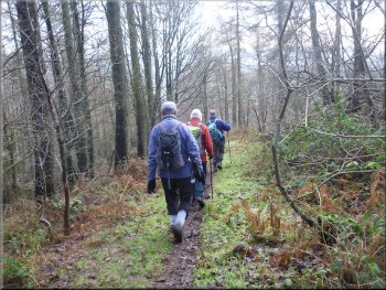
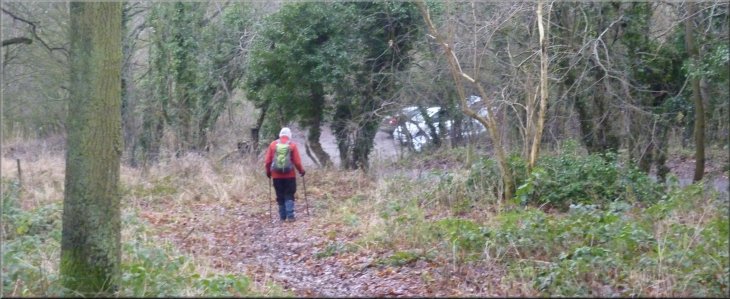
From the car park we set off down the road for about 150m to a junction
and there we turned left to walk along the road towards Oldstead. It's
a quiet road and after such a wet autumn it was good to have a firm
non-slip surface to walk on for a change. |
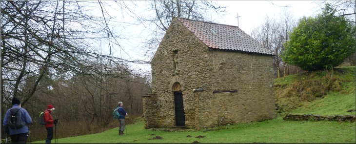
My friend Peter Crosby suggested that I should take a look at John
Bunting's Chapel, so this morning my mate, Jim, and I met Ray Brown,
who contributes some of his walks to this web site, and his wife, Sylvia,
at a little parking area at the bottom of White Horse Bank near Kilburn
at map ref. SE514806.
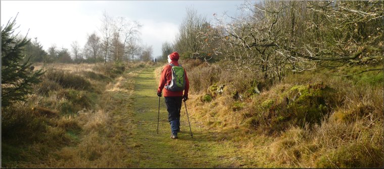
We set off down the hill from the car park
|
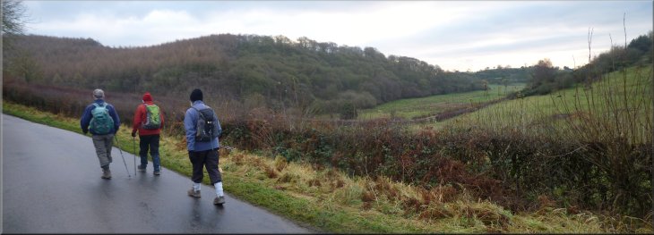
Following the road to Oldstead
Approaching our turning in Oldstead
|
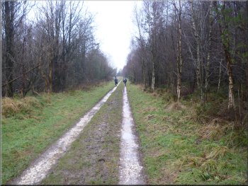
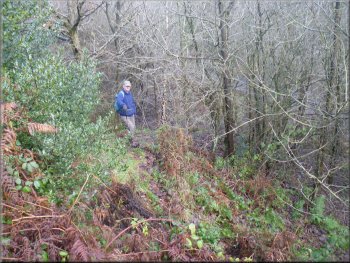
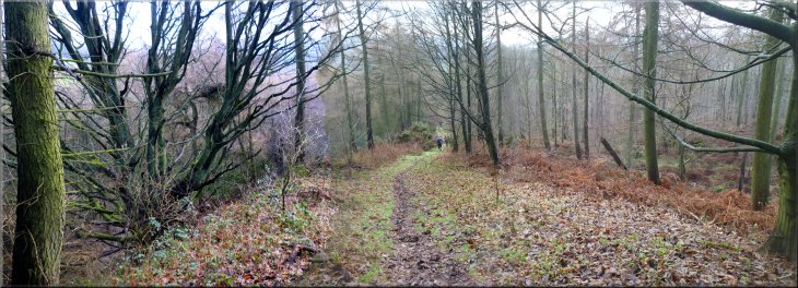
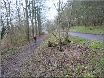
Following an access road on the edge of Oldstead
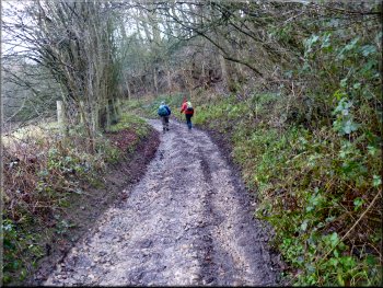
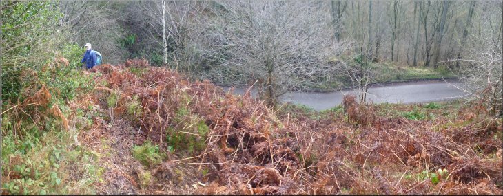
The track here is called Oldstead Bank and it was quite steep with
pleasant views over the fields as we climbed. After about a kilometer
from the large house we came to a place in the woods called Scotch Corner.
I don't know the origin of the name but it's not the main road junction
on the A1/A66. It's just a track in the woods. |
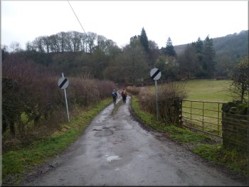
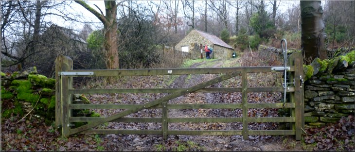
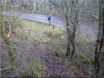
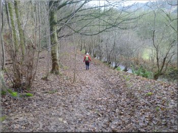
After about 2km we came to the edge of Oldstead and just beyond
the village name sign we turned left at map ref. SE530804. We had turned
onto an access road which we followed for about 150m to a large private
house on our right. Here the road became a stony track that bent round
to our left and began to climb up the wooded hillside.
The stony track up Oldstead Bank
|
Looking West from the track up Oldstead Bank
The track up Oldstead Bank
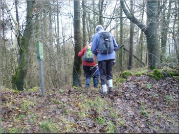
Approaching John Bunting's Chapel at Scotch Corner
John Bunting's Chapel
|
The chapel doorway
It was built in 1957 by John Bunting who was a renowned sculptor and
art teacher at Ampleforth College. The grounds of the chapel are open
to the public but the building was locked. It's a simple but attractive
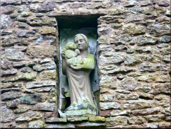
building and there's a wooden sculpture of a mother and child on the
hillside just above the chapel. |
Here there is a chapel in the wood built as a memorial to those who
were killed in the second world war.
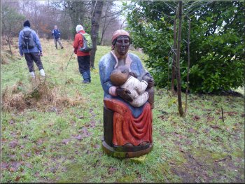
A figure of a mother and child above the chapel
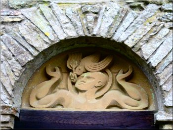
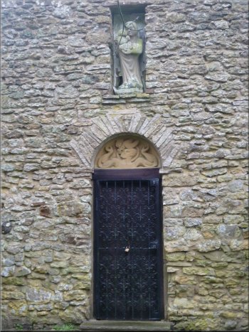
Sculpture over the chapel doorway
|
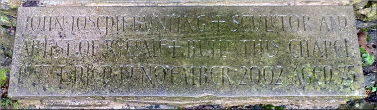
This inscription on the stone threshold of the chapel reads:
"John Joseph Bunting + Sculptor and artist of Ryedale + Built this
chapel 1957 + Died 19 November 2002 Aged 75" |
Madonna above the chapel entrance
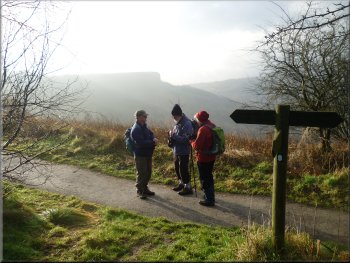
Cleveland Way path heading south west from the A170
After about 200m we came to the road that climbs up White Horse Bank
and passes the glider field on Roulston Scar. At the road we turned
right and walked along the road towards the Hambleton Inn. After about
700m we came to the A170 and here we turned left off the road to follow
the Cleveland Way route through the woods for about 500m to the escarpment
at the edge of the glider field. |
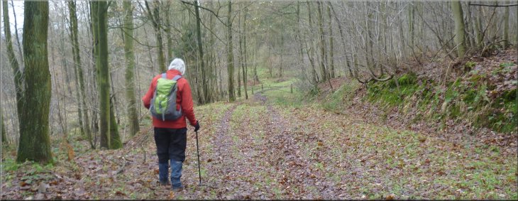
After our visit to the chapel we continued along the track up the
hillside and very soon we reached the top of the climb and the track
levelled out. Here the track is called Hambleton Road as it leaves the
woodland and passes between the fields. At a place called Shaw's Gate,
map ref. SE523882, the track turns sharp left.
Track called Hambleton Road
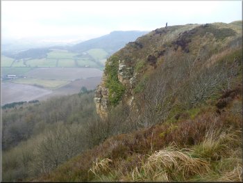
On the Cleveland Way path with a misty Roulston Scar behind
|
Looking to Sutton Bank along the Cleveland Way
Path along the cliff top around the glider field
We turned left to walk along the cliff edge around the perimeter of
the glider field to Roulston Scar. |
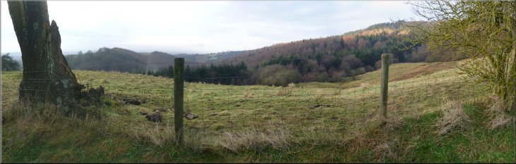
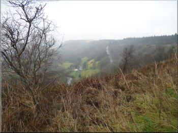
The weather was still very hazy and we could only see a few fields
below us, the rest of the amazing view from here was lost in the mist.
The road up Sutton Bank
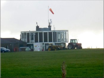
The control tower at the glider field
|
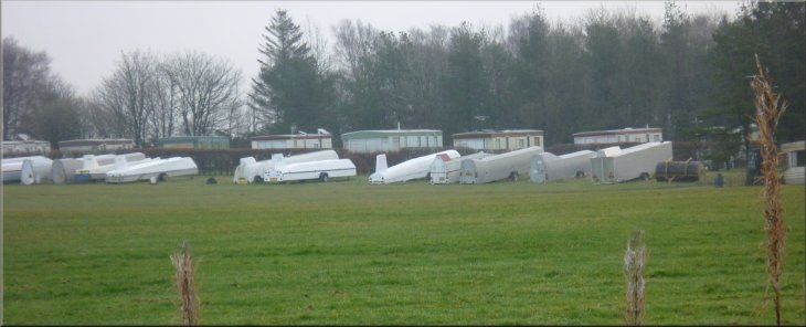
Gliders in their cases lined up by the glider club caravan park |
Looking back to Roulston Scar
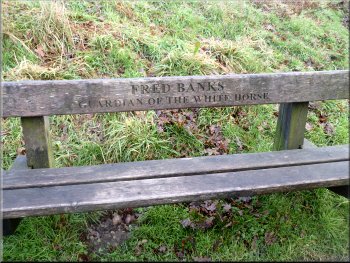
Seat at the top of the White Horse steps
Dropping down to the road
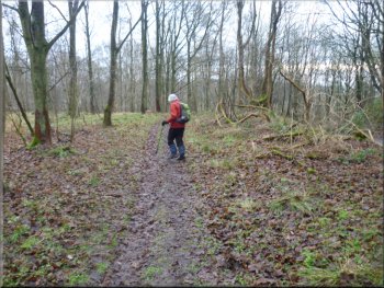
From the seat we followed a narrow path through the heather along the
hill top for about 200m towards the road at the top of White Horse Bank.
There is a short steep drop down to the road with a "Public Footpath"
sign where the path meets the road. |
We continued along the gravel path above the Kilburn White Horse
to the steps at the eastern end of the horse. At the top of the steps
there is a wooden seat and we walked in front of the seat.
Gravel path along the top of the White Horse
Path through the heather to the road
Footpath sign where the path meets the road
|
Dropping down the bank to the road |
Climbing the roadside bank to descend through the woods
It was a steep but pleasant grassy track in a straight line through
the trees for about 350m. Here the well walked track bends round to
the right. There is a grassy track continuing straight on but it's clear
that most walkers follow the track to the right and after about 100m
we reached the road up White Horse Bank at map ref. SE516809. |
We crossed the road to another "Public Footpath" sign on
the opposite side and crossed a high steep bank on the road side to
drop down onto a path below the road. The path was well worn and easy
to follow along side the road for a little way and then straight down
the hillside through the woods.
Grassy track down through the woods
|
Grassy track down through the woods
Approaching the road along the grassy track
|
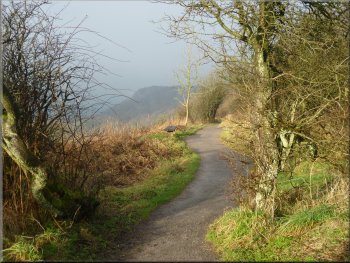
Path by the road heading down the hillside
View to the fields from the path by the road
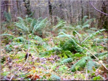
Ferns in the woodland
The whole route had been 8km and it had taken us about three hours
including our stops to admire the scenery in the brief sunny spells
and to look at John Bunting's Chapel. We had finish at a good time to
stop for some lunch at a cafe on the way home. |
Just at the road side we turned left to walk along a well walked
path just a few metres from the road in the edge of the wood and we
followed this path down the hill for about 350m back to the car park
and the end of our walk.
Path by the road heading down the hillside
Path above the road heading for the car park
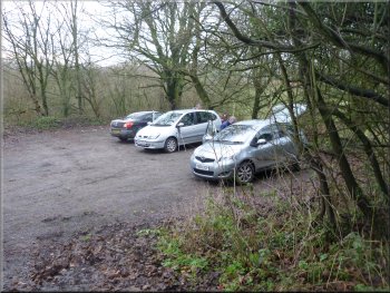
The car park at the bottom of White Horse Bank
|
Approaching the car park at the end of the walk
|
Background Notes:
This walk is a circular route of 8km, about 5 miles, starting from a little car park at the bottom of White Horse Bank near Kilburn in the Hambleton Hills. From the car park we walk down the hill and along the lane for about one and a half kilometers to the edge of Oldstead. Oldstead is the village where a small Cistercian Priory was established in the mid 1100's for about 30 years before the monks moved a couple of kilometers eastwards to found the monastic community of Byland Abbey.
At the edge of Oldstead we turn left to walk along a track climbing up Oldstead Bank. This track is the continuation of the Hambleton Drove Road that we've come across before on these walks. In the 1700's live stock was driven along this route from Scotland as far south as London to feed the growing urban population.
Near the top of the climb is a place in the woods called Scotch Corner (not to be confused with the A66/A1 junction further North). This Scotch Corner was the site of the battle of Byland in the early 1300's between Edward II's army and the Scots army of Robert the Bruce that the Scotts won and Edward II was lucky to escape with his life. In the 1600's and 1700's the Scotch Corner Inn was here providing accommodation for the drovers using the drove road.
The site was later a farmstead that was abandoned and fell into ruins. In the late 1950's the site was acquired by a renowned sculptor called John Bunting who converted one of the ruined buildings into a memorial chapel for his friends who had been killed in the second world war. The site is open to the public and there is a wooden sculpture of a mother and child on the hillside above the chapel. The building itself is only open to the public on a few days a year. John Bunting learnt his wood carving skills whilst working for Robert Thompson, "the mouse man", in nearby Kilburn. He later qualified as a teacher and taught at Ampleforth College.
From this historic site we continue along the old drove road and along a minor road to join the Cleveland Way route near the Hambleton Inn. We follow the Cleveland Way out to the edge of the escarpment on Roulston Scar. What an amazing place this is. The top of the escarpment is at a height of about 300m, around 1000ft, above sea level with views out across the Vale of Mowbray to the Yorkshire Dales with Gormire Lake over to the right. There are some benches by the path and it's well worth taking a break here just to admire the view. The Sutton Bank Visitor Centre is just a few hundred metres away with its exhibition, cafe and toilets if you'd like to go there.
Our route continues around the edge of the escarpment on Roulston Scar. The large field on top of the cliffs is the site of the Yorkshire Gliding Club - a wonderful site to fly from with almost guaranteed lift from the winds blowing from the west and forced up by the cliffs. This whole field was an iron age hill fort around 400BC and is one of the largest such sites in England.
The path takes us along the top of the Kilburn White Horse. The figure of the horse was cut into the hillside in 1857 and can be seen from many miles away. In the nearby village of Ampleforth there is a pub called "The White Horse" and it has had this name since the mid 1700's, about 100 years before the Kilburn White Horse was cut. The pub name seems to refer to a much older local traditional story. There are several versions but all have the central feature of a rider on a spirited white mare that was uncontrollable and galloped with its rider over the cliff of Roulston Scar as if pursued by the devil. Such legends seem to go back into prehistoric times when horses were sacred and a white mare was associated with the Moon Goddess.
Our walk continues along the top of the white horse figure and crosses the road at the top of White Horse Bank. There is a pleasant path down the hill side through the woods that emerges from the woods opposite the little car park at the bottom of the hill and the end of this week's walk.
top of page
|