| 2001 walks | 2002
walks | 2003 walks | 2004
walks |
| 2005 walks | 2006
walks | 2007 walks | 2008
walks |
| 2009 walks | 2010
walks | 2011 walks | 2012 walks |
| 2013 walks | 2014 walks | 2015 walks | 2016 walks |
| 2017 walks | 2018 walks | 2019 walks |2020 walks |
| 2021 walks | 1993-2000 library | Find a Route Index |
| A few Routes to print out | Request a Route... |
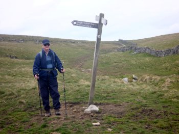
Route No. 467 - Wednesday 9 May 2012
Malham, Malham Cove, Watlowes,
Langscar Gate, Pikedaw Hill circuit - 9km
Airedale, Yorkshire Dales . . .
Route map from Ordnance Survey
Open Space service.
Map: OS Explorer OL2 Yorkshire Dales Southern & Western areas
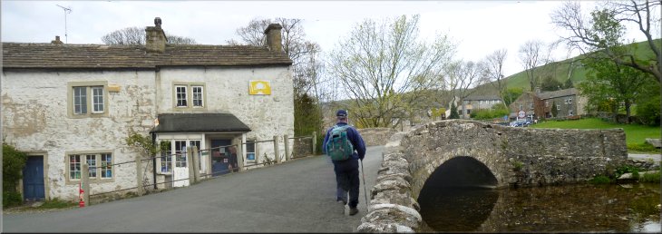
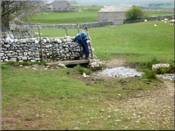
Bridge over Malham Beck (soon to be the River Aire) in Malham |
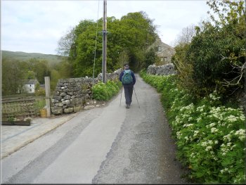
Walking through Malham from the visitor centre car park
The path to Malham Cove
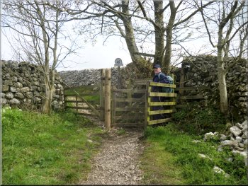
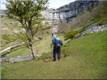
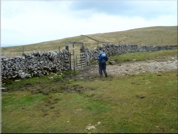
We followed the road for about 100m from the bridge to the Malham Youth
Hostel. At the hostel we turned left along a track down the side of
the hostel heading northwards out of the village to cross the fields
towards Malham Cove. The farmer here has clearly had a lot of trouble
with unruly visitors and the way is festooned with handwritten signs
attempting to guide visitors to behave with consideration. |
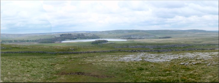
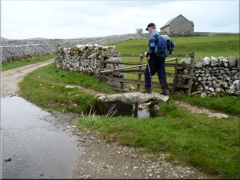
The weather forecast for today predicted a wide band of persistent
rain moving up from the south but it was not due to reach the western
dales until later in the afternoon so Jim & I drove to Malham and
parked at the Dales Visitor Centre on the edge of the village at map
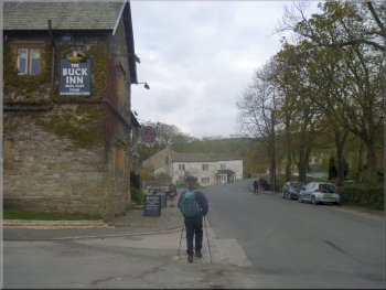
ref. SD899626. From the visitor centre we walked up the village street
to the fork in the road at the Buck Inn. We took the right hand fork
in the road in front of a white cottage and over a narrow stone arch
bridge across Malham Beck that becomes the River Aire about 1km downstream.
Lane from the Youth Hostel to Malham Cove
An early view of Malham Cove
|
The track to Malham Cove from the youth hostel
Approaching Malham Cove across the fields
|
Path down to Malham Beck at Malham Cove
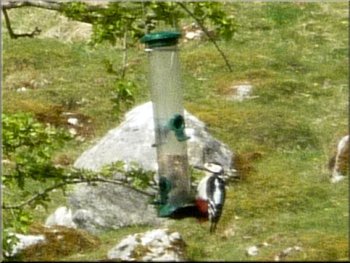
Great spotted woodpecker on an RSPB feeder at Malham Cove
Unfortunately the male was off hunting and the female was sitting out
of sight at the back of the nest. The volunteers had installed bird
feeders handing from a hawthorn tree about 150m away and we were lucky
enough to see a great spotted woodpecker coming to feed there. One of
the volunteers showed us a little owl, a daytime hunter, that he had
his telescope trained on. It was well camouflaged in some rocks on the
hillside. |
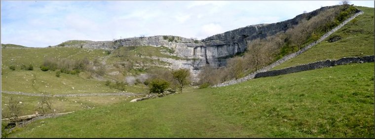
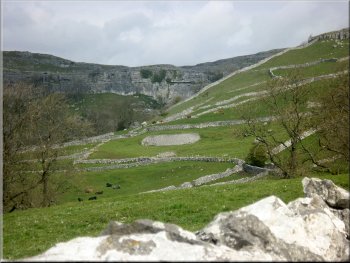
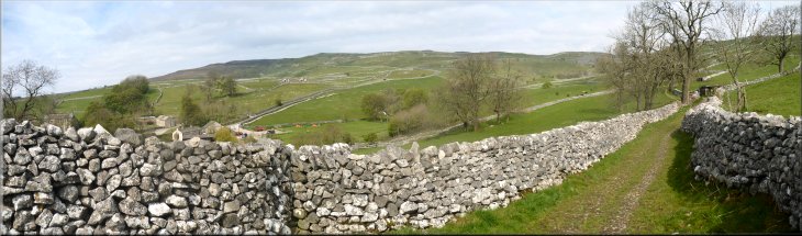
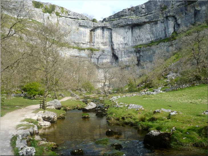
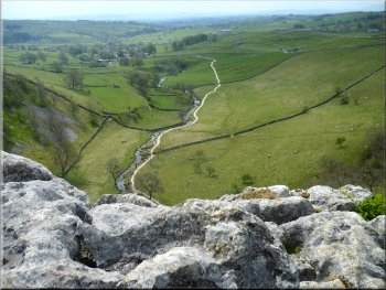
As we crossed the fields the spectacle of Malham Cove was gradually
revealed and we followed the path down to a stone clapper bridge over
Malham Beck a few hundred metres from the Malham Cove cliff (this beck
becomes the River Aire about 1km downstream of Malham village). Nearby
was a small group of RSPB volunteers with their telescopes set up to
watch a pair of peregrine falcons nesting on the cliff.
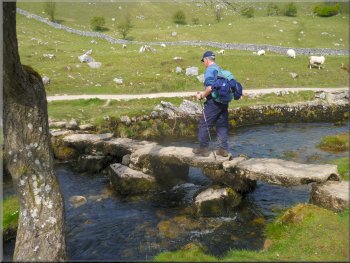
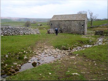
Stone clapper bridge across Malham Beck
Malham Cove from the steps up the western end of the cliff
|
Malham Beck rising from the foot of Malham Cove |
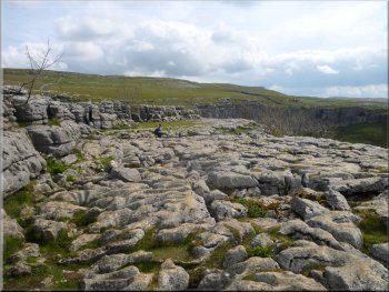
Limestone pavement on top of Malham Cove
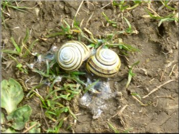
Mating snails by the path
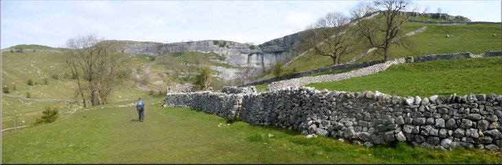
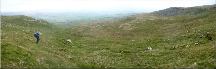
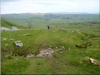
The path along Watlowes from the top of the Cove
We left our viewpoint and followed the path up the craggy limestone
valley, called Watlowes, away from the cove. The path climbed up through
the crags for almost a kilometer from the cove to a junction in the
paths at SD890649. Here one path doubled back around a craggy hillside
but we turned left over a ladder stile to cross a field to the road
at map ref. SD888648 at Langscar Gate. |
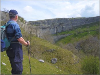
We left the RSPB volunteers and followed the path towards the cove
and then up the long flight of steps up the western end of the cove
to the limestone pavement on top. It's a climb of 80m, about 270ft.
We found a comfortable block of limestone to sit on near the eastern
end of the cove where we had a drink and sat just to admire the view.
from the edge of the limestone pavement.
Looking back over Malham from the top of Malham Cove
The path along Watlowes from the top of the Cove
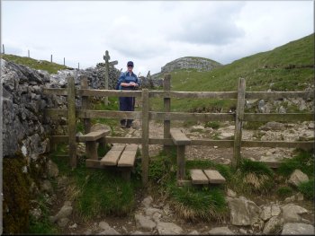
Stiles at the top of Watlowes:
The stiles are in pairs along this path to cope with busy times
|
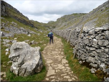
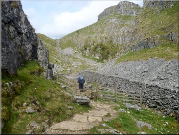
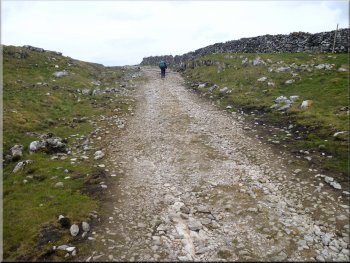
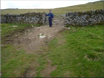
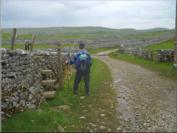
Old byway up from Langscar Gate

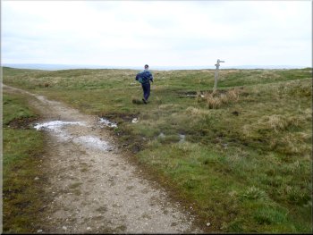
Finger post where the bridleway leaves the old Byway
After about 800m, at map ref. SD880649, there is a finger post marking
the start of a bridleway to the left that continues to climb up the
grassy hillside with rocky limestone outcrops. |
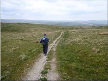
Here we crossed the road and continued along an old byway route climbing
up the hillside with a view across to Malham Tarn behind us as we climbed.
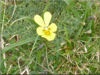
One of many Mountain Pansies by the track
The old byway climbing up from Langscar Gate
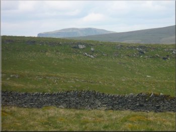
A glimpse of Pen-y-Ghent on the horizon
|
Looking back over Malham Tarn from the byway
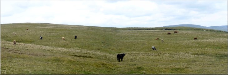
Cattle grazing the open hillside
|
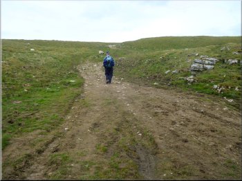
Climbing up along a bridleway to the highest point of our walk
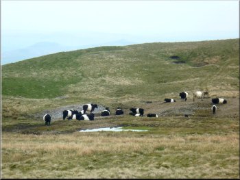
Herd of belted galloway cattle on the hillside
After a little over a kilometer we came to another bridleway at map
ref. SD874639. This bridleway runs roughly east to west and to the west
goes through Stockdale to Attamire Scar and down into Settle. |
There were herds of highland cattle and belted galloway cattle on
the hillsides, both breeds seem to do well on the coarse grazing available
up here.
Joining the bridleway going from Malham to Settle
Downhill at last along the bridleway heading East
|
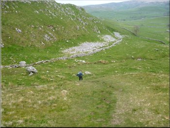
Beginning our descent around the side of Pikedaw Hill |
Turning off the E/W bridleway to descend round Pikedaw Hill
The path down the side of Pikedaw Hill
Here there was another finger post indicating the start of a footpath
heading down the side of the craggy limestone hill called Pikedaw. After
the long climb up from Malham my old knees were complaining about this
steep descent which continue for about 1.5km down to a walled track
at map ref. SD891632. |
This bridleway was the highest point on our walk and after climbing
all the way from Malham, at last we began to descend as we turned left
to head east along the bridleway for about 400m to map ref. SD878639.
The path down the side of Pikedaw Hill
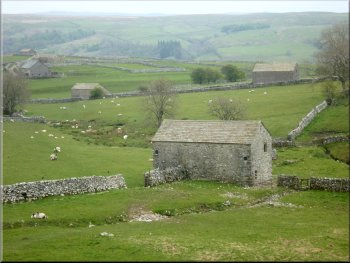
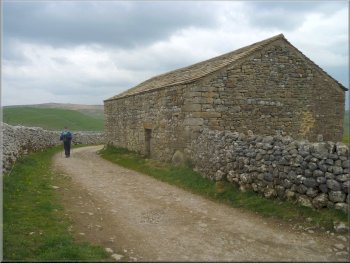
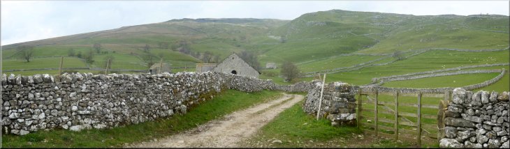
Field Barns by the lane into Malham
|
Field Barn near the lane into Malham
Heading for the lane into Malham
The lane into Malham
I managed to walk round the corner to a nice little tea shop for a
coffee and toasted tea cake before driving home after a lovely day in
this magnificent limestone scenery. The forecast rain started soon after
we set off for home and continued overnight and into the following day. |
Adjoining the track was a series of old stone Field Barns and away
to our left was a last view of Malham Cove about a kilometer to the
north. We followed the walled tracks back to the visitor centre car
park and the end of our walk. The whole route was only 9km but it is
all climbing for the first 6km and then a steep descent for the last
3km so my old knees had had enough.
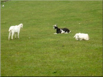
A few goats were grazing amongst the sheep
The stile on to the lane into Malham
Barn by the lane into Malham
|
Looking back to Pikedaw Hill from the lane into Malham
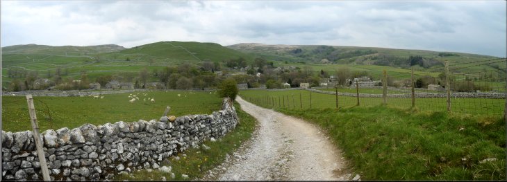
Heading into Malham at the end of our walk
|
Background Notes:
This walk is a 9km circuit, that's almost 6 miles, from the Dales Visitor centre car park at Malham. This is limestone country and the spectacular scenery is formed by the erroded shapes of the craggy limestone hills. We leave Malham on a track from the Malham Youth Hostel that leads out across the fields to Malham Cove. We cross a stone clapper bridge, that's just a series of stone slabs, over Malham Beck. It's the clear limestone watercourse that changes its name to the River Aire just downstream of Malham Village at Aire Head. Malham Cove is one of the most spectacular pieces of limestone scenery you are likely to see in this country. It's a semi-circular cliff around 80m high, that's 270feet, that was formed by melt water from the glaciers of several ice ages. I believe the current thinking is that it was first formed around 50,000 years ago. Now-a-days water from Malham Tarn flows underground through fissures in the limestone to emerge from the foot of the Malham Cove cliff. In the spring and early summer there is often a group of RSPB volunteers with their telescopes set up looking at the nest of a pair of peregrine falcons high up on the cliff and there are other birds to look out for around the cove too, including little owls, they're daytime hunters, and both green and greater spotted woodpeckers. Our route takes us up the steps at the western end of the cove to the limestone pavement that tops the cliff. This amazing layer of erroded limestone looks like the surface of a vast brain with is interlocking pattern of limestone clints and the grykes, or gaps, between them. These sheltered gaps allow a whole range of plants to grow that could not survive up here without shuch a sheltered position. (harts-tongue fern, wood-sorrel, wood-garlic, cranesbill, anemone). From the limestone pavement on top of the cove we follow the dry valley away from the cove. The valley is called Watlowes and it has an unusual wall running along the bottom of the valley. It's a steep craggy place and the wall beside the path has straight sides unlike the sloping sides of a normal drystone wall. This wall was built hundreds of years before the drystone wall field enclosures we see in the dales. This wall was the ancient bounday between the lands owned by Bolton Priory to the east of the wall and Fountains Abbey to the west of the wall. I have no idea how the lands of Fountains Abbey managed to stretch so far west but apparently they did. We climb up through Watlowes to the road at Langscar Gate and follow an ancient byway from there climbing up across the hillside. There are vast fields enclosed by dry stone walls on the hillside and these are grazed by hardy cattle, such as belted galloways and highland cattle that seem to do well on this coarse grass. Sticking up from a wall by the path is a square stone shaft that is all that remains of an ancient cross marking a monastic route over the hills. It's called Nappa Cross. On top of the hills we join another ancient route that crosses the hills from Malham to Settle. Nearby, above Pikedaw Hill, is the site of a calomine mine. Calomine is an ore of zinc and its discovery at the end of the 1700's was at just the right time for the developing process of brass production using copper and processed calomine, and the industry was at its height for about 30 years at the beginning of the 1800's. From here we follow a steep path down the side of Pikedaw Hill to a series of stone field barns at the bottom of the hill and walk along walled lanes back to the visitor centre car park and the end of our walk.
top of page
|