| 2001 walks | 2002
walks | 2003 walks | 2004
walks |
| 2005 walks | 2006
walks | 2007 walks | 2008
walks |
| 2009 walks | 2010
walks | 2011 walks | 2012 walks |
| 2013 walks | 2014 walks | 2015 walks | 2016 walks |
| 2017 walks | 2018 walks | 2019 walks |2020 walks |
| 2021 walks | 1993-2000 library | Find a Route Index |
| A few Routes to print out | Request a Route... |
Route No. 450 - Monday 2 January 2012
Boltby, Low Paradise farm, Hambleton
Drove Road, High Barn circuit - 8km
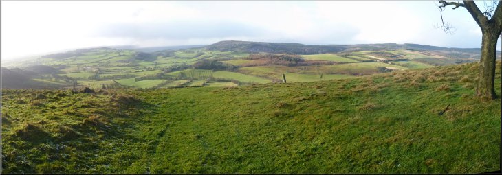
Hambleton Hills . . .
Route map from Ordnance Survey
Open Space service.
Map: OS Explorer OL26 North York Moors Western area
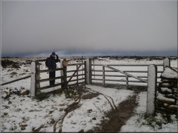
The access road to Lunshaw House farm leaving the road from Boltby |
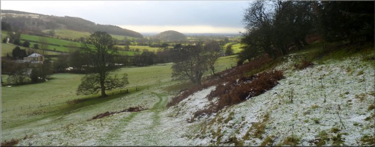
High Barn on the skyline from the lay-by at the start
The field below the lay-by falls away to Lunshaw Beck and all being
well we would return to the lay-by up this slope at the end of our walk.
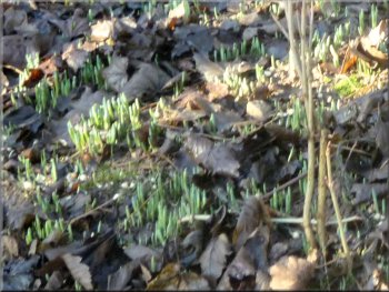
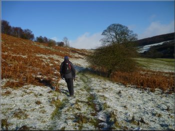
We set off, at about 10.45am, heading northwards along the road for
about 100m and turned left along a steep access road with wooded banks
at either side. The banks were covered with the fallen leaves from last
autumn and well grown through the leaves were a great many crocus shoots
ready for the spring. |
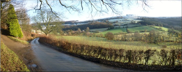
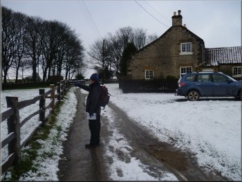
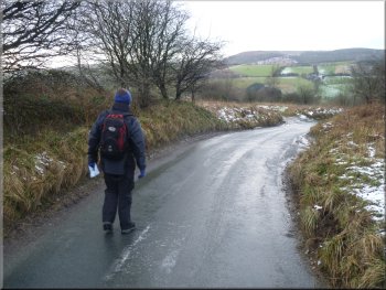
This morning a friend of mine called Andrew drove us both to Boltby
near Thirsk on the western edge of the North York Moors in the Hambleton
Hills. As the road leaves the eastern end of the village there is a
sharp left hand bend in the road with a small lay-by on the right hand
side of the road. We parked there at map ref. SE 494865 next to a very
large sycamore tree that is clearly a children's play tree with steps
nailed to it giving access to a tree house platform.
Crocus shoots already well grown in January
|
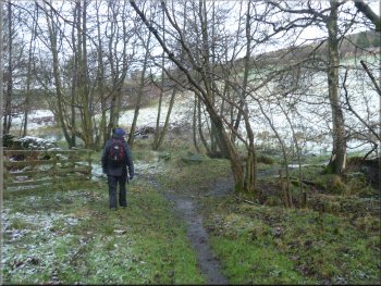
Path across the fields at the start of the walk
Entering Boltby Forest
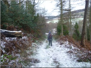
Path in Boltby Forest down to Lunshaw Beck
(Boltby Forest is a Forestry Commission forest and there is open access
in it except for any active forestry operations). The weather was very
changeable. As we set off it was bright sunshine with clear blue sky
but now black shower clouds were approaching fast in the strong winds.
The whole day continued like this with bands of bright sunshine alternating
with dark shower clouds but we only had one short sleety shower as we
approached High Barn near the end of the walk. |
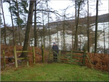
After a few hundred metres we turned off the access road onto a
public footpath across the fields on our right. Ahead on the access
road was a very unfriendly notice warning of attack by guard dogs roaming
free should you dare to approach Lunshaw House! We followed the path
across the fields and down through some woodland, part of Boltby Forest
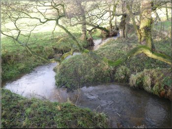
to a small stone clapper bridge over Lunshaw Beck.
Looking down Lunshaw Beck to Skipton Hill
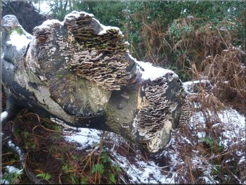
Clusters of small bracket fungus on a tree stump
Approaching the stone clapper bridge over Lunshaw Beck
|
Another black shower cloud approaching fast on the wind |
Looking back to Low Paradise Farm
Passing High Paradise Farm
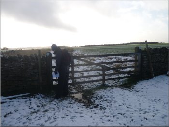
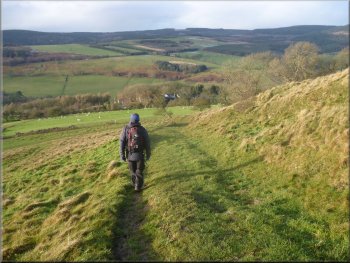
We continued on the Cleveland way route along the access road to High
Paradise Farm. We passed High Paradise and continued on to the Hambleton
Drove road. All the way since Low paradise Farm we had been above the
snow line. |
We crossed Lunshaw Beck and climbed up the field to Low Paradise
Farm. From the farm we followed the farm access road on up the hillside
to join the Cleveland Way route at a sharp bend in the road at map ref.
SE504883.
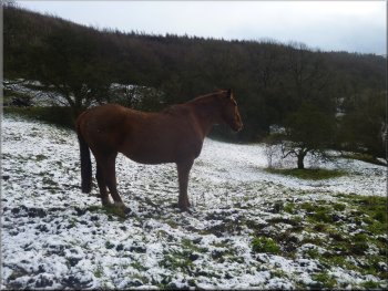
Horse in his snowy field
The access road from High Paradise Farm
|
Joining the Hambleton Drove Road from High Paradise Farm |
Footpath across the moor from the drove road
There was an inviting hollow below the wall where we sat out of the
cold wind for our lunch. |
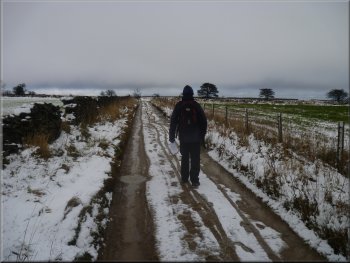
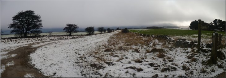
We crossed the Hambleton Drove Road and followed a snowy track beside
a wall across the moor to map ref. SE512890.

Footpath across the moor from the drove road
|
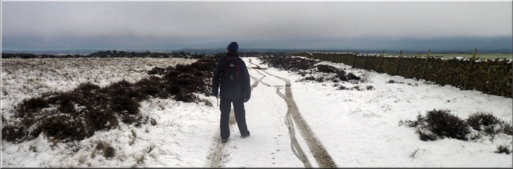
Snowy footpath across the moor from the drove road |
Leaving the moor for the field path
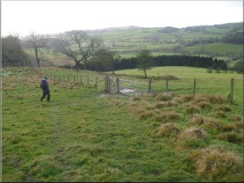
Gate off the road at Silver Hill Farm
The deer will have found a secluded sheltered spot to sit out the
bad weather. At the road we turned right and walked along the road past
the small car park at the top of Sneck Yate Bank and continued down
the bank to rejoin the Cleveland Way at map ref. SE507875. |
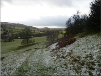
After our break we turned right off the moorland onto a path across
the fields for almost a kilometer to a road at map ref. SE513881. There
is a small herd of fallow deer that roams Boltby forest and the moor
top here but we saw nothing today.

Path between the fields to Silver Hill Farm
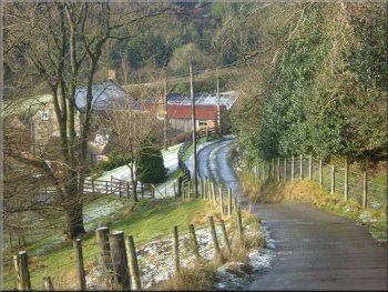
The road at Sneck Yate Bank
|
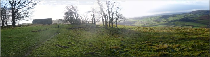
The Cleveland Way approaching High Barn |
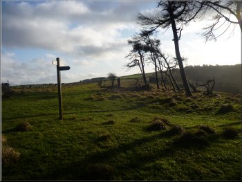
Our turning at High Barn
Beginning the descent from High Barn
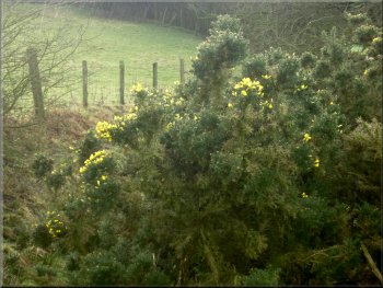
Gorse in flower by the path
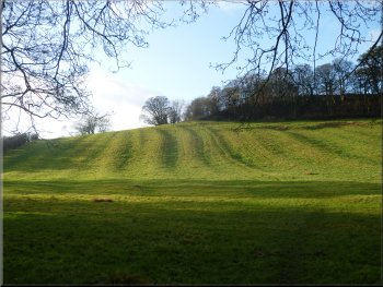
We turned right in front of the barn to begin our descent on a public
footpath zigzagging down the hillside into the valley of Lunshaw Beck.
|
Here we turned left off the road and walked along the Cleveland Way
route for about 1km to High Barn.
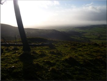
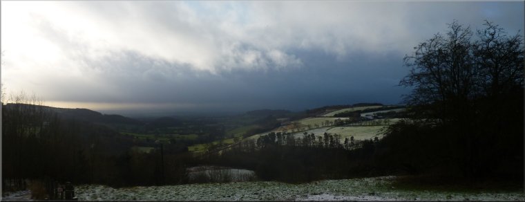
The view southwest from High Barn
The path down from High Barn
Looking down towards Lunshaw Beck
|
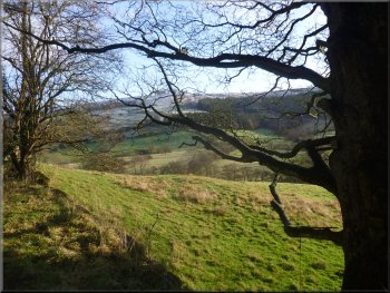
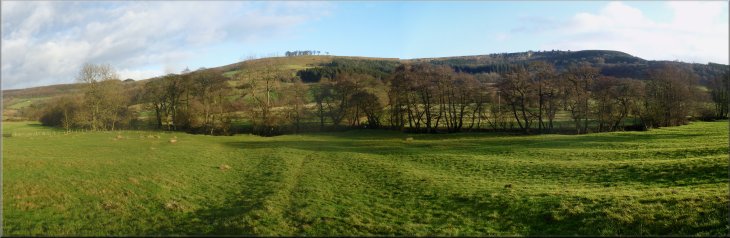
Looking west from High Barn to Boltby Forest on the ridge beyond Boltby
village |
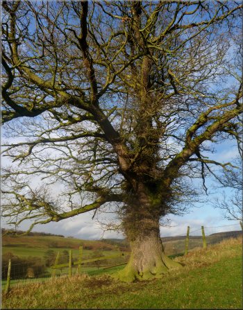
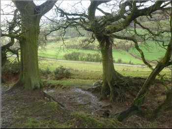
A fine oak tree by the path
It seems odd to me to realise that these two living things have both
been growing in this spot since the late 1700's and ever since then
people going about their daily lives have passed by these self same
trees. |
I'm always on the lookout for big old trees (see the ancient
tree hunt web site) and in the field boundary as we approached the
beck there is an old oak and a rather battered old ash tree.
An old ash tree by the path
|
Almost in the valley bottom
Lunshaw Beck by the footbridge
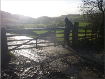
A young rider passed the lay-by as we were taking our boots off before
we drove home for a coffee and some christmas cake, with Wensleydale
cheese of course. |
We crossed the footbridge over Lunshaw Beck and slowly climbed the
field back to the lay-by. It's quite a steep climb to encounter right
at the end of the walk.
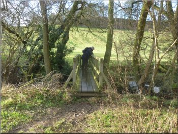
Footbridge over Lunshaw Beck
Looking up the slope to the lay-by at the top
|
Looking back across the valley from the lay-by to the little knot of trees
on the skyline at High Barn
|
Background Notes:
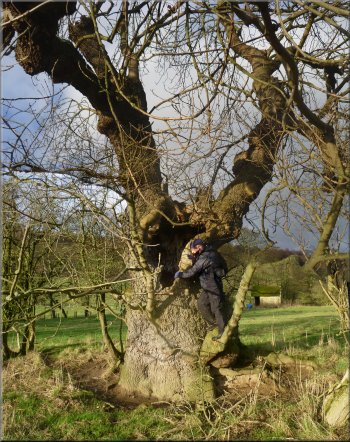
This walk is just 8km, that's 5 miles starting at the village of Boltby on the western edge of the North York Moors National Park. Boltby is a tiny village with a population of only 150, but it's been here at least since the Norman conquest and it's recorded in the Domesday Book as being owned by Hugh, son of Baldric. Hugh was the sheriff of York and was a major land owner in Yorkshire at that time.
We start from a layby at the eastern end of the village where there's a large sycamore tree with steps nailed on to give access to a tree house platform. It's about 20 years since I first saw this so the children who played there then will be grown up by now.
We follow a path out to the edge of Boltby Forest. This is a conifer forest owned by the Forestry Commission and there are many biking trails and paths through it. We come to a stone clapper bridge over Lunshaw Beck that flows down from the moor, through the forest and below our starting point at the layby. Long before the forest was planted a dam was built in the 1880's by the Thirsk District Water Co. across Lunshaw Beck about 1km upstream of the footbridge to form a reservoir for drinking water. It was a very contavertial scheme and the company had to work hard to get any support of the project. As part of this campaign the residents of Boltby were granted a free water supply from the reservoir.
From the old stone clapper bridge over Lunshaw Beck we climb up the valley side past Low Paradise farm and High Paradise farm along the Cleveland Way to the Hambleton Drove Road. This is an ancient prehistoric ridgeway route that got its present name from the fact that it was used in the 1700's and 1800's as a route to drive cattle, sheep, pigs and even geese from Scotland to feed the cities of England even as far south as London after being fattened on the grazing in East Anglia along the way. As we cross the old Hambleton Drove Road spare a thought for the many thousands of animals that passed along this route on their way to feed the growing cities of England during the industrial revolution.
Keep a lookout for the small herd of fallow deer that roam Boltby forest and the open fields here on Murton Common. We reach a road at Silver Hill farm and follow the road to Sneck Yate Bank. Sneck is just a dialect word for a latch and Yat is a gate so it was once a gated road.
A short way down the hill we turn off onto the Cleveland way again and follow it along the edge of the escarpment to High Barn. This is an old barn in a sparse knot of trees on the windy edge overlooking Boltby and the Vale of Mowbray across to the Yorkshire Dales. It's a steep descent from here back across Lunshaw Beck and up a final steep slope from the beck to the layby and the end of this week's walk.
top of page
|