| 2001 walks | 2002
walks | 2003 walks | 2004
walks |
| 2005 walks | 2006
walks | 2007 walks | 2008
walks |
| 2009 walks | 2010
walks | 2011 walks | 2012 walks |
| 2013 walks | 2014 walks | 2015 walks | 2016 walks |
| 2017 walks | 2018 walks | 2019 walks |2020 walks |
| 2021 walks | 1993-2000 library | Find a Route Index |
| A few Routes to print out | Request a Route... |
Route No. 418 - Wednesday 25 May 2011
West Burton, Burton Pasture,
Walden Beck circuit - 10km
Wensleydale, Yorkshire Dales . . .
Route map from Ordnance Survey
Open Space service.
Map: OS Explorer OL30 Yorkshire Dales Northern & Central areas
Another interesting route from Ray Brown - Thanks Ray!
|
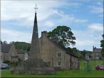
West Burton Market Cross
Gate latch built into a tree
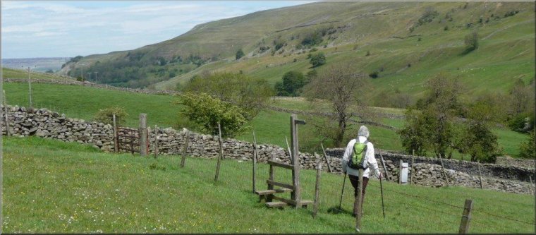
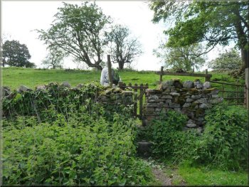
Through the stile we immediately turned left over a stone slab bridging
Little Beck. From here the route was a path running southwest through
a series of gated squeeze stiles set in stone walls between neighbouring
pastures. The route then became a track passing through farm gates and
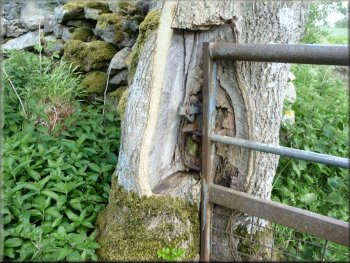
to the left of a derelict barn at SE 008862. A tree by the track had
been butchered to behave as a gatepost for one farm gate.
|
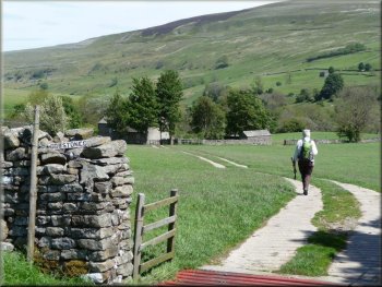
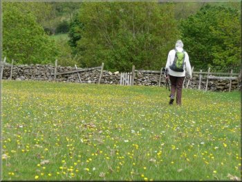
After parking in Front Nook, West Burton we walked along the road southwest
past the ancient octagonal market cross and wooden stocks on the village
green to SE 0156 8648 where we turned right onto a track that led into
a pasture. Passing through a squeeze stile in a stone wall we descended
through another pasture to a second such stile.
Leaving the road in West Burton
Turning left off the farm track
|
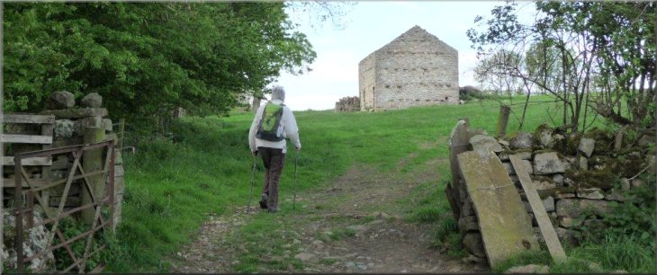
Derelict barn at SE 008862 |
|
Entering moorland at SE 004857
Keeping to the right of a felled forest
Eventually we crossed Myers Gill to arrive at SE 0062 8514 where a
gap in a stone wall allowed us to turn right onto a path running between
the wall on our right and a barbed wire fence on our left. Our O.S.
map indicates woodland beyond the fence but clearly the forest had been
felled and only a desolate wasteland remained. At SE 002 844 we crossed
a stile into the ex-forest and followed a winding track to the surfaced
road at SE 0074 8378.
|
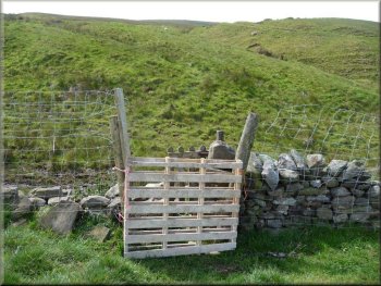
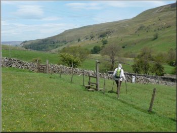
At SE 0035 8580 we turned left off the track through a gated squeeze
stile and over pasture south-south-east towards moorland which we entered
with some difficulty as a pallet had been fixed in front of another
gated squeeze stile. Here we turned right on a path for only 20 metres
before resuming our SSE direction, climbing steeply on a faint moorland
path which ran parallel with, but about 20 metres to the left of, an
unnamed gill.
Thoralby from the Moor
Approaching Cowstone Gill House
|
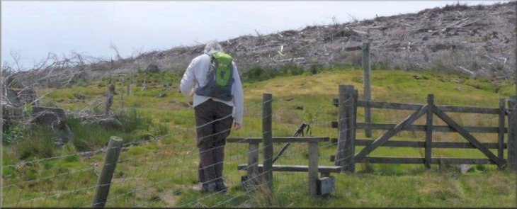
Entering the felled forest |
|
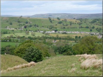
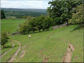
Burton Moor and Harland Hill
From there the route to Cote Bridge, running above and some 200 metres
to the west of Walden Beck, was fairly clear through countless pastures
and gated squeeze stiles and over three minor gills. Beyond the beck
Burton Moor and Harland Hill imposed their majesty. The edifice of Castle
Bolton in the distance lay directly ahead of the path. Lapwings made
frantic piercing calls to distract us from their nests and bluebells
adorned a strip of woodland on our right. From the buttercups in the
final pasture we turned right for a mere 100 metres on a surfaced road
which took us past small caravan sites and over the hump-backed Cote
Bridge.
|
Turning right we followed the road to 70 metres beyond where it bridges
Cowstone Gill. There a track on the left led towards Cowstone Gill House.
Keeping left at a fork 160 metres further on, we walked around the left
side of Cowstone Gill House before crossing the gill and climbing a
grassy slope beyond. Veering right through a small gate we climbed through
a small pasture to a stile into a large pasture. Here a signpost indicated
a right turn to follow a route around the perimeter whereas our map
shows the right-of-way being direct to the diagonally opposite corner.
The last squeeze style before Cote Bridge
|
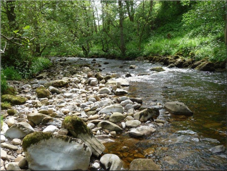
Walden Beck by Rookwith Bridge |
|
Contoured right on a narrow path
Bearing slightly left the route continued through further pastures
to pass to the right of Riddings farm. Crossing a private farm track
that ran downhill we contoured right on a narrow path via a small gate
to a signpost where we turned left towards a second signpost "West Burton".
|
With an immediate left turn we took a riverside path which passed Rookwith
footbridge before veering right away from the beck across pasture to
a squeeze stile with a large gate.
Approach to West Burton
|
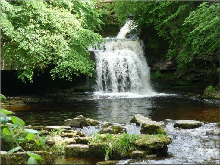
West Burton waterfall |
|
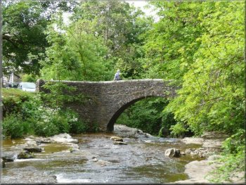
West Burton footbridge
Fine weather had contributed to our enjoyment of this walk but some
ramblers, especially in large parties, might find the plethora of stiles
(almost 40) difficult to negotiate - Ray Brown
|
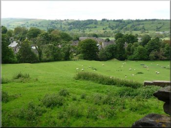
A barn on our right marked the start of the descent towards the village
which we accessed by the stone footbridge and from the west bank of
the beck we enjoyed the classic fine views of the waterfall.
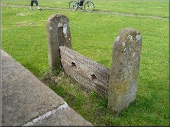
Stocks on West Burton village green
|