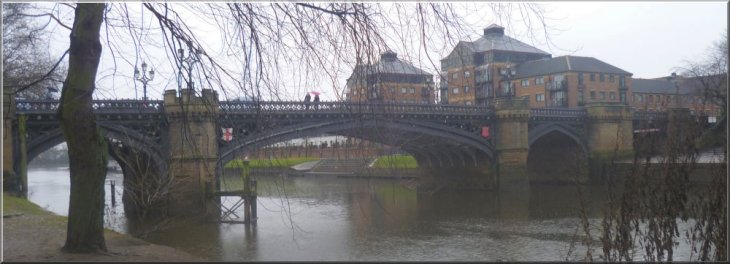
Skeldergate Bridge over the River Ouse in York |
|
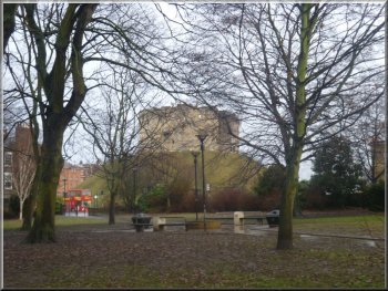
Clifford's Tower from the park by the Davey Tower
We walked downstream to the point where the New Walk starts at the
Davey
Tower. It was named after John Davey who lived there in the 1420's.
The tower was used along with the now vanished Hynsbrig Tower to protect
the City of York from invaders. The gardens around the tower are said
to be York's first public park. Just down stream of the Davey Tower
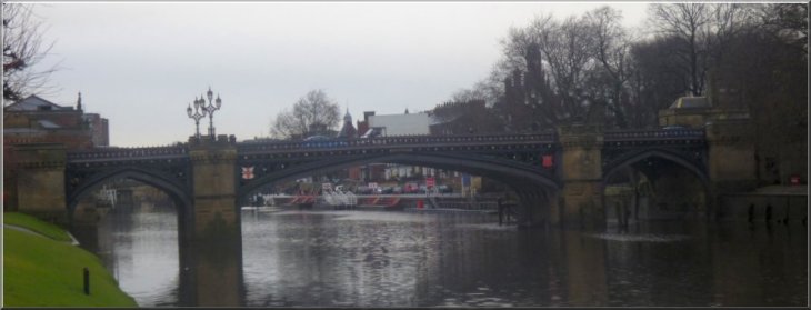
we reached Skeldergate
Bridge. It was built in 1881 to open to let boats pass but the mechanism
was long since removed. The bridge is made of cast iron and was designed
by Thomas
Page who had designed Westminster Bridge in London and Lendal Bridge
in York.
|
My decrepit knees are still restricting my walking so today my mate,
Jim, and I took the "Park & Ride" bus into York and followed
the route of "The New Walk" by the River Ouse. In the 1730's
the tree-lined "New
Walk" was laid out where fashionable people could stroll and socialise
by the River Ouse.
All the background information that I have included
about this walk is taken from a public information board erected by
York City Council near the Blue Bridge over the River Foss on the route
of the walk.
We began our walk at the Museum Gardens where the Park & Ride bus
from Rawcliffe Bar stops, map ref. SE600519. We walked through the city
to Ouse Bridge and took the steps from the bridge down onto the river
side at the Kings Arms.
Looking back to Skeldergate Bridge
|
|
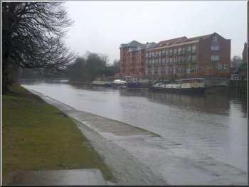
One of many blocks of riverside flats in York
Just beyond St. George's Field car park we came to the Blue Bridge
over the River Foss at its confluence with the Ouse. The
Blue Bridge was first erected in 1738 and has been rebuilt four
times since then. The present structure was built in 1929.
|
We continued downstream along the river bank with the St. George's
Field car park on our left. (Public toilets available there) The ghost
of Dick Turpin, the highway man, is said to haunt St. George's Field
car park where St. George's Chapel once stood.
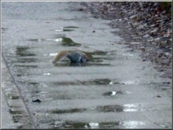
Grey squirrel drinking from a puddle
|
|
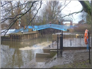
The Blue Bridge over the River Foss
When the River Ouse is in flood, the barrier is closed to prevent flood
water from the Ouse from flowing up the River Foss. Water from the Foss
is then pumped into the Ouse.
|
Looking up the River Foss from the Blue Bridge we could see the River
Foss Flood Barrier. The
Foss Barrier was built after the floods of 1972 and 1982.
The River Foss flood barrier
|
|
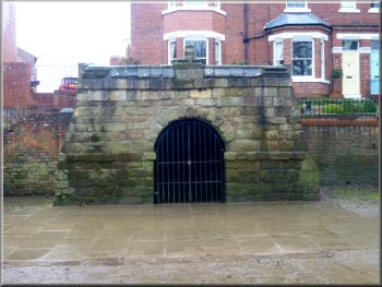
The well head over the Pikeing Well
The well head over the Pikeing Well was designed by John
Carr in 1752. The waters of the well were believed to have healing
properties.
|
From the River Foss we continued along the path and cycle track by
the river Ouse to the Pikeing Well.
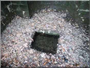
The water in the Pikeing Well
|
|
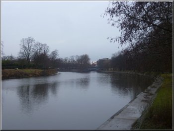
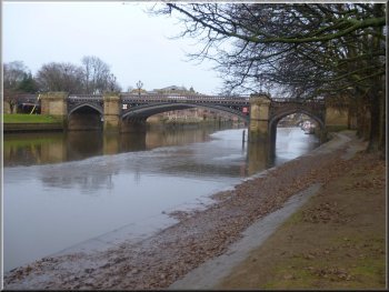
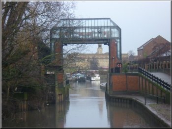
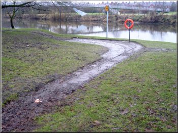
Looking upstream along the River Ouse
We followed the riverside path towards the millennium bridge and came
to the remains of a Tramway,
visible on the river bank. The tramway was used to transport stores
from a wharf, built in 1888, on the River Ouse into the Fulford Army
depot.
|
Apparently in the summer there are clumps of the tansy plant on the
river bank near the Pikeing Well. Nationally this plant is in decline
and along with it the now rare tansy
beetle which depends on the plant. This shimmering green beetle
can now only be found along the banks of the River Ouse.
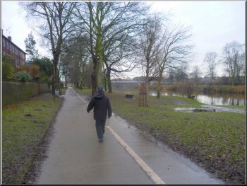
The New Walk near the Millennium Bridge
|
|
Remains of the military tramway
The bridge carries a foot path and cycleway over the river and the
arch of the bridge and its suspension cables are apparently to represent
the rim and spokes of a bicycle wheel.
|
Just beyond the tramway tracks we reached the millennium
bridge, which provides a link from the New Walk to Rowntree Park.
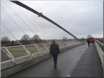
The millennium footbridge & cycleway
|
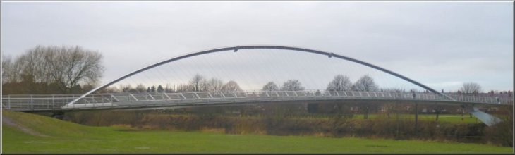
The millennium footbridge & cycleway over the River Ouse |
|
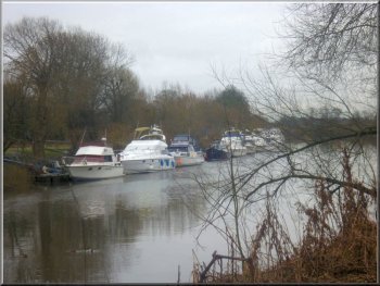
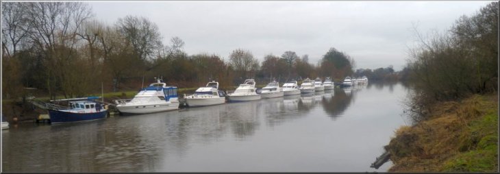
River cruiser moorings below the millennium bridge
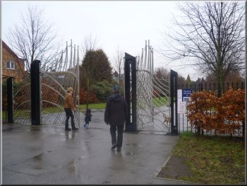
Entrance to Rowntree Park by the millennium bridge
At the end of the access ramp from the bridge at map ref. SE602503,
we entered Rowntree Park. It's a large park with ducks and geese on
the ponds which were still frozen after our December cold spell. We
followed a path through the park to return to the riverside at map ref.
SE605509. At the riverside we turned left to follow the narrow road
upstream back to Skeldergate Bridge where the "New Walk" ends.
We continued along Skeldergate and across Ouse Bridge. Then we walked
along Coney Street and back to the Museum Gardens where we caught the
park and ride bus back to Rawcliffe Bar to drive home.
|
Once across the bridge we turned left to continue downstream along
the river bank for about 300m following the tarmac footpath and cycleway
to map ref. SE601498. We the path turned right to lead us out to Bishopthorpe
Road. At the road we turned right again to follow the road back towards
the centre of York, past the old Terry's chocolate factory entrance.
After about 200m we turned right into Reginald Grove. Where this road
turned right after about 100m we took the pedestrian path straight ahead
back onto the river bank and made our way back to the millennium bridge.
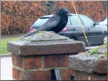
Injured rook resting on a gatepost
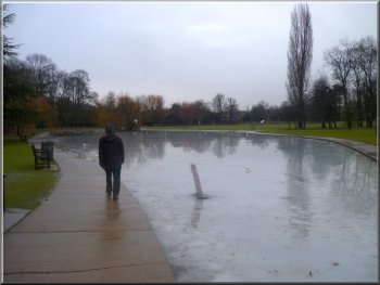
Frozen pond in Rowntree Park
|
Returning to Skeldergate Bridge |