| 2001 walks | 2002
walks | 2003 walks | 2004
walks |
| 2005 walks | 2006
walks | 2007 walks | 2008
walks |
| 2009 walks | 2010
walks | 2011 walks | 2012 walks |
| 2013 walks | 2014 walks | 2015 walks | 2016 walks |
| 2017 walks | 2018 walks | 2019 walks |2020 walks |
| 2021 walks | 1993-2000 library | Find a Route Index |
| A few Routes to print out | Request a Route... |
Route No. 379 - Wednesday 3 November 2010
Cayton Bay to Filey
via the Cleveland Way - 10km,
Yorkshire Coast. . .
Route map from Ordnance
Survey Open Space service.
Map: OS Explorer 301 Scarborough, Bridlington & Flamborough Head at
1:25000
|
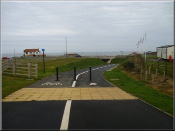
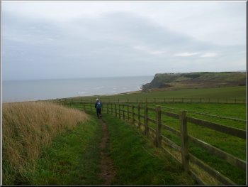
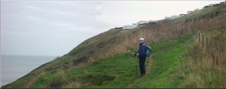
Heading for the underpass to cross the A165
At the service road we turned right and walked along the road for
about 150m. Here we turned left along an access road. We passed the
Surf Shop and car park to reach the Cleveland Way coastal path at map
ref. TA070842. We turned right to walk along the Cleveland Way on the
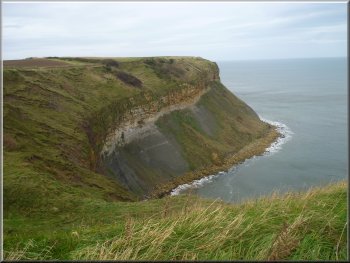
coast side on a few houses and continued climbing up to a high headland
at the Southeastern end of Cayton Bay. Even on the drab November day
there were several people in wetsuits standing in the water with their
surf boards, forlornly waiting for a wave in the calm sea. It was approaching
high tide and the wind was offshore so they could still be waiting for
a wave.
|
The weather forecast for today was generally poor with lots of heavy
rain about, but at least on the East coast it would remain cloudy but
fine until late in the afternoon. We, that's Jim and I, drove to Filey
to get the 10.35am no.121 bus to Cayton Bay. The bus was about 15 minutes
late and was very busy so we had to stand. It was only a short ride
and we were soon getting off at the "Haven Holiday Park" bus stop near
the A165 at Cayton Bay (map ref. TA065840). We walked up the road towards
the roundabout on the A165 and went through the pedestrian and cycleway
underpass to a service road on the far side of the A165.
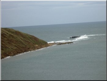
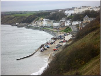
Cayton Bay from the cliff top path
|
|
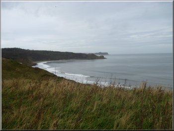
Walking along the Cleveland Way to Lebberston Cliff at the Southern
end of Cayton Bay
Looking Northwest to Scarborough South Bay from Lebberston Cliff
|
|
Heading towards Gristhorpe Cliff
Looking along the coast to Gristhorpe Cliff
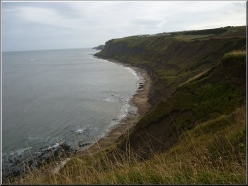
As we continued the path followed the cliff top down and then began
to climb up again towards a huge caravan site. We followed the path
along the edge of the caravan site.
|
Despite the overcast sky there was still a good view Northwest along
the coast to Scarborough as we continued along the top of Lebberston
Cliff.
Rocky pinnacle near Lebberston Cliff
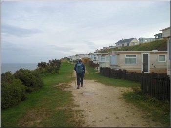
Caravan site above Gristhorpe Cliff
|
Climbing up to a caravan site above Gristhorpe Cliff |
|
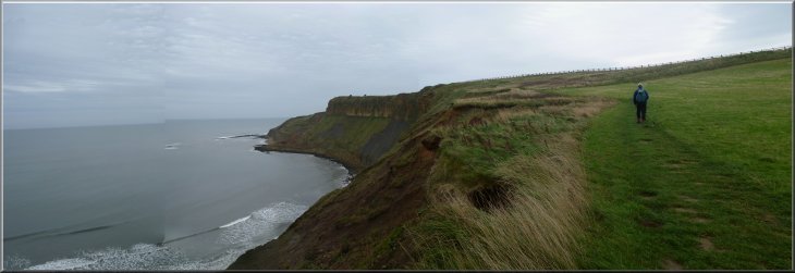
Looking along North Cliff towards Filey Brigg
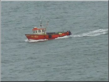
Inshore fishing boat at work
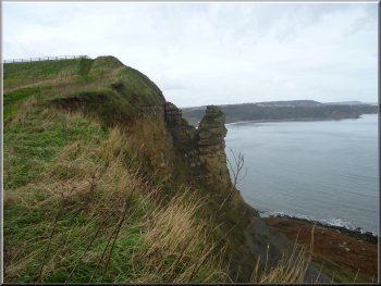
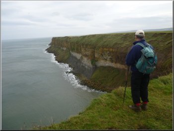
After all the caravan sites the path followed the cliff top round
to the right and we could see the long stratified face of the North
Cliff stretching away towards Filey Brigg about 3km away.
|
There was a good view out to see but even with the binoculars we could
not see any shipping. There were only a couple of small inshore fishing
boats working their way around their crab pots.
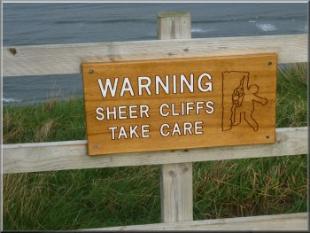
One of many signs along the cliff top
Looking back to Cunstone Nab
|
 |
 |
|
Start of the Cleveland Way on Filey Brigg . . .
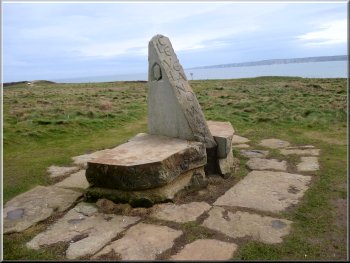
We followed the Cleveland Way path to the start of Filey Brigg itself
where there is a stone marker sculpture where the Cleveland way starts
and heads Northwest along the coast. At the same point and the same
marker, the Wolds Way starts and heads into Filey.
|
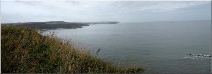
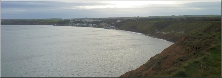
As we continued along the top of North Cliff we could see the little
town of Filey getting closer over to our right. Beyond the town, across
Filey Bay, the line of Bempton Cliffs leading out towards Flamborough
Head was also becoming visible.
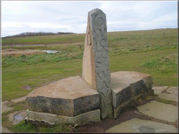
. . . also the start of the Wold Way on Filey Brigg
|
Looking across the bay to Filey from Filey Brigg |
|
Filey Brigg almost submerged at high tide
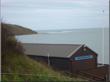
Looking over Filey Sailing Clubhouse to Filey Brigg
The path led us along the edge of the North Cliff Country Park to cross
a steep little ravine where the Filey Sailing Club house is situated.
|
We walked out along Filey Brigg until we could see the sea breaking
over the rocks. Then we made our way back to the marker and this time
we followed the Wolds Way back into Filey.
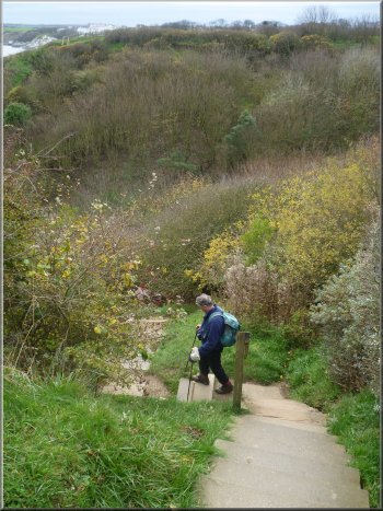
Descending into the ravine at Filey Sailing Club
|
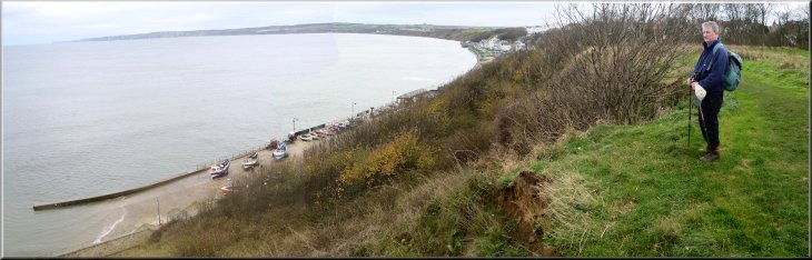
Filey Bay from the path above Cobble Landing |
|
High tide on Cobble Landing at Filey
Descending in to the ravine next to Cobble Landing
Then we turned right to climb a few steps off the promenade and walk
up the slope to the main street at map ref. TA118806. We continued back
along the main street to pass the bus station where we had caught the
bus this morning, and back to our car. We drove back to the roundabout
where the A1039 meets the A64 and stopped for a late fish and chip lunch
at a cafe there. Very nice they were too. The walk had been 10km and
it had taken us around three hours to walk.
|
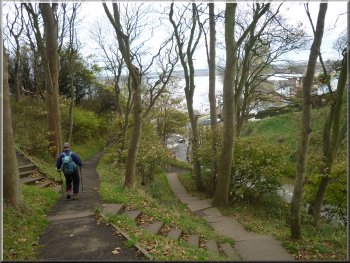
We climbed up the other side of the ravine and walked along the cliff
top above Cobble Landing where the inshore fishing boats we hauled up
on the slipway. We came to a church on our right and then the path dropped
down another steep sided little valley to a road on the edge of Filey
town. We turned left to walk down the road to the sea front at map ref.
TA120809. We walked along the promenade for about 200m.
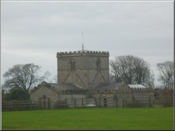
Church on the edge of Filey
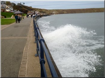
The promenade at Filey
|
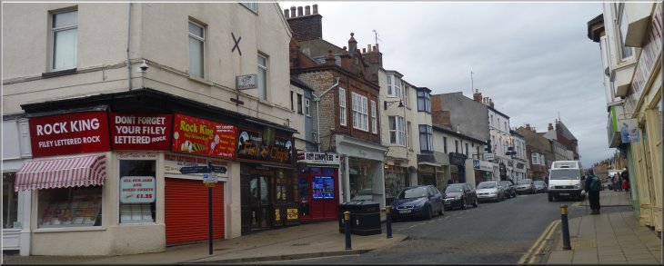
The main street in Filey on a very quiet off season day in November |
Background Notes:
This week is a linear walk of 10km or 6 miles along the coast, rather than the usual circular route. My suggestion is to park your car in Filey and get the no. 121 bus from the central bus station, northwards along the coast. The bus ride is only a few minutes and you get off at the "Haven Holiday Park" bus stop near the A165 at Cayton Bay. The walk crosses the A165 coast road and joins the Cleveland Way route on the cliff top above Cayton Bay. From there looking north you can see Scarborough Castle on its headland almost 6km away. Looking down into the bay you're quite likely to see some serious surfers waiting for the right wave. Cayton Bay has quite a good reputation amongst surfers for the quality of the waves in the right conditions. At the extemity of low water the Oxford clays are exposed in Cayton Bay and these are rich in many kinds of small fossils including amonites and molluscs. Our route takes us southeast along the cliff tops following the Cleveland Way route. The cliffs are high and sheer along this part of the coast and much of it is unfenced so some care is needed. It's a popular part of the coast and there are a series of large caravan parks along the cliff top. It's a spectacular part of the coast and there are excellent views in both directions along the coast. The route passes first Lebberston Cliff and later Gristhorpe Cliff both with interesting rock formations on the cliffs. Inshore fishing boats work along this part of the coast and you should be able to see the coloured flags on their buoys marking their crab pots. As the route nears the start of the Filey Brigg headland you can see across the headland into Filey Bay and the white cliffs from Reighton, past Bempton and out to Flamborough. On this part of the walk the route passes the "Filey Rocket Pole". The white pole, about 6m high with climbing rungs up each side, was restored shortly after the millennium. The original pole was erected by the Filey Volunteer Life Saving Rocket Company, formed in the 1870's. One man climbed to the top of the pole and other members of the volunteers fired a rocket carrying a line towards him to practise firing a line onto a vessel at sea. This rescue system was apparently in use until as recently as the 1960's. It all sounds a bit risky for the man up the pole to me. A little way beyond the rocket pole is a monumental sculpture at the beginning of the Filey Brigg headland, marking the ends of the Cleveland Way route and the Yorkshire Wolds Way route. The Cleveland way goes northwards along the coast beyond Whitby to encircle to North York Moors to Helmsley. The Wolds Way heads inland to the west and winds its way through the Yorkshire Wolds to Hessel and ends by the Humber Bridge. From Filey Brigg our route follows the coastal path into Filey crossing a couple of deep steep sided gulleys on the edge of the town before reaching the promenade along the sea front at Cobble Landing. This is a slipway onto the beach where inshore fishing boats are launched with the help of tractors.The lifeboat station is located here too. We walk along the sea front into Filey and the end of our walk.
top of page
|
