| 2001 walks | 2002
walks | 2003 walks | 2004
walks |
| 2005 walks | 2006
walks | 2007 walks | 2008
walks |
| 2009 walks | 2010
walks | 2011 walks | 2012 walks |
| 2013 walks | 2014 walks | 2015 walks | 2016 walks |
| 2017 walks | 2018 walks | 2019 walks |2020 walks |
| 2021 walks | 1993-2000 library | Find a Route Index |
| A few Routes to print out | Request a Route... |
Route No. 340 - Wednesday 19 May 2010
Scargill Reservoir, Beaver Dyke Res.
Swinsty Res. Little Alms Cliff circuit - 12km
Washburn Valley. . .
Route map from Ordnance
Survey Open Space service.
Map: OS Explorer 297 Lower Wharfedale & Washburn Valley at 1:25000
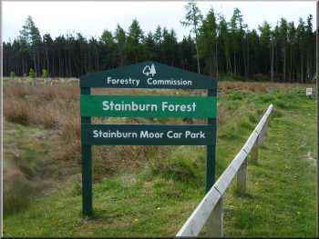
The car park at the start of our walk
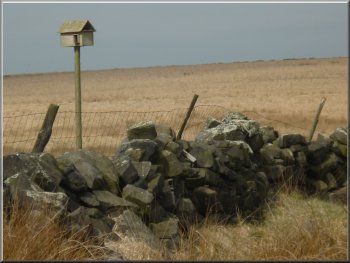
An owl nesting box by the access road
From the car park we walked along the road to the north east for about
300m. Here we turned left off the road on to a permissive path along a Yorkshire Water access road to Scargill reservoir.
|
This morning my wife and I drove to the public car park in the Forestry Commission's Stainburn Forest at map ref. SE235522 on the hill top on the
Eastern side of the Washburn Valley about 8km on the northern side of Otley.
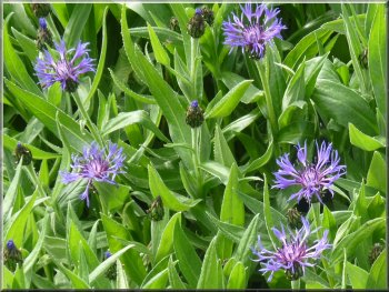
Corn flowers at the car park entrance
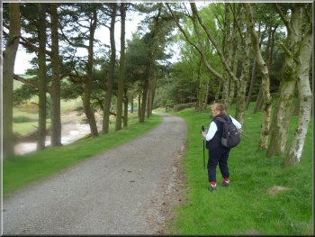
The access road to Scargill Reservoir
|
|
|
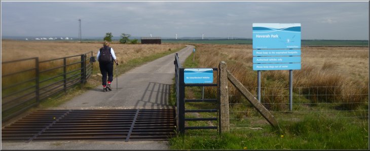
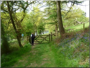
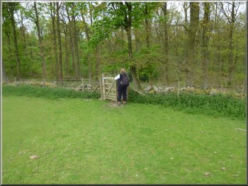
Start of the permissive path along the access road to Scargill Reservoir at Haverah Park
Scargill Reservoir
|
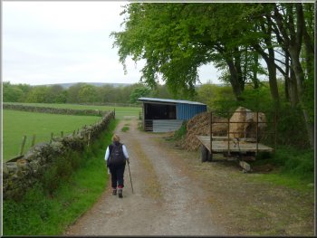
The access road heading for Beaver Dyke reservoir
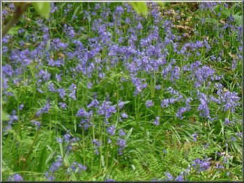
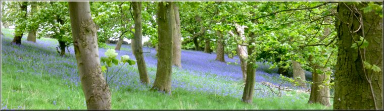
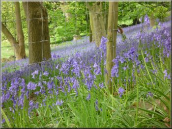
Bluebells by the access road
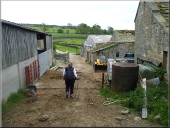
Farm track above Beaver Dyke Reservoir
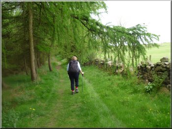
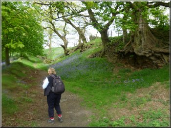
We continued along the access road skirting around Scargill reservoir and then heading along the wooded lane towards Beaver Dyke Reservoir. About 2.5km from the public road at map ref. SE230545 we turned right off the access road and followed a footpath across the fields climbing up the hillside to Long Liberty Farm. At the farm we turned left onto a farm track which led us through woodland on the northern side of Beaver Dyke reservoir. There were bluebells in the woodland and it was a very pretty path to walk. |
Along side the access road was a series of dilapidated single storey wooden buildings and the remains of an array of radio aerials. There is a notice on one of the buildings stating that they belong to the University of Leeds Physics Department. They were in fact the 'Leeds Haverah Park array' used in the 1970's and 80's. This was an array of radio aerials used as part of the university's research into cosmic rays.
Bluebells by the access road
Bluebells by the access road
Farm track above Beaver Dyke Reservoir
|
Beaver Dyke Reservoir
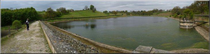
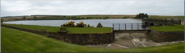
Crossing the dam at John O'Gaunt's Reservoir
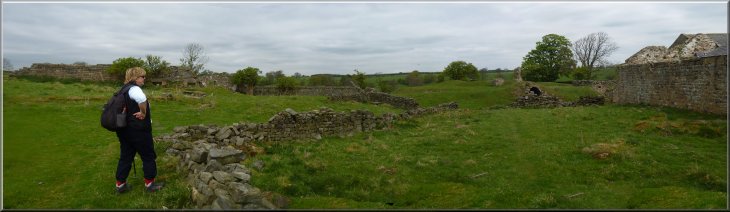
The site of John O'Gaunt's Castle next to the ruins of Haverah Park farm
|
Farm track down to Beaver Dyke Reservoir

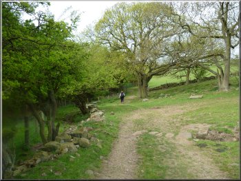
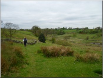
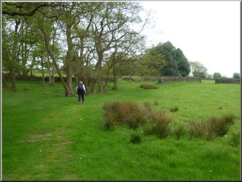
Heading for Bank End farm from Haverah Park
He granted it to his son, John O'Gaunt later in that century. Gaunt is an English corruption of Ghent, the town in France where John was born. He was a very powerful figure in his time being the Duke of Lancaster and his descendants became the Kings from the house of Lancaster starting with Henry IV. From John O'Gaunt's Castle we make our way along a path around the head of the reservoir to a farm track that contours around the hillside along the top edge of a small wood full of bluebells to Bank End Farm. Just below Bank End Farm we kept left to follow a footpath across the fields for almost 800m to the Sun Inn on the B6451. We stopped here for a pleasant pub lunch, but the pub does get busy at weekends. |
At the end of Beaver Dyke Reservoir the path turned left to cross the dam of the next reservoir called John O'Gaunt's Reservoir. The reservoirs are on tributaries of Oak Beck which flows through the northern edge of Harrogate and into the River Nidd. From the dam we followed the path up the grassy hillside to the remains of John O'Gaunt's Castle at map ref. SE219545 next to the ruined farm at Haverah Park. In fact it's not a castle, but a fortified hunting lodge where the hunting forest rangers would have lived. Visiting dignitaries here for the hunting would have slept here too including King Edward III who had the lodge built in the first half of the 1300's.
Heading for Bank End farm from Haverah Park
Heading for Bank End farm from Haverah Park
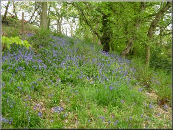
A carpet of bluebells beneath the trees
|
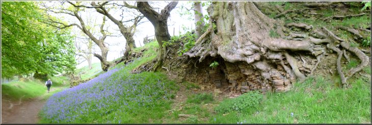
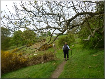
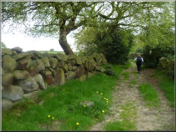
Bluebells by the path heading for Bank End farm
Approaching the Sun Inn along the path from Bank End farm
|
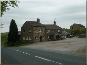
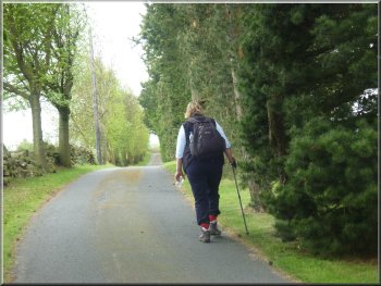
Looking back to the Sun Inn as we set off after lunch
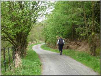
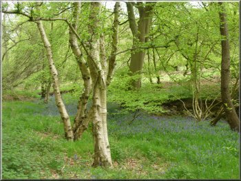
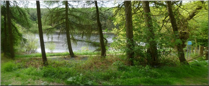
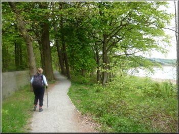
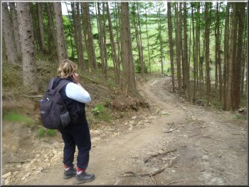
Path through the woods to Swinsty reservoir
That would give you a down hill finish to the walk which is always good. At the road we turned left and walked along the road for about 100m then we turned right off the road to follow the footpath around the edge of Swinsty Reservoir for about 450m to the access road to the reservoir dam. |
After our lunch we crossed the road in front of the pub and took the path opposite down the hillside through the woodland to the road at the edge of Swinsty reservoir at map ref. SE199535. To the right here there is a large car park beside Swinsty Reservoir where you could start and finish this circular walk if you wish.
Heading for Swinsty reservoir from the Sun Inn
Approaching the road at Swinsty reservoir
|
Path through the woods to Swinsty reservoir
|

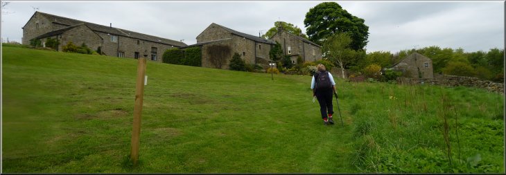
Path to Scow Hall from Swinsty reservoir

Path through the farm at Scow Hall
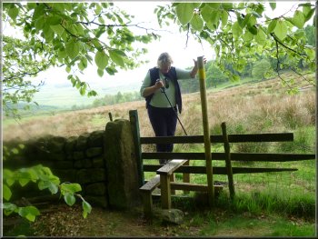
About 350m beyond the farm we reached the road called Top Lane at map ref. SE206516. We turned left to walk along Top Lane for about 200m to the B6451. We crossed the main road here and walked up the left hand verge for about 100m before turning into the forest on the left hand side of the road following a public footpath along a forest track. |
Here we crossed the access road and took the bridleway climbing up the hillside to the road, called Brat Lane, just beyond Scow Hall farm. At the road we turned left to walk along Brat Lane for about 250m, then we turned right off the road to climb up the hillside past Cherry Tree Farm.
Path to Scow Hall from Swinsty reservoir
Path to Scow Hall from Swinsty reservoir

Path through the fields to Top Lane
|
Walking along Top Lane heading for the B6451
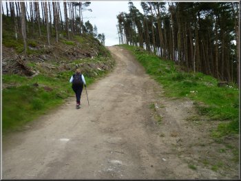
We followed the track down the far side of the hill
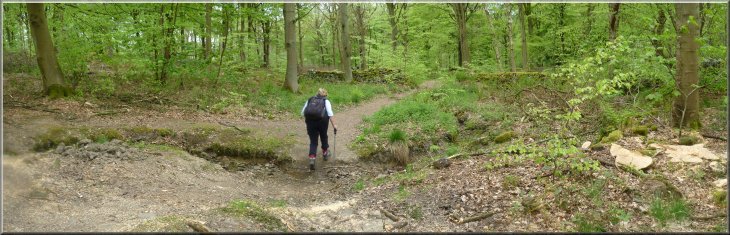
We followed the track down the far side of the hill to join a path running north east through the forest. We came to a series of large gritstone boulders called the Hunters Stones. |
The track climbed up over the shoulder of a hill where about 250m to the left of the track on the hill top there is a radio relay mast. This is a Forestry Commission woodland and there is normally open access to walk along the forest tracks.
Climbing the track up over the shoulder of the hill
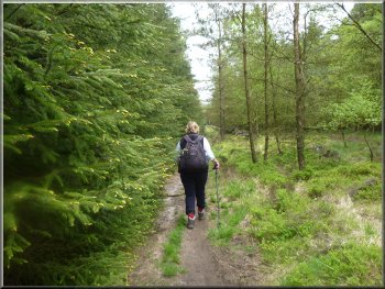
Woodland path towards the Hunter's Stones
|
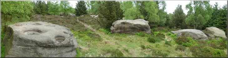
Some of the Hunter's Stones
|
Forest path heading for Little Alms Cliff
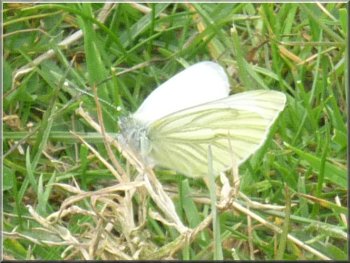
Green veined white butterfly
There is however a genuine ancient cup & ring mark on one of the vertical faces of the rock, although it is quite eroded. From Little Alms Cliff we made our way out to the road where we turned right to follow the road for about 300m back to the Stainburn Forest car park where we started. The whole walk had been 12km and it had taken us almost hours to walk including our pub lunch. |
The path emerged from the forest at map ref. 228520 into a large area of sheep pasture and about 500m away was the gritstone outcrop of Little Alms Cliff. We made our way across the field to climb to the top of the outcrop for a great panoramic view of the surrounding countryside. There's also a carving on top that superficially looks like an ancient cup & ring mark but in fact seems to be a much more recent 'new age' style mark.
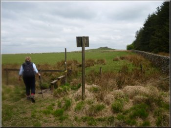
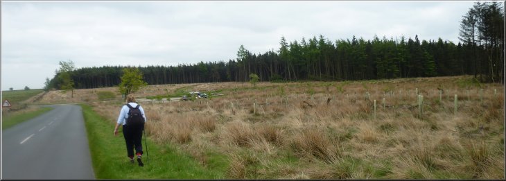
Little Alms Cliff in the distance as we left the forest

|
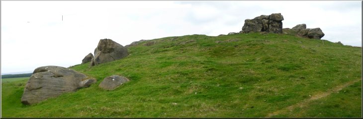
Little Alms Cliff
Returning to the Stainburn Forest car park at the end of the walk
|
Background Notes:
This walk is a circular route of 12km, about 8 miles around a series of small reservoirs above the Washburn Valley. When I did the walk we started from a Forestry Commission car park on the edge of Stainburn Forest and this particular forest is best known for its mountain biking trails. From the car park our route uses a water company permissive path along their access road to Scargill and Bever Dyke reservoirs. From the public road this access road passes a radio mast and a series of dilapidated wooden buildings with the remains of radio aerials. There is a notice on one of them stating that they belong to the University of Leeds Physics Department and they were in fact the 'Leeds Haverah Park array' used in the 1970's and 80's. This was an array of radio aerials used as part of the university's research into cosmic rays. Our walk skirts the edge of Scargill reservoir. It's in quite a pretty setting and there is access around part of it if you want to linger a while. The walk continues to a public footpath around the northern side of the Bever Dyke reservoirs. Again the reservoirs are in a pretty wooded setting and our route crosses between the two reservoirs. The upper one is clled John O'Gaunt's reservoir and our walk climbs up from the reservoir to the ruined farm at Haverah Park and beside it are the remains of John O'Gaunt's castle. In fact it's not a castle, but a fortified hunting lodge where the hunting forest rangers would have lived. Visiting dignitaries here for the hunting would have slept here too including King Edward III who had the lodge built in the first half of the 1300's. He granted it to his son, John O'Gaunt later in that century. Gaunt is an English corruption of Ghent, the town in France where John was born. He was a very powerful figure in his time being the Duke of Lancaster and his descendants became the Kings from the house of Lancaster starting with Henry IV. From John O'Gaunt's castle we make our way over the fields to cross the road at the Sun Inn (lunch stop there if you like) and down through the woods to the edge of Swinsty reservoir. There's a large car park here and a picnic area and you could start and finish this circular walk there if you wish. That would give you a down hill finish to the walk which is always good. We follow the path around Swinsty reservoir for a few hundred metres and then climb up the hillside to the road near a tall radio mast at the western end of Stainburn Forest. We follow a path through the Stainburn Forest past some clusters of large boulders and gritstone outcrops called the Hunter's Stones. The largest of these are at the OS trig point near the radio mast and these are used by climbers to practice their techniques. The path emerges from the forest to cross sheep pasture to the much larger rocky outcrop of Little Almscliff. There is a great panoramic view from the top of the rock. There's also a carving on top that superficially looks like an ancient cup & ring mark but in fact seems to be a much more recent 'new age' style mark. There is however a genuine ancient cup & ring mark on one of the vertical faces of the rock, although it is quite erroded. From Little Almscliff we make our way out to the road and back to the Stainburn Forest car park where we started.
top of page
|