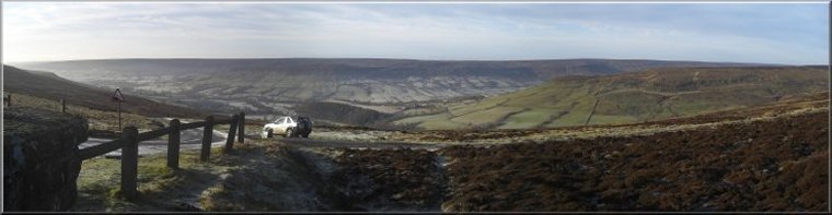
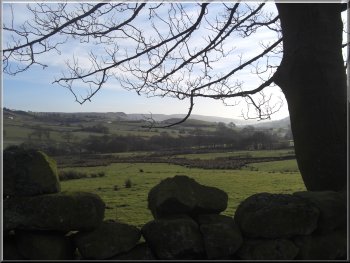
Looking across Rosedale at the start of our walk |
|
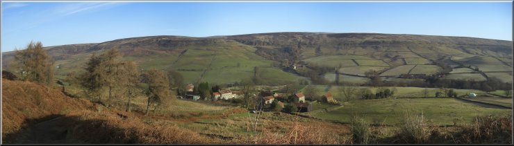
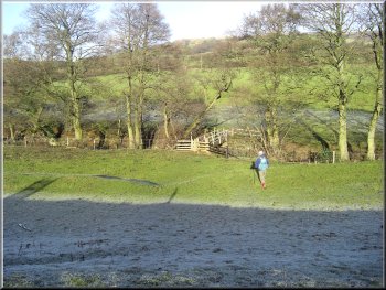
Starting the descent to Hollin Bush Farm
We started walking at about 1015am and headed east for about 100m to
the bed of the old ironstone railway that runs around the head of Rosedale.
At the railway we turned left to head north along the railway for about
300m to map ref. SE683992. Here we turned right to follow a farm track
down the valley side to Hollin Bush Farm.
|
The weather forecast for today was quite good and we were expecting
a calm settled fine day with a good deal of clear blue sky. We drove
to a little car park off the Blakey Ridge road at map ref. SE683989
about 1km south of the Lion Inn at the top of the steep road down to
Church Houses in Farndale.
Looking down Rosedale at the start of our walk
|
Looking over Hollin Bush Farm near the head of Rosedale |
|
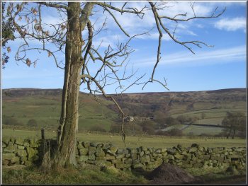
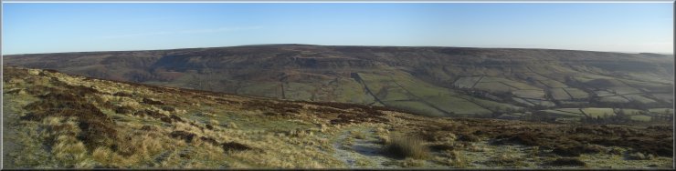
Looking across Rosedale to Dale Head Farm
As forecast we weather was just perfect for a good walk with a light
frost, clear blue sky and the low winter sun picking out the landscape.
As we passed High House Farm the track became a tarmac access road.
|
At the farm the track becomes a tarmac access road and about 150m past
the farm at map ref. SE692988 we tured right off the road to follow
a track across the fields heading in a southerly direction down Rosedale.
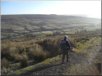
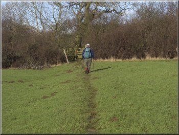
The track heading down Rosedale towards Thorgill
|
The track heading down Rosedale towards Thorgill |
|
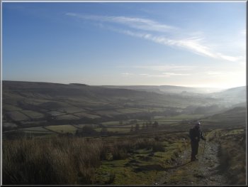
View down Rosedale from the road near Thorgill
We crossed the river on a little wooden footbridge and walked up the
hill side, part of the way on an old paved way, until we reached the
Daleside road at Hill Cottages, map ref. SE708975.
|
We followed the access road for about 2km through the hamlet of Thorgill
to map ref. SE710965. Here we turned left to walk down the farm track
through Thorgill Farm and across a field to the River Seven.
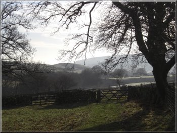
Approaching the footbridge over the river Seven
|
|
The path up to Hill Cottages
The farm is at the start of the old Rosedale Ironstone Railway that
ran around the head of the valley, and along Farndale to Ingleby Incline
and down the incline to the blast furnices of Tesside.
|
Opposite was a farm access track and we crossed the road to walk up
the access track past a farm with dozens of free range fancy poultry
pecking at anything that took their interest.
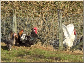
Free range poultry near the start of the railway path
|
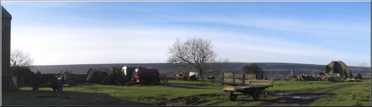
Farm equipment near the start of the railway path |
View up Rosedale from the railway path |
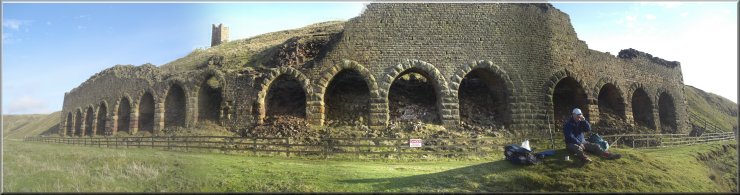
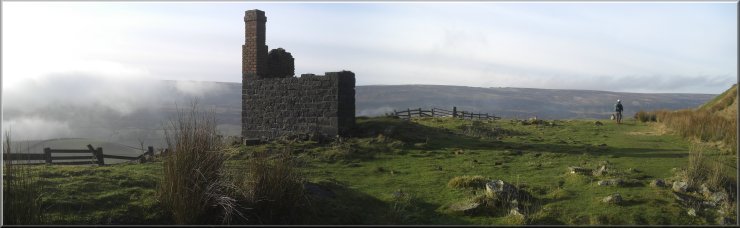
Lunch stop by the relics of the Rosedale Ironstone Industry |
|

Relics of the Rosedale ironstone Industry
On a plateau above was a terrace of tiny miners' cottages. We stopped
for our lunch on a bank by the track and as we sat there admiring the
view up the valley in the bright sunshine we noticed a bank of thick
low cloud slowly drifting up the valley towards us.
|
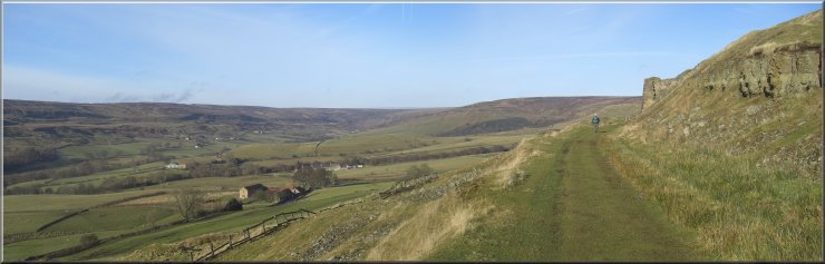
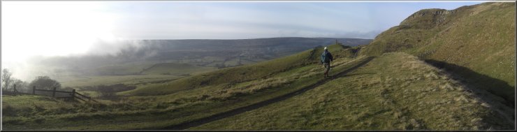
Just above the farm we joined the railway and followed the path along
the railway for about 2.5km to map ref. SE697998. Along the way we walked
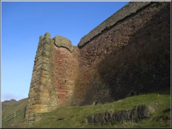
past the relics of the ironstone industrial era with huge stone kilns,
hearths and storage bins beside the rail track.
Relics of the Rosedale ironstone Industry
|
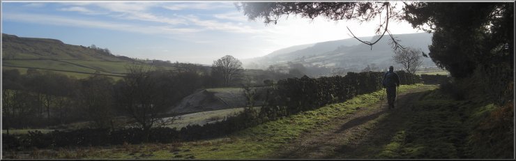
Low cloud stalking us along the valley |
Low cloud stalking us along the valley |
|
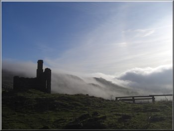
Low cloud stalking us along the valley
By this time the cloud had covered the ridge opposite us and we walked
down into the cloud in the valley bottom. From Dale Head Farm we followed
the road for about 300m passed Red House Farm to the road junction at
map ref. SE696988.
|
As we walked along the railway path after our break it was clear that
the cloud was moving a little more quickly than our walking pace. We
turned left off the railway to descend a path to Dale Head Farm.
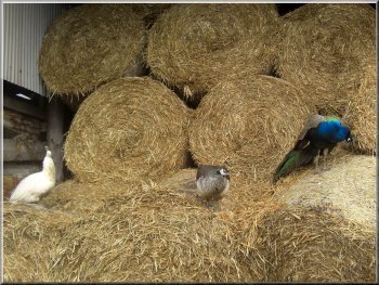
Peacocks in a barn at Dale Head Farm
|
|
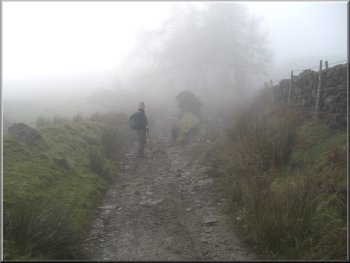
Climbing up from Hollin Bush Farm in the mist
The whole route had been 12km and had taken usjust over four hours
to walk including our breaks. As usual we stopped in Helmsley on the
way home for a coffee and a toasted teacake. We got there at 3.00pm
only yo find our regular cafe was already closed for the day, but we
found another one just as good.
|
The rest of the walk was in thick mist, and at the junction we turned
right and followed the road for about 500m to Hollin Bush Farm. From
there we retraced our steps up the valley side, quite a climb at the
end of the walk, up to the railway and the car park where we had started.
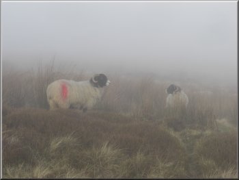
Swaledale ewes in the mist
|
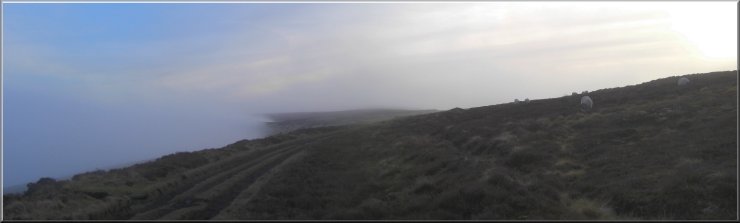
Just emerging from the mist on the ridge at the end of our walk |