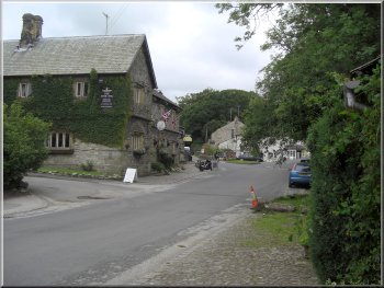
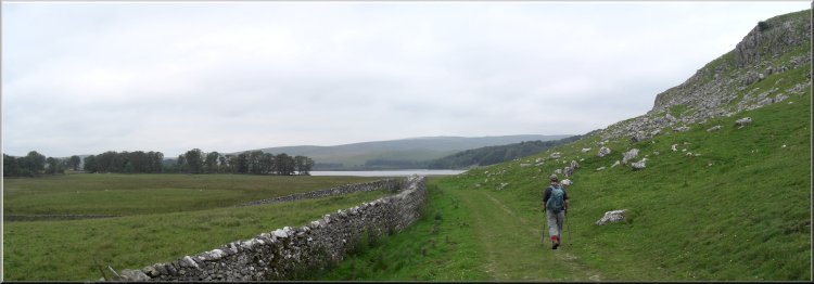
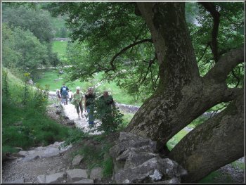
Malham Village near the car park
Incidentally
if you do not have the change for the car park ticket
machine, you can buy a ticket from the shop in the visitor
centre. We walked into the village for about 100m and
then turned right to cross the infant river Aire on a
stone slab footbridge.
|
This
morning my neighbour, Jim, and I drove to Malham. It's over an hour
and a half's drive, but the scenery there is well worth the long drive.
(I know, we're just spoilt living so close to so much gorgeous countryside)We
started walking at about 10.30 from the large car park next to the
visitor centre at the southern edge of Malham village.
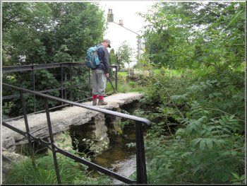
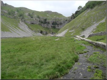
Stone Slab bridge over the stream that becomes the River
Aire
|
|
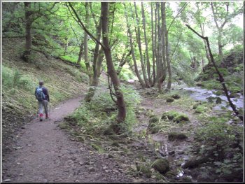
Goredale Beck by the path to Janet's Foss |
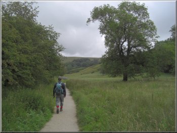
Path towards Janet's Foss
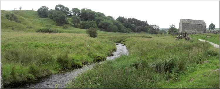
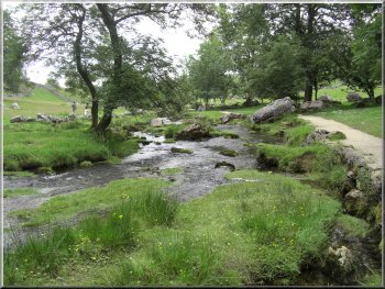
There
we turned left to follow a path beside Gordale Beck across
the fields for about 1.5km to Janet's Foss.
|
Over
the footbridge we turned right again to follow the public
footpath downstream for about 300m.
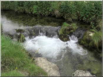
A natural weir on Gordale Beck
|
The woods approaching Janet's Foss
More people were gathering to look at the waterfall so
we moved on to join the road near Gordale Scar.
|
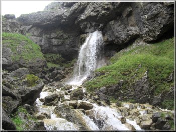
This
is a very pretty waterfall in a little wooded area. It's
the kind of place where you just have to stop and look
for a while before you move on.
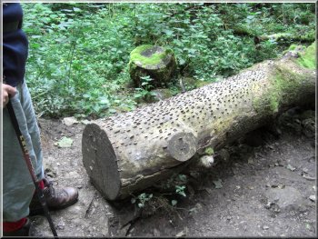
A log studded with coins hammered in by people for good
luck
|

Jim looking at Janet's Foss |
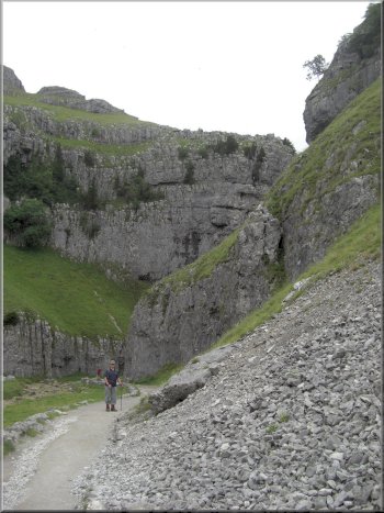
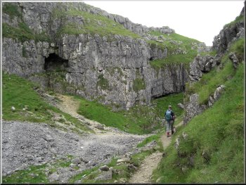
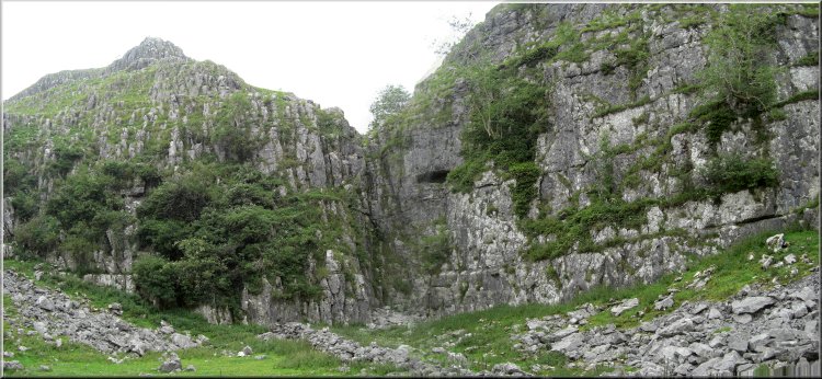
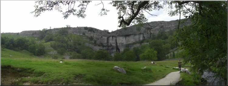
Approaching Gordale Scar
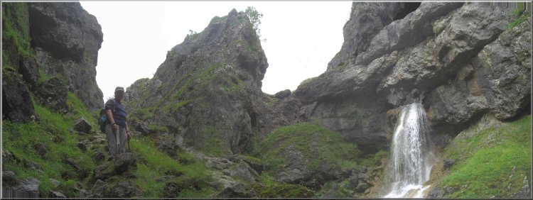
Thousands
of years ago the roof collapsed leaving the deep rugged
limestone gorge with Gordale beck running through it.
As we approached the limestone walls of the gorge towered
above us and the light began to fade a little.
|
We
walked along the road for about 150m to map ref. SD913634
where we turned left off the road to follow a path across
a camp site field to the mouth of Gordale Scar. I believe
that originally this was a huge limestone cave.
Approaching Gordale Scar
|
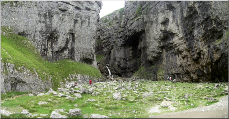 The
mouth of Gordale Scar with the waterfall in the distance
The
mouth of Gordale Scar with the waterfall in the distance
|
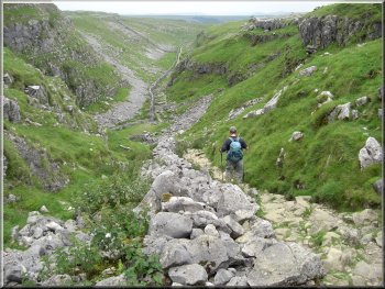
The
floor of the gorge is still a rubble of limestone boulders
from the roof collapse all those years ago, but there
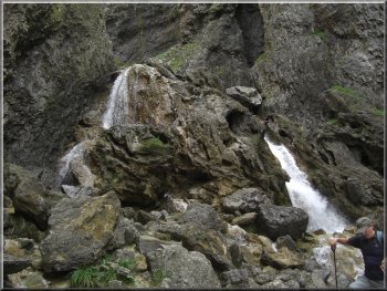
is a reasonable path around the foot of the right hand
wall of the gorge. Ahead is a waterfall about 10m high
over what is essentially a large stalagmite. The material
is called tufa and is still being deposited by the calcium
rich water. You can see the coating on the bed of Gordale
Beck as you walk across the camping field towards the
gorge. The waterfall seems to block any progress up the
gorge, but there is a public footpath. We crossed the
beck - it was more difficult than usual because there
was a strong flow in the beck after the recent heavy rain.
Then we approached the waterfall from the left hand side
of the beck. With the high flow there was a second smaller
waterfall to the left of the main fall. Between the two
falls there is a large boulder of the tufa material.
Approaching the mouth of Gordale Scar
|
Large tufa boulder at the foot of the waterfall in Gordale
Scar
View
from the top of the waterfall climb
We scrambled around the boulder (in the beck) to the foot
of the main waterfall and climbed on top of another boulder
there. From this position we could see a series of large
hand and foot holds going up the left hand side of the
waterfall. We climbed up to the top of the waterfall.
This was a bit of a struggle for me because my old knees
do bend as freely as they used to do and I only just managed
to reach a couple of the large foot holds.
|
|
Jim at the start of the climb out of the Gordale Scar gorge
from the top of the waterfall climb with another waterfall
to the right |
The gorge approaching
the top of the waterfalls
Looking
back down the slope we had just climbed out of the gorge
This height is gained in no more than 200m forward so
an average gradient of one in two (or 50% if that how
you measure them) It took me about 25 minutes to make
the climb and Jim, as usual was waiting for me at the
top. We stopped here for a drink and several other people
joined after they followed us up the slope.
|
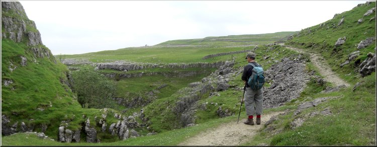
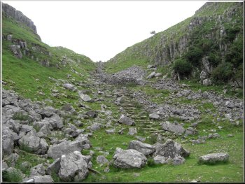
At
the top of the falls we began the long hard slog up the
very steep rocky path to the rim of the gorge on the west
side. The whole climb from the foot of the waterfall to
the rim of the gorge is about 120m.
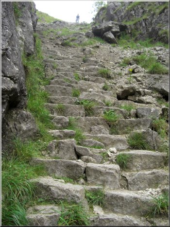
Jim waiting for me near the top of the climb out of Gordale
Scar gorge
Path from Gordale scar to Mastiles lane
|
Edge of some limestone pavement by the path to Mastiles
Lane |

Orange lichen on a stone wall |
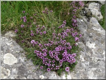
Wild thyme growing by the path |
|
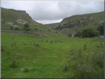
Path around the foot of Great Close Scar - just out of camera
range there were numerous wheatears flying ahead of us and
perching on the rocks |
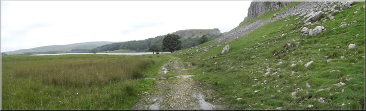
Approaching Malham Tarn around the foot of Great Close Scar
|
|

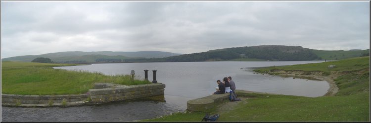
Malham Tarn |
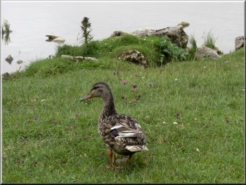
A female mallard came to scrounge some crumbs
We sat by the tarn for our lunch. We had barely unwrapped
our sandwiches when a female mallard duck flew directly
towards us from across the tarn (near a boathouse that
was being renovated). It landed on the grass just in front
of us and was clearly expecting to be fed. There were
other ducks about but they took no notice of us at all.
After a few crumbs from us the duck flew off to try its
luck with some people a few hundred metres away.
|
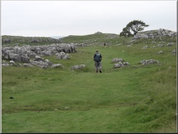
After
our break we continued along the path to the road at map
ref. SD904656. At this point we crossed a track called
Mastiles Lane which is an old "green road" that goes all
the way down into Wharfedale at Kilnsey Crag. We continued
northwards on a track for about 1km to map ref. SD904664.
Here we took the left hand fork in the track around the
foot of Great Close Scar, another high limestone cliff,
again for about 1km to the edge of Malham Tarn.
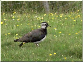
A lapwing by the path (alternatively called a green plover
or a peewit)
|
|
The outlet stream from Malham Tarn |
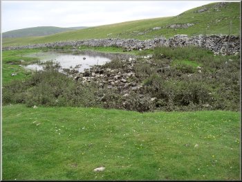
The stream from Malham Tarn disappears underground here
|
The dry gorge leading to Malham Cove |
|
The dry gorge leading to Malham Cove |
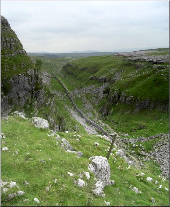
The dry gorge leading to Malham Cove
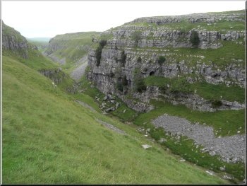
After
our lunch we followed the Pennine Way route past the outlet
from Malham Tarn and back to the road at map ref. SD893657.
From there we continued to follow the Pennine Way for
about 2km down the rocky gorge of a dried up river. The
gorge was worn into the rock by the huge torrent of melt
water from the retreating glaciers at the end of the ice
age. This water must have been an awesome sight as it
thundered over the cliff of Malham Cove.
|
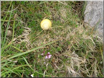
Small colourful snail by the path
The
dry gorge leading to Malham Cove
|
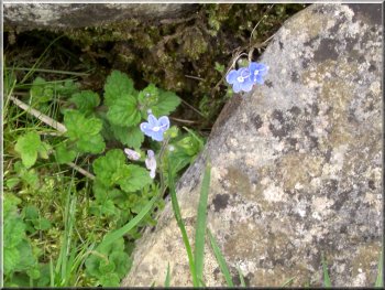
Blue speedwells growing from a crack in the rocks
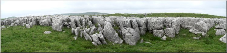
Above Malham Cove is an amazing area of limestone pavement
where the gaps between the blocks of limestone have a
variety of plants growing that enjoy the sheltered climate
in there.
|
Nowadays
the stream from the outlet of Malham Tarn disappears underground
a few hundred metres from the road and emerges at the
foot of the Malham Cove cliff to become the River Aire,
a beautiful clear stream at this stage.
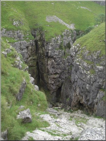
Path round a cliff, step, in the gorge
|
|
A cliff (a step) in the gorge leading to Malham Cove where
a huge waterfall poured over this 'V' in the rocks at the
end of the ice age |
|
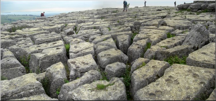
The Limestone pavement on the top of Malham Cove (the top
of the flat slabs are called 'clints' and the gaps between
them are called 'grikes') |
Looking across Malham Cove from the edge of the limestone
pavement |
The path down the side of Malham Cove
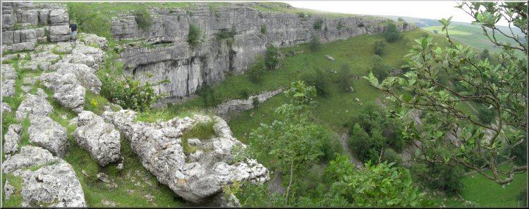
As
we crossed the fields at the foot of the cove there was
a observation post set up by RSPB volunteers with their
large twitchers' telescopes to watch
the peregrine falcons nesting on the cliffs of the
cove, but we did not see them.
|
After
a lingering look at the views, and the limestone formations
we continued along the Pennine way down the long winding
path and steps down the western end of Malham Cove.
The stream from the foot of Malham Cove that becomes the
River Aire
|
A last look back at Malham Cove |
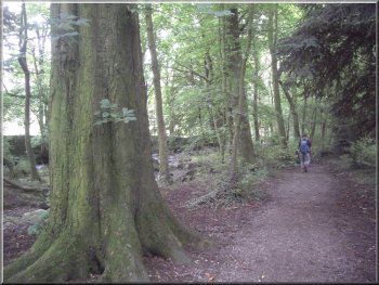
Woodland path beside the road into Malham
The
whole route had been about 12km and had take us five hours
to walk including all our breaks and sightseeing stops.
It had been a memorable day in the striking limestone
scenery of Malham.
|
From
there it was about 1km back to the car park where we changed
into our shoes before walking back round the corner to
a very pleasant tea shop for a coffee (well two large
mugs each actually) and a bacon sandwich to round off
our day before driving home.
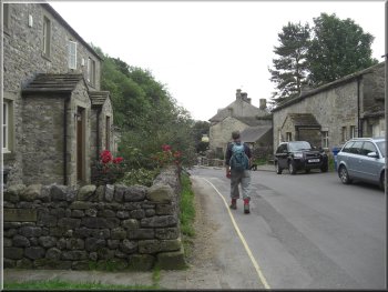
Returning to the car park through Malham
|
Background Notes:
This route is a longer and more adventurous walk of 12km, about 8 miles from Malham in the Yorkshire Dales. We start from the large car park at the visitor centre on the southern edge of Malham. From there we follow Malham Beck and then Gordale Beck across the fields. This is a popular walk and there's a good gravel path.
After about 1.5 km we reach Janet's Foss. This is a very attractive waterfall on Gordale Beck. Over thousands of years a thick layer of 'Tufa' has covered the rock behind the falls. Tufa is a calcite deposit from the calcium rich water. The water falls into a deep pool where in the past sheep were washed prior to shearing. It was a very cold job for the shepherds standing over waist deep in the water and it became a festive occasion for the whole community with plenty of strong drink to keep out the cold. The falls are named after Jennet, the queen of the local fairies who was believed to live in a cave behind the falls.
Just beyond the falls we reach a road and from this road we follow a path across a camp site field still beside Gordale Beck. The path leads into Gordale Scar. This is a deep limestone gorge with walls that seem the crowd in above, and in fact that's just what they do because this was a huge cavern eroded over tens of thousands of years by melt water from successive ice ages until the cavern grew so large that the roof collapsed leaving the open gorge that we see today.
Deep inside the gorge Gordale Beck flows over a waterfall and the way ahead through the gorge seems to be blocked. Here we cross the stream where it flows over the rock debris at the foot of the falls. The fall is over another mass of Tufa deposited from the water by the same process as the tufa screen at Janet's Foss. The waterfall is about 6m, 20ft, high and on a closer inspection there are good foot and hand hold ledges in the tufa up to the top of the falls on the left hand side of the fall. It's a straight forward scramble to a platform at the top of the falls and from there it's a long very steep climb up the path to the top of the gorge. Part of the way is loose scree and part is up a long series of stone steps.
At the top we follow a path out to cross Mastiles Lane. This is an ancient trackway that dates from pre-Roman times. We cross Mastiles Lane at a place called Street Gate and about a kilometer, half a mile east of here is a square embankment across the track at the site of a Roman marching camp. We continue along the track round the foot of a limestone cliff called Great Close Scar and reach the edge of Malham Tarn. This is a natural lake although the level has been raised by about 1.5m by a dam at the outlet.
At the tarn we join the Pennine Way route which we follow to the south following the outlet stream from the tarn. After about 400m from the tarn the stream disappears underground down fissures in the limestone. We continue following the Pennine way down the now dry limestone valley. We pass a large step in the valley where once there would have been a great waterfall of glacial melt water and the valley here is called Watlowes. There is an ancient wall running along the bottom of Watlowes that marked the boundary between the lands of Fountains Abbey and the lands of Bolton Abbey, both made vast fortunes from sheep farming in this wild country.
At the end of Watlowes we come to the limestone pavement on top of Malham Cove. There's an amazing view from here to Malham village and down the valley. There's a steep descent down steps at the side of the cove to the foot of the cliff. Malham Beck emerged from the foot of the cliff but this is not the beck that flows out from Malham tarn and then sinks into the limesstone fissures. That water flows at a deeper level and emerges at Aire Head springs about 500m south of Malham village to become the River Aire and just below these springs the river is joined by both Malham Beck and Gordale Beck.
During the nesting season volunteers from the RSPB have their telescopes set up on the grass below Malham Cove to allow the public to see the peregrine falcons nesting on the cove cliff face. From the cove we follow the path out to the road and back into Malham and the end of this week's walk.
top of page
|