| 2001 walks | 2002
walks | 2003 walks | 2004
walks |
| 2005 walks | 2006
walks | 2007 walks | 2008
walks |
| 2009 walks | 2010
walks | 2011 walks | 2012 walks |
| 2013 walks | 2014 walks | 2015 walks | 2016 walks |
| 2017 walks | 2018 walks | 2019 walks |2020 walks |
| 2021 walks | 1993-2000 library | Find a Route Index |
| A few Routes to print out | Request a Route... |
Route No. 203 - Saturday
11 November 2006
Burnsall, Hebdon, Grassington
(via High Lane), River Wharfe circuit
- 11km
Wharfedale,
Yorkshire Dales
Map: OS
explorer OL2 Yorkshire Dales Southern & Western areas
Route
Map on 'Landranger' base from OS Open Space service
Open this route in Google Earth
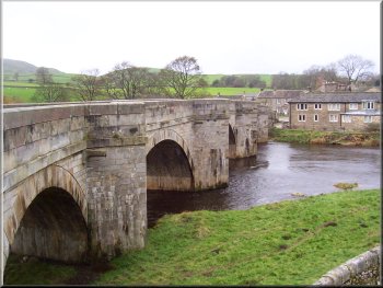
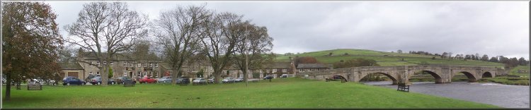
Burnsall Bridge
Anyway after all this excitement we didn't start walking
until 11.15. We crossed Burnsall Bridge and took the path
on the left immediately over the bridge at map ref. SE
033611. There is a little gate in the wall that leads
to a long flight of stone steps with a very wonky handrail
down to the river bank. There was a stone plaque built
into the bridge which said "THIS BRIDGE WAS REPAIRED
AT THE CHARGE OF THE WEST RIDEING 1674"
|
The
weather forecast today was for strong winds and blustery
showers getting more frequent later in the day, but it
was a chance for my wife and me to have a walk together.
We drove to Burnsall on the river Wharfe and parked in
the car park next to the river at map ref. SE 031610.
We were late setting off this morning because I now qualify
for a winter flu jab as I am now advancing into decrepit
old age. There are so many people in that category where
I live (my son calls it 'the elephants graveyard') that
the doctors decided to do everyone mass production style
today. It was very efficient and worked very well. Everyone
had an appointment timed to the minute - mine was 9.49am
- I've never seen so many elderly, infirmed people in
the same place at the same time!
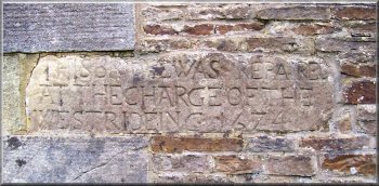
Stone plaque built into Burnsall Bridge
|
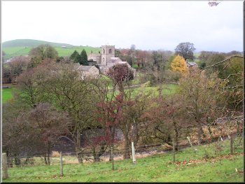
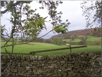
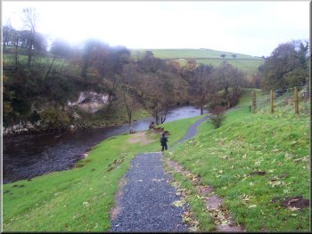
Looking back to Burnsall Church |
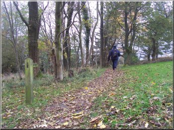
Looking back over Burnsall as the path climbed up above
the river |
Footbridge over Hebden Beck
The path brought us out on to the village street at map
ref. SE 026629. We walked along the village street to
its junction with the B6265 and turned left to follow
the main road up the hill for about 200m to map ref. SE
024631. Here we turned off the road to follow a for almost
3km to Grassington.
|
We
followed this path climbing up the river bank to the road
at map ref. SE 033617. We walked along the road for about
600m and then took the path across a field to a farm access
road at map ref. SE 029622. We approached the farm (Ranelands
Farm) and took the path across the fields to join a path
in a little valley that follows hebden Beck up the valley
to Hebden village.
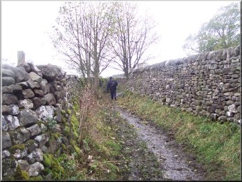
Start of the High Lane track from Hebden toward Grassington
|
The valley of Hebden Beck seen from High Lane |
Conservation area in the old hospital grounds |
|
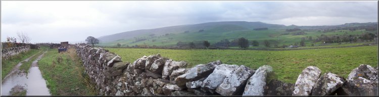
The hills above Thorpe village seen from High Lane |
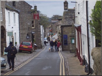
The main street in Grassington
A group of four ladies came by as we sat there and it
turned out that they were trainee national park volunteer
rangers learning how to schedule maintenance defects in
public footpaths and bridleways. It's good to know that
the National Park authority takes such good care of us.
The paths are usually in good shape in the park area.
After our break we continued on into Grassington and joined
the main street at map ref. SE 003641. We walked down
the main street to the junction with the B6265 at the
bottom and walked about 300m to the car park and visitor
centre (toilets here).
|
The
track joins a walled track called High Lane about 800m
before we reached Grassington. The path crosses what used
to be the grounds of a hospital but is now a conservation
area for meadow flowers. Just beyond this area we stopped
in the shelter of a wall for our lunch. It was very windy
and we were glad of the protection of the wall.
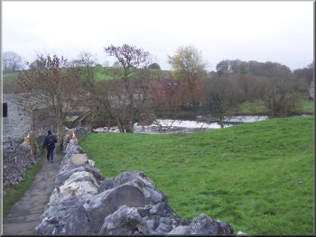
Weir and footbridge below the car park in Grassington
|
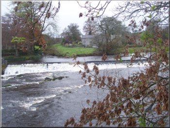
Weir below the car park in Grassington |
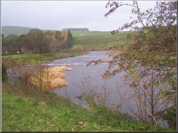
Bend in the river Wharfe below Grassington |
|
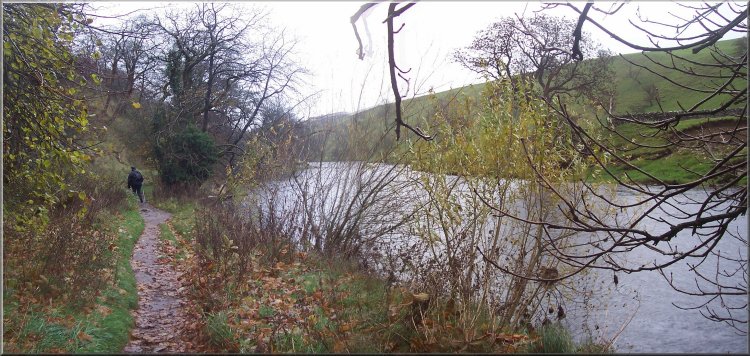
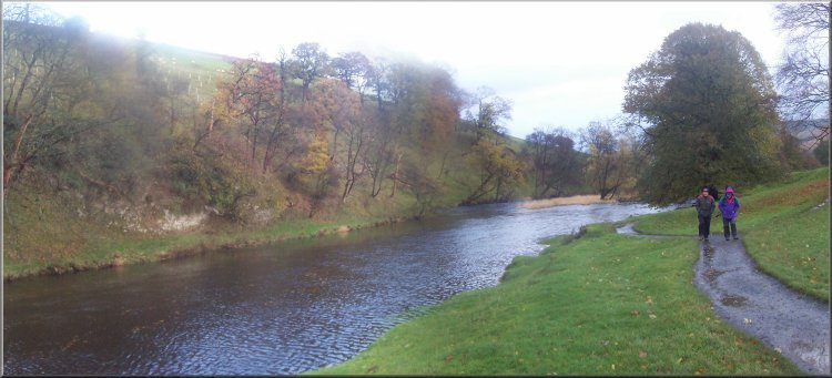
The Dales Way path by the River Wharfe |
|
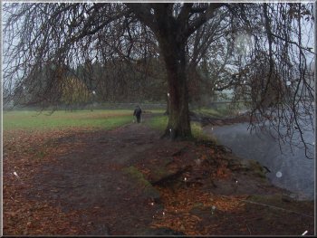
The Dales Way path by the River Wharfe above Hebden |
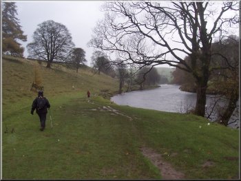
The Dales Way path by the River Wharfe
Fortunately
the wind had been on our faces on the way out to Grassington
but now it was on our backs. The only part of us to feel
the cold driving rain was our legs and it was not long
before the wind had driven the rain through our 'waterproof'
trousers. We passed many people coming the other way with
their heads down forcing their way through the wind and
rain. There was one tiny elderly lady in particular walking
on her own with all the right gear, but clearly buffeted
by the wind and gamely heading toward Grassington.
|
From
the car park we followed the footpath down to the footbridge
over the river Wharfe at map ref. SE 001633. We did not
cross the footbridge but instead turned left to follow
the Dales Way path along the river bank for about 3km
to the pedestrian suspension bridge over the river below
Hebden at map ref. SE 025623. We had been congratulating
ourselves on missing the showers all the way to Grassington,
but as we began the walk back along the river bank the
rain started.
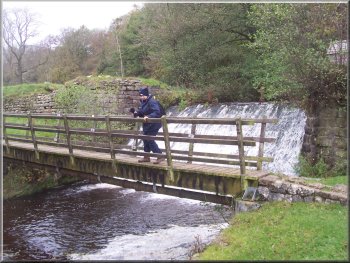
Squally hail by the suspension bridge at Hebden
|
Squally hail by the suspension bridge at Hebden
|
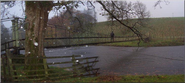
Squally hail at the suspension bridge at Hebden
|
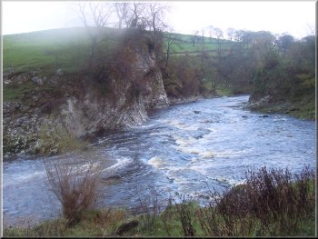
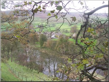
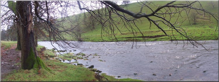
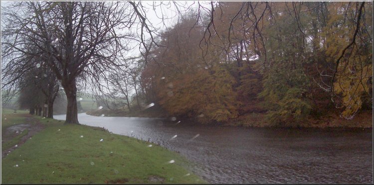
River Wharfe at Loop Scar near Burnsall
This part of the River Wharfe is one my favourite places
and I wanted to linger a while to take it all in, but
my wife was fed up of the wet trousers making her legs
cold so we had to press on back to the car PDQ. It had
been a lovely walk and even the weather added to the experience.
The whole route had been about 11km and it had taken us
four hours to walk including our lunch stop.
|
As we approached the suspension bridge near Hebden there
was a sudden heavy squall of hailstones swirling round
the trees and kicking up spray from the surface of the
river. Two fishermen huddled against a tree on the river
bank as the hail battered their umbrella. The squall was
starting to ease as I crossed the bridge but it still
swayed worryingly in the middle as I crossed. Then in
just a few minutes the wind eased and the hail stopped
and there were breaks in the cloud and even a little sunshine
as we finished the last 2km back into Burnsall.
River Wharfe at Loop Scar near Burnsall
|
|
River Wharfe at Loop Scar near Burnsall |
| Top of Page |