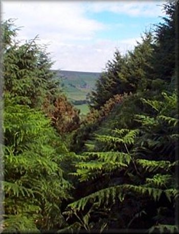
Path through head high bracken down to High Gill Beck
There are several places where you can park a couple of cars off the
road. We set off at about 9.50am along the road to the corner of the
plantation and turned left off the road on to a bridleway to drop down
first across the moor and then into the plantation to the house at High
Gill Beck. We came out onto the road at map ref. NZ 756029. |
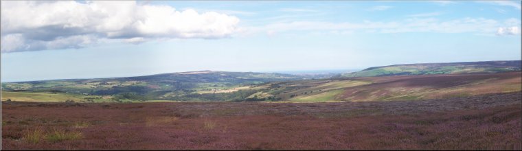
My neighbour, Jim, and I drove across Rosedale and out towards Glaisdale
this morning to park at map ref. NZ761016. It's a moorland road alongside
Wintergill Plantation above Glaisdale.
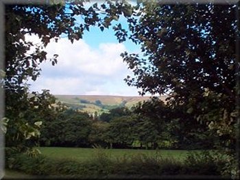
Looking to the head of Glaisdale from High Gill Beck
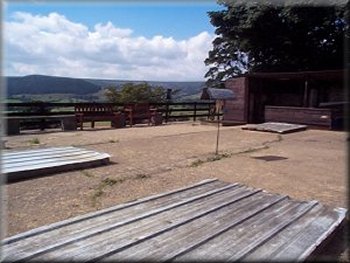
Glaisdale Quoits court
|
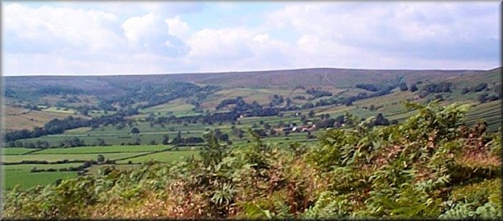
The head of Glaisdale from Glaisdale Rigg
We walked along the road to Low Gill Beck Farm where we turned left
off the road on to a path across the valley. The path crosses Glaisdale
Beck and climbs up through a farm yard to the road at map ref. NZ 753043.
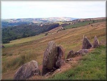
About 100m to the right there is a Quoits court with benches for the
spectators and a lovely view up the valley. It's a very popular game
in this area and in the Yorkshire dales with an active league competition.
After looking at the quoits court we walked back along the road to map
ref. NZ 752043 and took the bridleway up to join the track on Glaisdale
Rigg which we followed into Glaisdale village. In the village we took
the path from map ref. NZ 774056 down to the minor road which we followed
alongside the river to Carr End where the minor road joined the main
road through the village (Glaisdale is a very long strung out affair)
At this road junction we crossed straight over the main road and took
the track opposite which comes out at the railway viaduct over the Esk
at map ref. NZ 784055. There is space to park a few cars under the viaduct
and you could start/finish this route here if you wished. Sandwiched
between the railway viaduct and a road bridge is a lovely old stone
packhorse bridge.
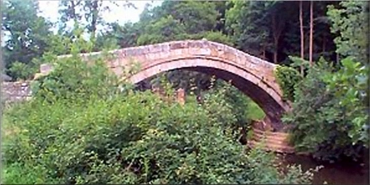
Old stone packhorse bridge at Glaisdale
After a quick look at the packhorse bridge we returned to the path
through the woods to Delves (map ref. NZ 793046) |
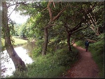
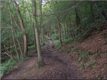
Path by the River Esk into East Arnecliff Wood
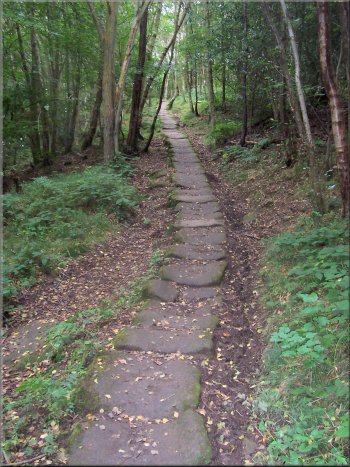
Old paved route though the woods to Delves
Most of the way the path is along an old paved route that I believe
was part of the Monk's Trod from Guisborough Priory to Whitby Abbey.
|
Old paved route though the woods to Delves
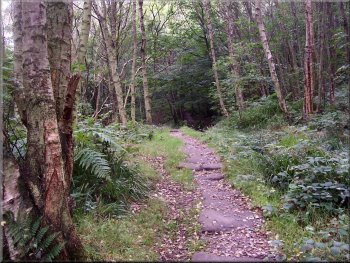
Old paved route though the woods to Delves
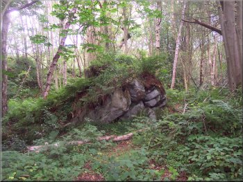
Rocky outcrop in East Arnecliff Wood
|
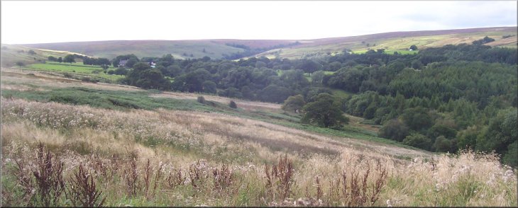
Looking up the valley of Butter Beck over Grange Head farm to Egton High
Moor |
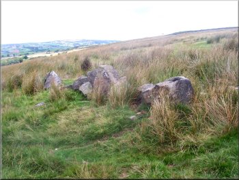
Ancient field boundary on the moor above Grange Head Farm
Just before Grange Head Farm at map ref. NZ 792028 we turned left off
the track to climb up to the moor top to join a path at map ref. NZ
794025. From the moor top there is a great view down the Esk valley
to the sea.
|
At the road we turned right to climb the hill for 200m and then turned
left off the road to follow a path down the side of a farm called The
Delves, across the valley of Butter Beck to a track at map ref. NZ 796044.
At the track we turned right to follow it for about 2km.
Ancient field boundary on the moor above Grange Head Farm
|
We followed this path along a well defined track for
over 4km back to our starting point. The whole route had been about
17km and had taken us five and a half hours to walk including several
stops for refreshments and to admire the views. We stopped in Hutton-le-Hole
on the way back for our traditional tea and toasted teacake just to
round off the day.
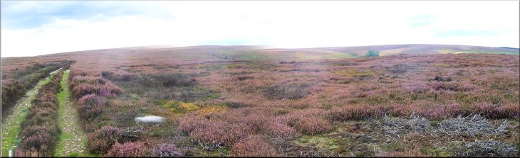
The track across Egton High Moor
|
Background Notes:
This walk is a longer walk of around 10 miles, 16km. It's a circuit of Glaisdale off the Esk Valley in the Northern part of the North York Moors. We start from a moorland road between Egton Bridge and Rosedale Abbey next to a forestry plantation at Wintergill. About a year ago a large part of this plantation was clear felled, but still hidden in the plantation is a substantial stone shaft. It's the remnants of an ironstone mine once owned by the South Cleveland Ironworks Co. and operated for only a few years around 1880.
At the corner of the plantation we turn off the road onto a path through what looks like a ruined farmstead. It was the mine offices, stores and workshops with some smallscale farming on the side. Our path takes us down the side of a ridge called The Nab, down into Glaisdale past a farm called Nab End where there are a few holiday cottages.
We follow a path across the valley bottom to cross Glaisdale Beck and start to ascend the other side of the valley to Plum Tree farm. The original building here was constructed in the 1680's. We reach the road along the valley and our route turns left but it's worth a detour right for about 100m to see the quoits court just above the road with benches round for spectators. It's a popular sport hereabouts with around a dozen teams competing in a league along the Esk Valley and results reported in the Whitby Gazette.
From the road we climb up to an ancient trackway along Glaisdale Rigg and follow this down into Glaisdale village. The village is quite spread out and we make our way to the railway viaduct next to the river near the railway station. There is room to park a few cars under the railway viaduct and this would be an alternative place to start and finish this circular walk.
Just next to the viaduct is the 'Beggars Bridge' over the River Esk. This is a stone packhorse bridge built in the early 1600's by Tom Ferris, a local man who had gone away to sea, made his fortune and returned to become an alderman in Hull. His initials, TF, are carved into the bridge.
From here we follow a path downstream along the bank of the River Esk and then up through East Arnecliff Wood. The path here is an ancient pannierway paved with stone slabs. I believe that it's part of the route used by monks travelling between Guisborough Priory and Whitby Abbey. There's another section of this paved route across the moor from Guisborough Wood to Commondale.
From East Arnecliff Wood we cross the valley of Butter Beck and follow a track up the valley almost to Grange Head farm. We turn off the track to climb up the hillside to the open moorland of Egton High Moor. Just before we reach to moor top the path passes some roughly square lines of large stones. These are the stones cleared from the land to make fields in prehistoric times and it's one of several ancient field systems in this area.
We join a track across Egton High Moor with a lovely view down the Esk valley to the sea at Whitby. The moor itself is a sea of purple heather in August and September and we follow this track through the heather for about 4km, two and a half miles, across the moor to the road at Wintergill Plantation and the end of our walk.
top of page
|