| 2001 walks | 2002
walks | 2003 walks | 2004
walks |
| 2005 walks | 2006
walks | 2007 walks | 2008
walks |
| 2009 walks | 2010
walks | 2011 walks | 2012 walks |
| 2013 walks | 2014 walks | 2015 walks | 2016 walks |
| 2017 walks | 2018 walks | 2019 walks |2020 walks |
| 2021 walks | 1993-2000 library | Find a Route Index |
| A few Routes to print out | Request a Route... |
Route No 30 - 15 January 2002
Halton Gill, Pen-y-ghent
Plover Hill circuit - 12 miles
Yorkshire Dales . . .
Route map from Ordnance Survey
Open Space service.
Map: OS Outdoor Leisure 2 Yorkshire Dales Western Area
and OS Outdoor Leisure 30 Yorkshire Dales Northern and Central areas
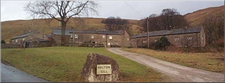
The hamlet of Halton Gill at the start of our walk
|
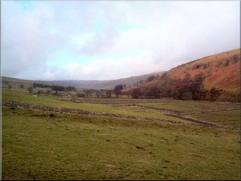
The path across the fields to Nether Hasleden
The forecast turned out to have it just right. We walked a few hundred yards down the lane to Halton Gill bridge and took the path across the fields to Nether Hasleden. It's good to see all the footpath signs with their green path open notices. This has been one of the last areas to be opened up after the foot and mouth disease outbreaks and so I haven't been in this part of the world for over a year. |
This morning I met my friend Tom at the tiny village of Halton Gill in Littondale. There is a small parking area (maintained by voluntary contributions) next to the village green and we set off from there at around 10.30am. The weather forecast last night had shown a front passing across the country from the west overnight, then a windy, cloudy-bright spell before the next wet front comes in from the west in the evening.

The track above Pen-y-ghent Gill
|
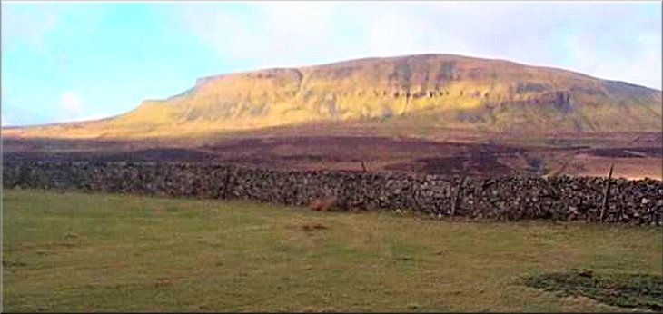
Our first clear view of Pen-y-ghent
|
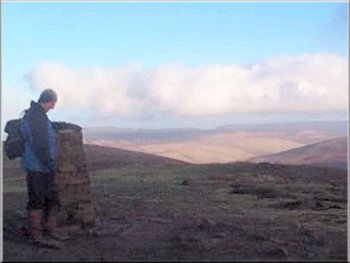
The summit of Pen-y-ghent
The climb from the road to the top of Pen-y-ghent took us about 40 minutes. There are so many people making this climb on summer weekends that the stiles over the dry stone walls consist of two substantial ladder stiles side by side. Someone had secured strands of new barbed wire, still with its factory coating of green lacquer, across the top of the first pair of ladder stiles so people have been using an old stone step stile to one side and the wall there has recently collapsed. |
We crossed the footbridge and continued almost to New Bridge on the River Skirfare. Here we joined a track that climbs steadily for over 3 miles above Pen-y-ghent Gill to join the road that comes up from Halton Gill on the opposite side of the valley. After a few hundred yards the Pennine Way joins the road after coming down from Fountains Fell and we continued on the road for over a mile to the point where the Pennine Way turns right to begin the climb of Pen-y-ghent.
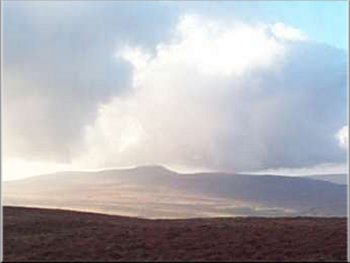
The distant shape of Ingleborough seen from Pen-y-ghent
|
|
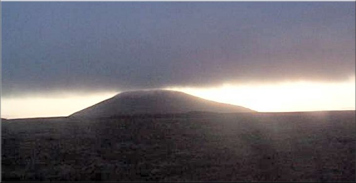
Looking back to Pen-y-ghent from Plover Hill
It is a hard climb to the top, but once there the views were amazing with a series of threatening black clouds racing across the sky and patches of bright sunshine in between. About 7 miles to the west is Ingleborough with its characteristic shape and about 5 miles north of Ingleborough is the huge mound of Whernside (not to be confused with Great Whernside & Little Whernside that lie in the watershed between the head of Nidderdale and the Wharfe valley at Kettlewell) |
Steep descent from Plover Hill to the Foxup Road
 |
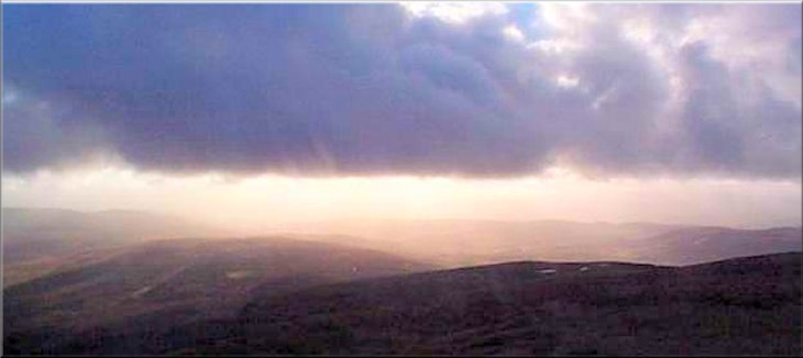
There were some wonderful effects of the sunlight behind the black clouds against a brilliant blue sky. There was another walker at the top of Pen-y-ghent eating his lunch and he was the only other walker we met all day. We continued along the ridge to Plover Hill. The ridge path runs beside a drystone wall and is quite hard going in the wet peat and rough marsh grass. From the northern end of Plover Hill we followed the path down a steep rocky descent to the Foxup Road, an ancient green road from Littondale into Ribblesdale. We followed the track for about 2 miles eastwards until it dropped down the valley side to the farms at Foxup where we joined the valley road for the last half a mile back to Halton Gill. By this time the light was fading and it looked as though the forecast rain would soon arrive. The whole route was about 12 miles and took us just over 6 hours including two refreshment stops.
|
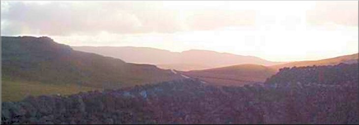
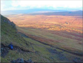
Looking back towards Littondale as we began the climb from the road up Pen-y-ghent
|