| 2001 walks | 2002
walks | 2003 walks | 2004
walks |
| 2005 walks | 2006
walks | 2007 walks | 2008
walks |
| 2009 walks | 2010
walks | 2011 walks | 2012 walks |
| 2013 walks | 2014 walks | 2015 walks | 2016 walks |
| 2017 walks | 2018 walks | 2019 walks |2020 walks |
| 2021 walks | 1993-2000 library | Find a Route Index |
| A few Routes to print out | Request a Route... |
Route No 4 - Thursday
30 August 2001
Longnor, Pilsbury Castle
River Manifold circuit - 7 miles
Derbyshire . . .
Route map from Ordnance Survey Open Space service.
Map: OS
Explorer OL24 The Peak District White Peak Area at 1:25000
|
I
spent the bank holiday week with three friends in a holiday
cottage on the edge of Ashbourne in Derbyshire where the
footpaths have been open since the beginning of June. The
weather was very hot with clear blue skies, much more like
the Mediterranean than grey damp Derbyshire.
|
|
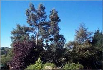
View from the balcony of our cottage in Ashbourne
|
On
Thursday 30 August 2001 we drove to Longnor and parked
in the square in the middle of the village in front of a
combined furniture shop and cafe. An interesting mix with
both the furniture and the cakes being home made (to a very
high standard). From the cross roads in the centre of the
village we took the road heading east to the edge of the
village and turned left onto a lane called Top o'th' Edge.
We followed the lane down the bank and then the bridle way
to Beggar's Bridge. After the bridge we took the path to the right, through
Crowdecote to Pilsbury, about two and a half miles. About a third
of a mile before Pilsbury are the ruins of Pilsbury Castle
(Motte and Bailey) where we stopped for our lunch (I had
a superb pork pie from the Bakewell Pudding shop in Bakewell
which we visited yesterday). From Pilsbury we took the path
straight up the hill to the road on the ridge and crossed
the ridge road onto the road down the side of Sheen hill.
|
|
After about a third of a mile on the road we turned right
onto the path at Hill End to Lower Boothlow Farm and then
onto the path by the River Manifold to return to Longnor
via Folds End. As usual we called for a cup of tea, this
time at the combined furniture shop and cafe, but beware
the very attractive hand made oak furniture could make it
a very expensive cup of tea. The whole route was about 7
miles and took us about 4 hours including a long stop at
the castle.
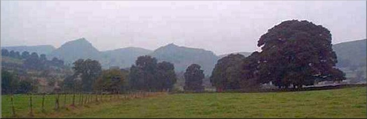
Chrome Hill from Beggar's Bridge
|