Menu:
National Parks
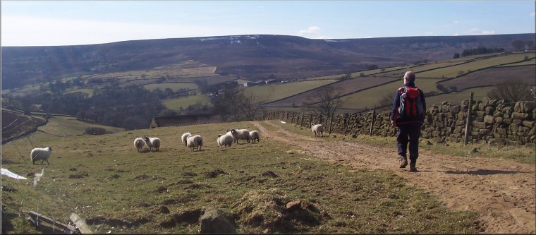
The approximate route is shown by a blue line.
Use your mouse to drag the map to the area of interest and
zoom in/out using the controls on the left hand side of the map.
Please use my map to find the route on your own large scale
walking map such as the OS Explorer series at 1:25000.
If you have time if you do this walk please let me know how you get on.
That would be very helpful to me to keep my information accurate and up to date.
Please note that I provide this free service to you as a fellow walker on the
understanding that you walk
the route entirely at your own risk and that the information is not used for
any commercial purpose.
Library Route No. 950415
Hazel Head Wood, Bilsdale Transmitter Mast, Cock Howe,
Head House, Plane Tree Farm, Street Gate Farm circuit - 15km
Hawnby, North York Moors . . .
Map: OS Explorer OL26 North York Moors Eastern area
1.) Start at the grassy parking and picnic area at map ref. SE529928 off the lane running between Hawnby and Osmotherly, about 500m south of the crossing of Blow Gill. From the grassy parking area return to the road and turn right along the road. About 50m from the corner of the picnic site turn left off the road into Hazel Head Wood through a small pedestrian gate built into the frame of a steel field gate. Follow the path northwards through the wood for about 850m to emerge from the wood on to the open moor about 100m above a ruined building below on the left. Continue out across the moor for about 350m to join a bridleway. At the bridleway turn right and follow the bridleway climbing up the moor for about 1.3km to at stony moorland access track passing Low Thwaites farm.
2.) At the track at Low Thwaites farm, turn left to follow the track for about 4km past the impressive Bilsdale Transmitter mast (compare the two & three storey buildings at its base with the mast itself) to Cock Howe at map ref. SE542983. Approaching the transmitter mast it's better to just follow the track rather than try to find the route of the public footpath. The reason for this small diversion is clear from the local name for this palce - "Meggy Mire").
3.) From Cock Howe look out for the bridleway heading south west down the moor to cross Arns Gill. The bridleway is shown on my map crossing the ridge track about 150m south of Cock Howe but the route on the ground leaves the ridge track on the bend SW of Cock Howe. Follow the route of this bridleway down to cross Arns Gill and climb up to continue around the intake wall of a small collection of fields. On the left is a footpath to Head House, a shooting lodge set on the grassland above Arns Gill at map ref. SE543971. There's no need to drop down to Head House unless you want to stop there for a break.
4.) Continue along the bridleway on Arnsgill Ridge for about 3km to a point about 500m beyond Hill Head Farm at map ref. SE513950. Turn left here off the farm access track to follow a public footpath across Arns Gill and around the hillside to a field gate on to the road opposite Plane Tree Farm at map ref. SE514942. At the road turn left and walk along the road for about 100m, past and old lime kiln on the left, to a farm access road on the right with a public footpath running along it. Turn right here off the road and follow the public footpath past Birkwood farm and continue around the hillside past Hagg House Farm to Street Gate Farm. From Street Gate farm continue along the farm access road for another 200m to the public road at map ref. SE528933. At the road turn right and follow the road for about 500m, crossing Blow Gill with an ols lime kiln above the stream on the left of the road, and continuing back to the car park and the end of the walk.
(top of page)