Menu:
National Parks
The approximate route is shown by a blue line.
Use your mouse to drag the map to the area of interest and
zoom in/out using the controls on the left hand side of the map.
Please use my map to find the route on your own large scale
walking map such as the OS Explorer series at 1:25000.
If you have time if you do this walk please let me know how you get on.
That would be very helpful to me to keep my information accurate and up to date.
Please note that I provide this free service to you as a fellow walker on the
understanding that you walk
the route entirely at your own risk and that the information is not used for
any commercial purpose.
Library Route No. 940220
Whinstone Ridge, Stoney Leas, John Cross,
May Beck, Leas Head Farm circuit - 17km
North York Moors . . .
Map: OS Explorer OL27 North York Moors Eastern area at 1:25000
General Directions (see markers on the route map)
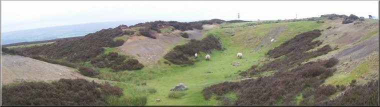
1.) Start from a small parking area about 2km north east of Goathland at map ref. NZ846012. The parking area is alongside the Whinstone Ridge, an intrusion of igneous rock that has been quarried for road stone. From the car park follow the track by the Whinstone Ridge across the A169 Whitby to Pickering road and around the edge of the forest conifer plantation for about 5.2km to the trig point at Stony Leas, map ref. NZ886992.
2.) About 200m beyond the Stony Leas trig point turn left to follow the track around the eastern side of the conifer plantation along the "Robin Hood's Bay Road". It's an ancient moorland track, part of the old pack horse route that was used to bring salt inland from Robin Hood's Bay. After about 3.8km turn left at John's Cross at the corner of the plantation, map ref. NZ.900027. Follow a path down the hillside to a minor road near May Beck car park. Follow the road down across May Beck and into the car park.
3.) From the May Beck car park follow the path along a track up to Old May Beck farm and continue past the farm, through the forest to Foss Farm at map ref. NZ885031. At the farm access road turn left to walk past Foss Farm and about 300m beyond the farm turn right to follow a track down to a ford across abeck and the up a slope to Leas Head Farm. From Leas Head Farm follow the track called Leas Head Road for about 1.5km to map ref. NZ865030 where the route turns left. The path to the left here is not well defined so aim for the north west corner of the plantation at map ref. NZ893028. From the NW corner of the plantation follow the track along the edge of the plantation for 600m out to the Whinstone Ridge at map ref. NZ860024. At the Whinstone Ridge turn right and retrace the outward route for about 850m back to the car park and the end of the walk.
(top of page)