Menu:
National Parks
The approximate route is shown by a blue line.
Use your mouse to drag the map to the area of interest and
zoom in/out using the controls on the left hand side of the map.
Please use my map to find the route on your own large scale
walking map such as the OS Explorer series at 1:25000.
If you have time if you do this walk please let me know how you get on.
That would be very helpful to me to keep my information accurate and up to date.
Please note that I provide this free service to you as a fellow walker on the
understanding that you walk
the route entirely at your own risk and that the information is not used for
any commercial purpose.
Library Route No. 930505
Saltergate car park (A169), Old Wives Way,
Crosscliff View Point, Noddle Farm, Dalby Snout,
Worm Sike Rigg, Malo Cross circuit - 19km
North York Moors . . .
Map: OS Explorer OL27 North York Moors Eastern area at 1:25000
General Directions (see markers on the route map)
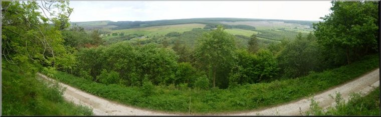
1.) Start and finish this circular walk from the Saltergate car park at map ref. SE852937, overlooking the Hole-of-Horcum. From the car park follow the road north for about 150m to a track on the right known as the 'Old Wife's Way'. Follow this track above the valley of Grain Beck and then Crosscliff Beck for a little over 4km to the Crosscliff view point at map ref. SE895915. There's a bench seat and an indicator board at the view point.
2.) From the Crosscliff view point continue along the track with the steep wooded bank down to Crosscliff Beck on your left for about 1km to map ref. SE905920. Here on the left take the narrow footpath diagonally down the steep wooded bank to the road at map ref. SE911922, near Noddle Farm. At the road turn left and follow the road for about 500m to cross Crosscliff Beck on the road bridge. Once over the beck turn right onto a track following the beck downstream for about 400m to a forest access track on the left.
3.) Here turn onto the forest access track on the left to follow this forest access track climbing up the wooded hillside called Dalby Snout. From the turning continue along this track for about 3.5km to a 'T'-junction in the track at map ref. SE888960.
4.) Continue across the 'T'-junction to walk along the firebreak opposite to a stony track around the edge of the forest. The last 300m along the firebreak are now very difficult because the firebreak is blocked by numerous fallen trees. It is still possible to go around them by making short detours into the forest and back to the firebreak but it is quite rough going. The stony track called Worm Sike Rigg leads to the bridleway following the outer perimeter of the Fylingdales RAF base. At the edge of the forest turn left and walk along the track heading roughly westwards for about 1km. The bridleway around the perimeter of the RAF base is well signed, but a swathe of forest has been cleared away from the perimeter of the base. Follow the signs around the base and continue on the public right of way around the edge of the forest to Malo Cross at map ref. SE867949.
5.) From the old stone cross follow the path up Whinny Nab to the hill top and continue around the hill top back to the 'Old Wife's Way' at map ref. SE854938. From there retrace your steps back to the Saltergate car park and the end of the walk.
(top of page)